
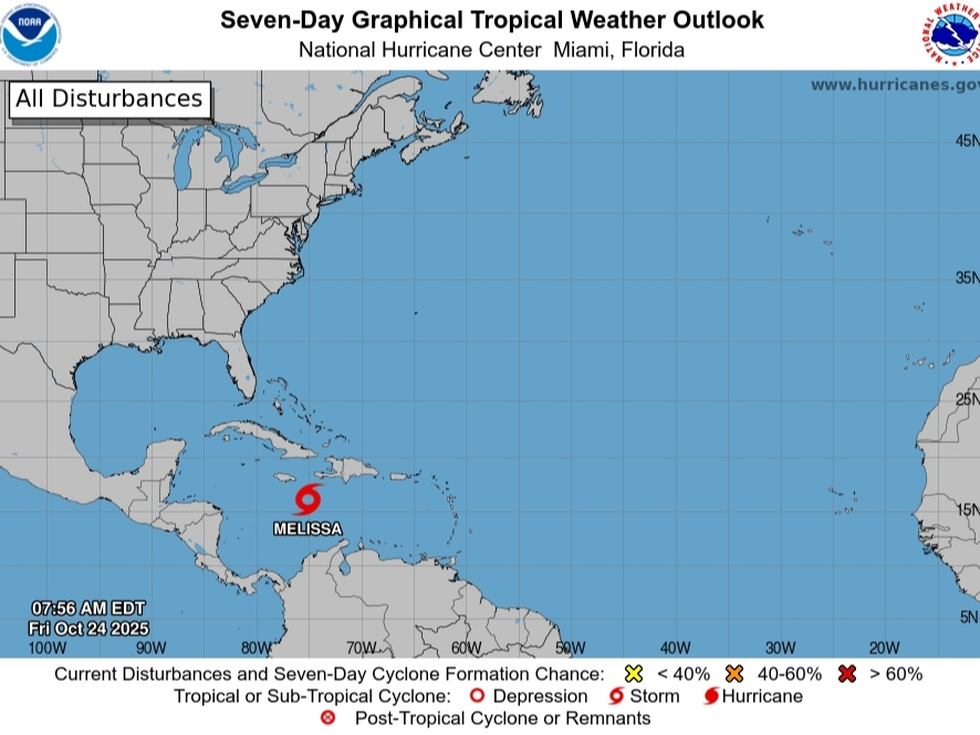
While Melissa churns through the Caribbean as a tropical storm on Friday morning, the system could possibly intensify into a catastrophic Category 5 hurricane with winds of 157 mph or greater, according to AccuWeather.
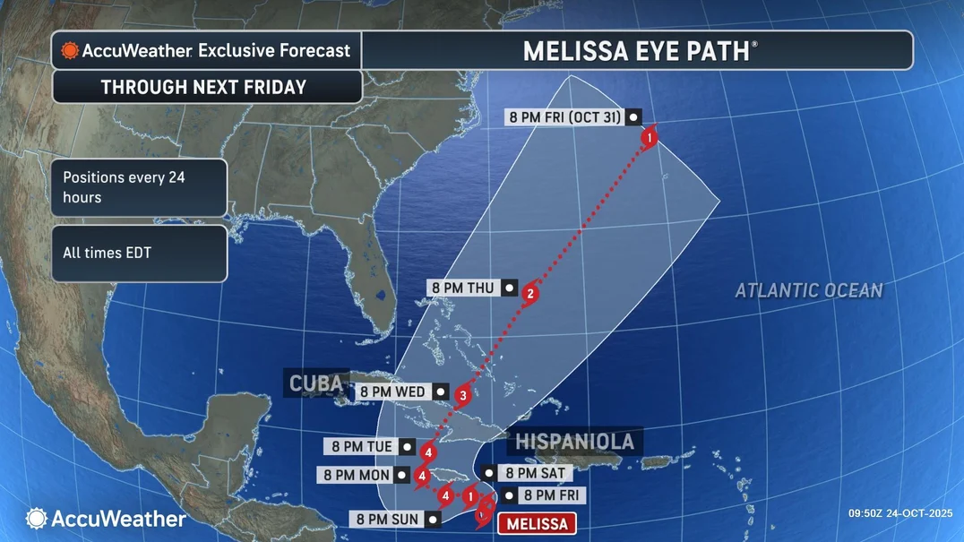
The storm poses a historic threat to parts of Jamaica, Haiti, the Dominican Republic and Cuba with torrential rainfall, destructive winds and catastrophic flooding expected, forecasters said.
“Several days of heavy rainfall will likely cause life-threatening and widespread flash flooding. Mudslides and road washouts could cut off communities. Extreme winds from the slow-moving hurricane are expected to damage homes and businesses throughout the western Caribbean,” Alex DaSilva, AccuWeather’s lead hurricane expert, said. “Power and communication networks could be knocked offline for days or even weeks. By the time the storm ends, rainfall totals in some areas may be measured in feet rather than inches.”
While a direct hit to the U.S. is unlikely, as the system is forecast to turn away from the mainland, parts of southern Florida and the Florida Keys could see gusty winds, rough surf and heavy rain late next week from the outskirts of the storm, experts said.
The slow-moving storm has winds of 45 mph on Friday morning, the National Hurricane Center said.
Melissa could bring “a prolonged multi-day” hit to Jamaica, where strong winds and flooding rains could start later on Friday or Saturday, the agency said.
The system will continue to slow over “very warm Caribbean waters with sea surface temperatures in the upper 80s” over the weekend, AccuWeather said. If it stays off sure long enough, it could strengthen into a Category 5 storm.
Calling Melissa “a slow-motion disaster,” parts of Jamaica could experience hurricane conditions for three days or longer, DaSilva said. “We are increasingly concerned about the threat of a humanitarian disaster unfolding, especially if this storm stalls.”
He added, “The slower a hurricane moves, the longer the rain, wind, and storm surge can hammer communities with devastating impacts. People in the path of this storm need to prepare for a long-duration event. Given the slow movement and forecast track for this storm, some areas could endure hours of wind gusts exceeding 100 mph and days of relentless rainfall.”
 (AccuWeather)
Denis Phillips, chief meteorologist for Tampa Bay 28, wrote in a social media post, “It was just a matter of time. Tons of Caribbean warm water. Unfortunately, it looks like Jamaica will be hit VERY hard by this storm.”
It’s also “a really bad situation” for Haiti and eastern Cuba as “Melissa has slowed to a crawl,” he wrote. “The storm will likely impact the islands for the next 5 days. (At least). The Euro is even slower.”
The system will rapidly intensify late Saturday into early next week, he added. “How strong she gets depends on whether or not the storm strikes Jamaica directly. If the eye stays just South of Jamaica, it will likely go Cat 5.”
Melissa will then threaten the central and eastern Bahamas and the Turks and Caicos next week after crossing Cuba or Haiti, Phillips said. “At that point, it will begin to accelerate rapidly.”
An expected cold front will keep Melissa east of Florida, Fox 13’s Paul Dellegatto wrote in a social media post.
“It will take some time, but eventually a trough is going to ‘pick up’ Melissa and accelerate it northeast,” he wrote. “This trough will keep the storm to our east and should bring us some cooler weather towards the end of the month.”