
TALLAHASSEE, Fla. (WCTV) – We are going from summer-like weather this weekend to frosty mornings early next week due to a STRONG cold front that moves through on Monday morning.
Warm and mostly dry today
Saturday stays mostly dry and warm under a stable air mass, with highs in the upper 70s to low 80s.
Isolated showers are possible for the western Big Bend and coastal areas today. Most do not see a drop of rain.
Still warm, isolated shower on Sunday
Rain coverage a dash higher on Sunday morning. A few heavy downpours or storms are not out of the question.
Skies will brighten up in the afternoon. Highs in the low 80s.
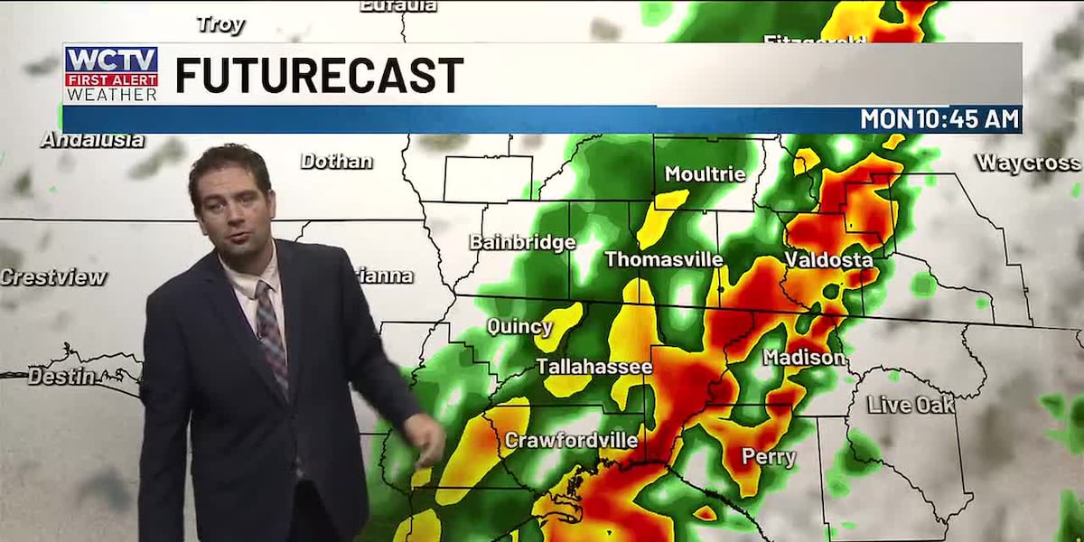
Strong storms on Monday
On Monday, we are monitoring the chance for more severe weather as a strong cold front approaches.
I expect a line of storms to develop and approach the area by your Monday morning commute. The strong to severe line will bring a few threats with it.
Scattered damaging wind gustsA few brief tornadoes
Storms will start as early as 6 a.m. and should exit the Suwannee River valley by 1 or 2 p.m.
Monday: hazardous marine conditions and a sharp cool-down
Non-thunderstorm winds will ramp up around the front, then turn breezy northwest behind it as much cooler, drier air rushes in.
The cool north wind will drop temperatures from the 70s and 60s on Monday morning to the 50s by the afternoon. It will feel chilly for much of the afternoon as the sun breaks through the clouds.
Hazardous marine and beach conditions on Monday, with advisory-level winds and seas expected and gale-force gusts possible.
Frost/freeze concerns early next week
Colder air settles in on Monday night and Tuesday night. I would expect a late-season frost/freeze for those who have planted early and farmers.
Warmer late next week
Temperatures start to moderate back to our typical March weather in the 70s, with little to no chance of rain.
To stay updated on all the latest forecasts and weather, follow WCTV First Alert Weather on Facebook and X (Twitter).
Click here to see all the latest weather headlines and here to view the First Alert Radar. Receive push alerts and watch the latest forecast anytime on the free WCTV First Alert Weather app. Click here to download it now.
Interested in becoming a WCTV First Alert Weather Watcher? Click here to join the team!
Copyright 2026 WCTV. All rights reserved.