An active stretch of weather moves into northwest Florida late Sunday night into early Monday morning as a strong storm system plows through the region.
Powerful frontal system moves in from the west
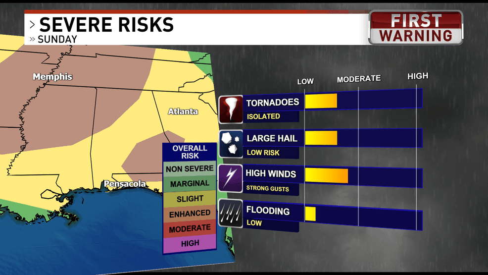
Northwest Florida and southwest Alabama are in a level 2/5 to 3/5 risk for severe storms per the Storm Prediction Center.
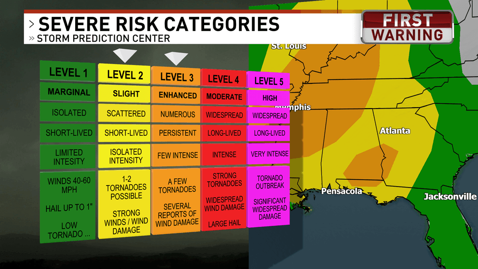
Here are what each level of severe risks mean
Sunday will start off mostly quiet with warm and breezy conditions, and highs will climb into the lower 80s. Humidity will be increasing as southerly winds pump moisture back into the area. Those warm and humid conditions will be fuel for storms later.
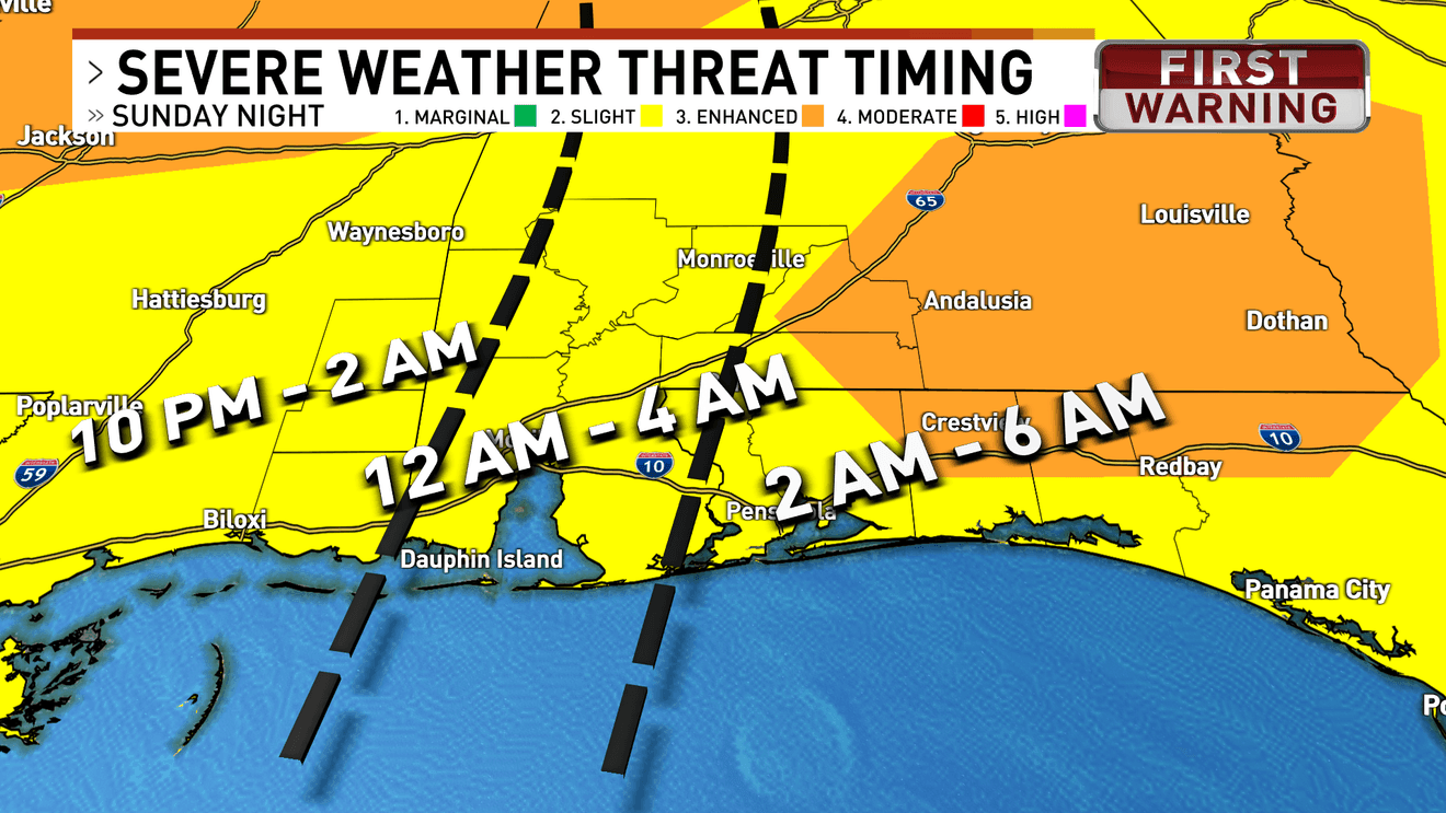
A few isolated showers or storms could develop during the afternoon, but the main concern arrives late Sunday night when a line of strong to severe thunderstorms is expected to sweep west to east across the region during the overnight hours and exit near or shortly after daybreak Monday.
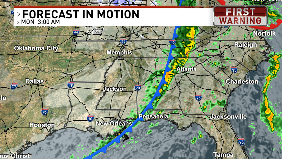
Future radar of storm

Timeline of severe weather Sunday night-Monday morning
The strongest storms could produce damaging wind gusts capable of downing trees and power lines along with the potential for a few tornadoes, some of which could develop quickly within the line.
Another risk with this system is the possibility for isolated storms to form ahead of the main line, especially near and east of the I-65 corridor, where the environment could support a stronger tornado if storms are able to develop. This is why the severe risk will last several hours overnight.
All modes of severe weather will be possible as this system pushes through{ }
Because the storms are expected to move through overnight while many people are sleeping, it’s important to have multiple ways to receive weather warnings.

Behind the storms, Monday morning bringing a significant drop in temperatures and breezy weather, with wind gusts around 30 to 35 mph possible through the day along with rough marine conditions and a high risk of rip currents along area beaches.
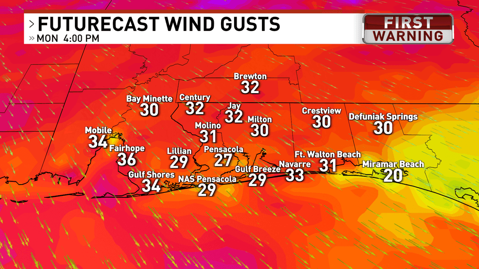
Winds will be gusty Monday afternoon behind the front
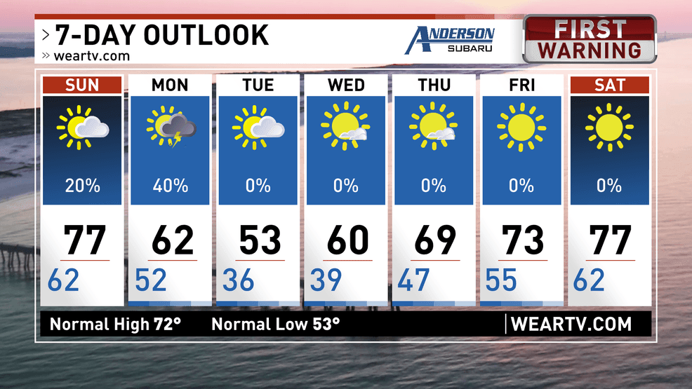
Temperatures will continue falling through Monday, dropping into the 40s by mid-morning and likely staying in the lower 50s for the afternoon.
Temperatures plummet behind the front
Much colder air settles in Monday night, and many inland locations could see temperatures fall below freezing for several hours late Monday night into early Tuesday morning, with lows dipping into the upper 20s to lower 30s, which could threaten sensitive plants as the growing season begins.
After this active start to the week, quieter weather is expected to return with dry conditions and gradually warming temperatures through the rest of the week.
Now is the time to know your severe weather plan, and where your safe place is in the instance of a tornado warning.