
Here’s what the First Alert Weather Team said you can expect for the First Alert Weather forecast:
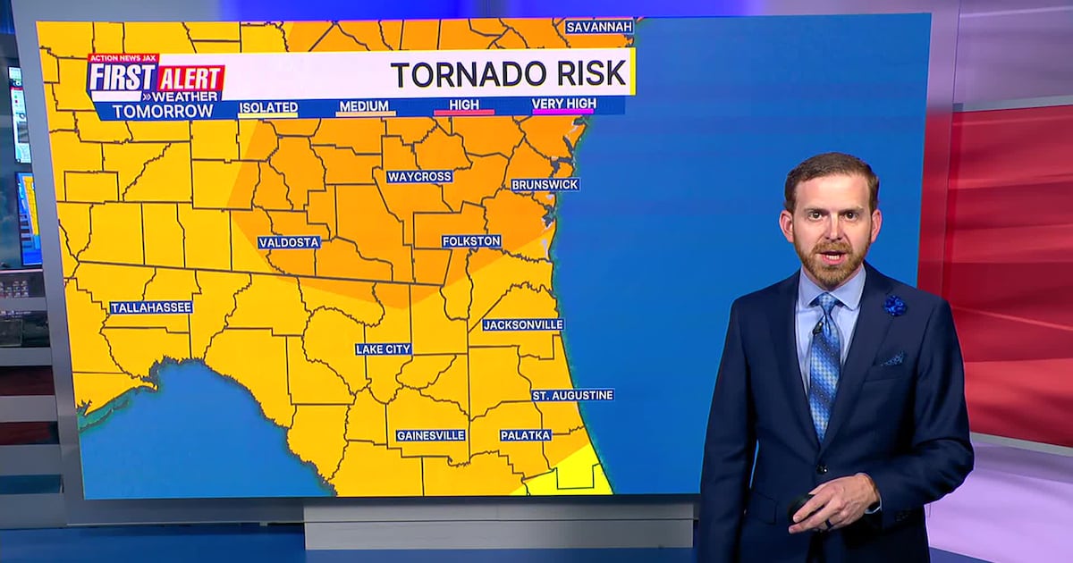
It’s been a warm and breezy SundayThe sea breeze is moving inland and rain/storms are lifting up from Central FloridaIt’s a waiting game for a few showers and storms to pop this eveningLooks like most of the activity will hold off until near and after sunsetA few showers and storms continue overnight and for the Monday morning commuteThen a line of storms pushes from west to east across the areaThese storms will pose a severe risk, including damaging winds, small hail and tornadoesMonday is a FIRST ALERT WEATHER DAY due to this severe threatIt won’t rain and storm all day, but stay weather aware and don’t let your guard downThunderstorm activity will clear around 4-5 PM MondayThen it gets COLDTemperatures fall into the 30s early Tuesday morning with a light freeze inland in Southeast GeorgiaTuesday’s a partly sunny and cool day with some spots struggling in the 50s during the dayWe have to watch for frost and more freezes inland early WednesdayTemperatures gradually warm up through the weekendWe’ll be getting back into the 80s for daytime highs beginning Saturday
WATCH THE FORECAST | DOWNLOAD THE APPS
TONIGHT: Isolated Shower/Storm. Low: 65
TOMORROW: First Alert Weather Day. Partly to Mostly Cloudy & Breezy, Scattered Showers & Storms. High: 81
TUESDAY: Partly Sunny, Much Cooler. 36/57
WEDNESDAY: Mostly Sunny. 37/63
THURSDAY: Partly Sunny & Breezy. 45/68
FRIDAY: Mostly Sunny & Nice. 45/77
SATURDAY: Mostly Sunny. 51/81
SUNDAY: Mostly Sunny. 55/84
Follow Action News Jax Meteorologists on Twitter for updates:
Mike Buresh | Garrett Bedenbaugh | Corey Simma | Trevor Gibbs

ALLERGY TRACKER: See what the pollen counts look like in our area
LISTEN: Mike Buresh ‘All the Weather, All the Time’ Podcast
INTERACTIVE RADAR: Keep track of the rain as it moves through your neighborhood
SHARE WITH US: Send us photos of the weather you’re seeing in your area ⬇️