Storms along a cold front Monday afternoon and evening expected to bring heavy rain and strong wind gusts across the region.
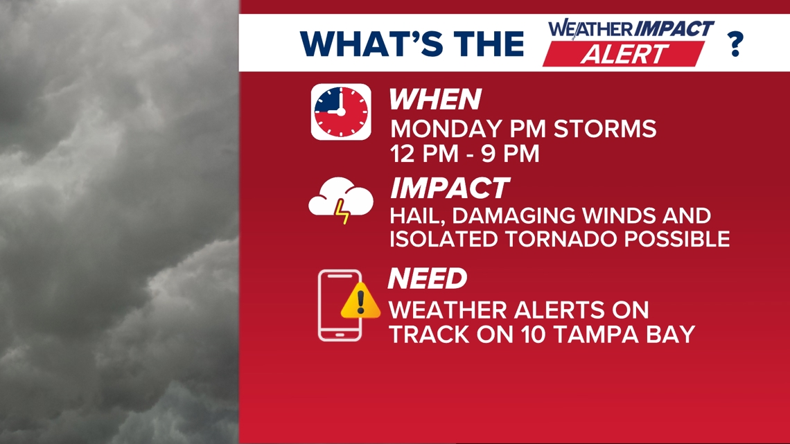
ST. PETERSBURG, Fla. — A Weather Impact Alert is in effect Monday as a line of storms is expected to move through the Tampa Bay area ahead of a cold front. Some storms could become strong during the afternoon and evening hours, with gusty winds and heavy downpours the main concerns.
When:
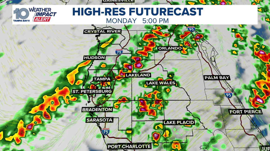
Noon – 9 p.m. Monday. Storms will first move into the Nature Coast late in the morning to early afternoon before pushing southeast into the Tampa Bay and I-4 corridor during the afternoon. The line will then continue into Southwest Florida during the evening.
Nature Coast: Noon – 3 p.m.Tampa Bay / I-4 corridor: 2 – 6 p.m.Southwest Florida: 6 – 9 p.m.
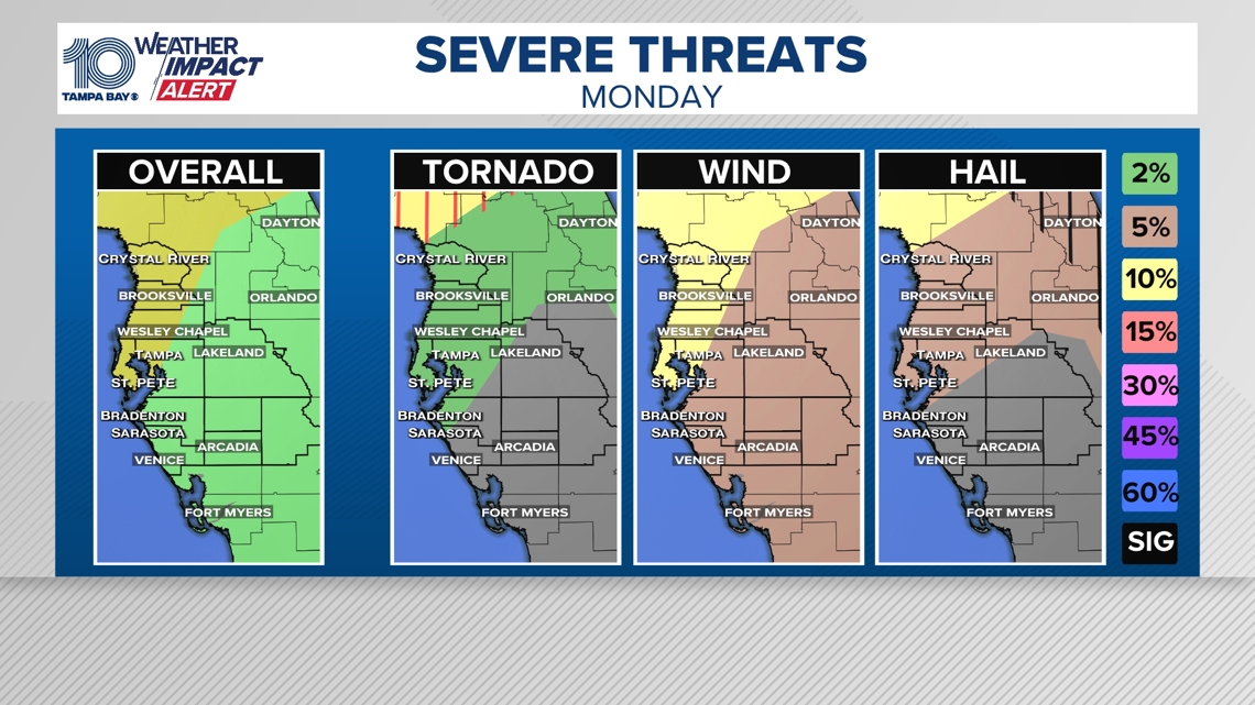
Impact:
A line of storms moving through the region may produce strong, gusty winds, which will be the primary threat as the front moves through. Some storms could also bring small hail, frequent lightning, and heavy downpours, with localized rainfall totals around 2–3 inches.
Need:
Stay weather aware Monday afternoon and evening. Be prepared to receive weather alerts, have multiple ways to get warnings, and track storms using the 10 Tampa Bay News app.
Behind the front, much cooler and drier air will move into the region late Monday night into Tuesday. Hazardous marine conditions are expected to develop early next week as winds increase over the coastal waters, and temperatures will turn noticeably cooler through midweek.