
Happy Monday, South Florida!
A strong cold front will sweep across the area tonight.
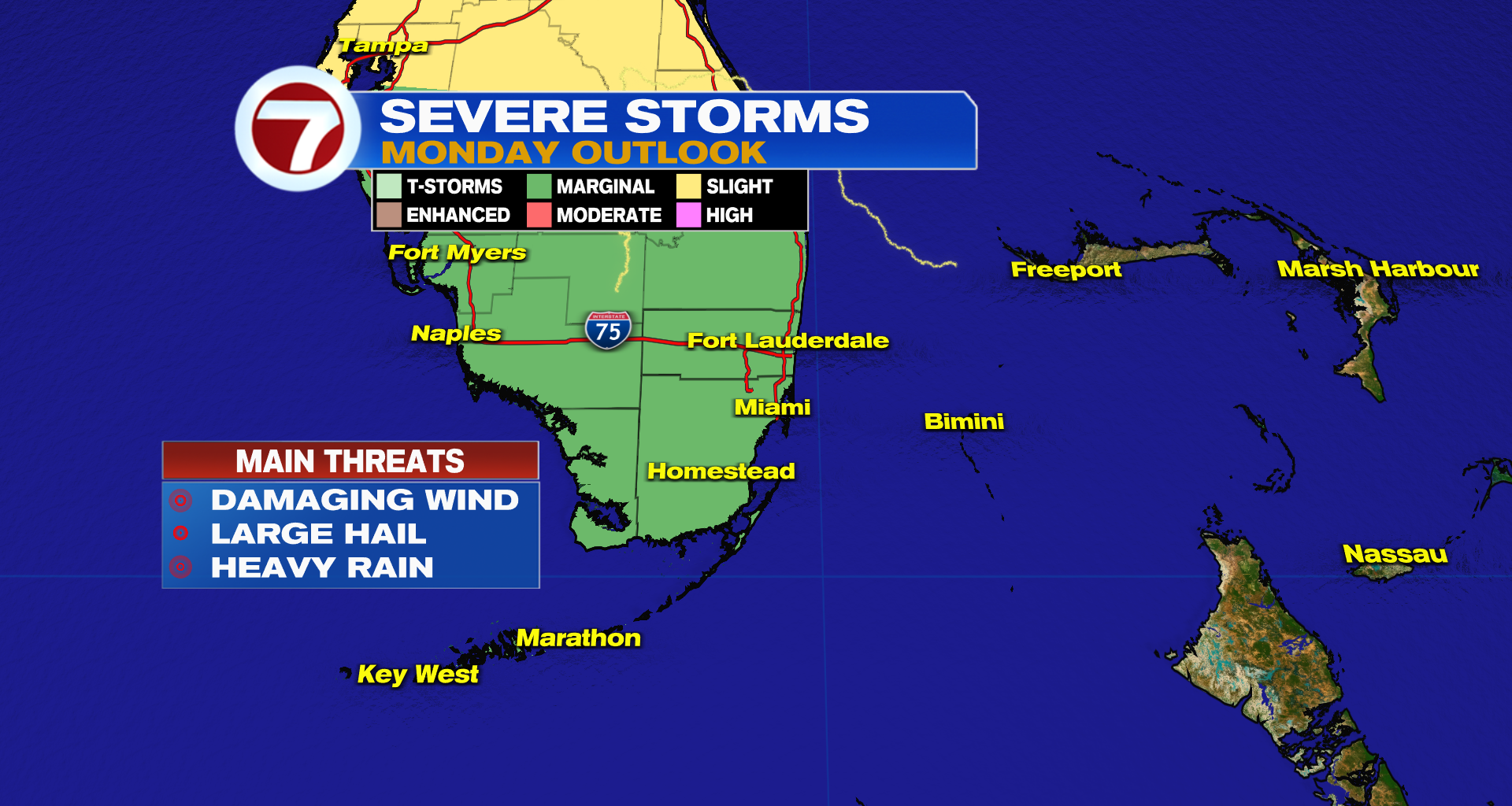
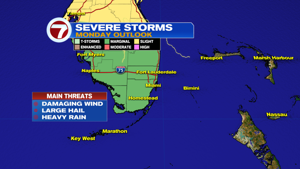
Ahead of the front, scattered storms are expected to impact the area from late this afternoon into the overnight hours. A few of these storms have the potential to become severe. The main threats are damaging 60 MPH wind gusts, pocket change hail, heavy rain, and frequent lightning.
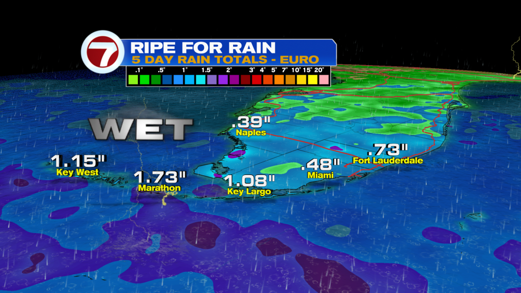
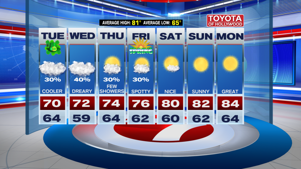
Behind the front we will turn sharply cooler and will be quite ugly outside midweek. Scattered showers will stay in the forecast and the sky will be quite gray. To make matters worse, it will be very gusty off the Atlantic. By the end of the work week, we could pick up an additional 1 – 3″ of rain, which would be very beneficial considering the drought we’re in.
The good news is there is a light at the end of the tunnel. We turn sunny heading into the weekend with highs back in the 80s!
Join our Newsletter for the latest news right to your inbox