
 Orlando AM Weather: Cooler temps return
Cooler temperatures have returned to Central Florida after a cold front moved in. But things will start to warm up by the middle of the week. FOX 35 Storm Team meteorologist Jessica Dobson takes a look at the forecast.
ORLANDO, Fla. –
We’re waking up to temperatures nearly 25 degrees cooler than yesterday morning.
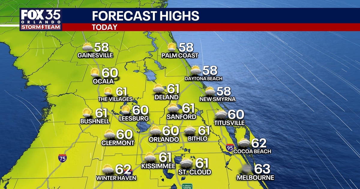
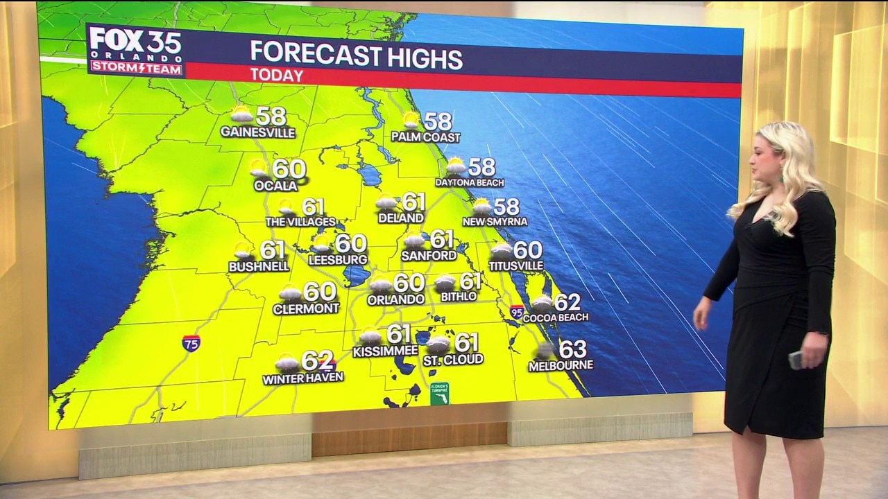
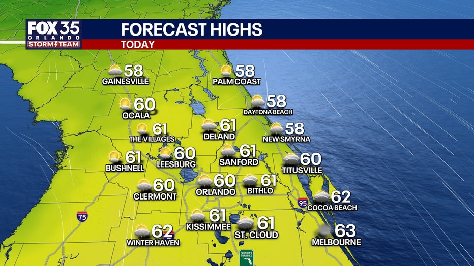
This is a trend that will stick with us for the rest of the day as highs today struggle to reach the low 60s across Central Florida.
With our forecast high of 60°, we could break the previous record cool high of 61° set back in 1901. That’s well below our normal high of around 79°. After a cloudy start to the day, we’ll plan for increasing sunshine giving way to a partly to mostly sunny sky.
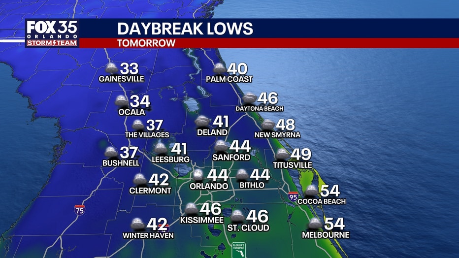
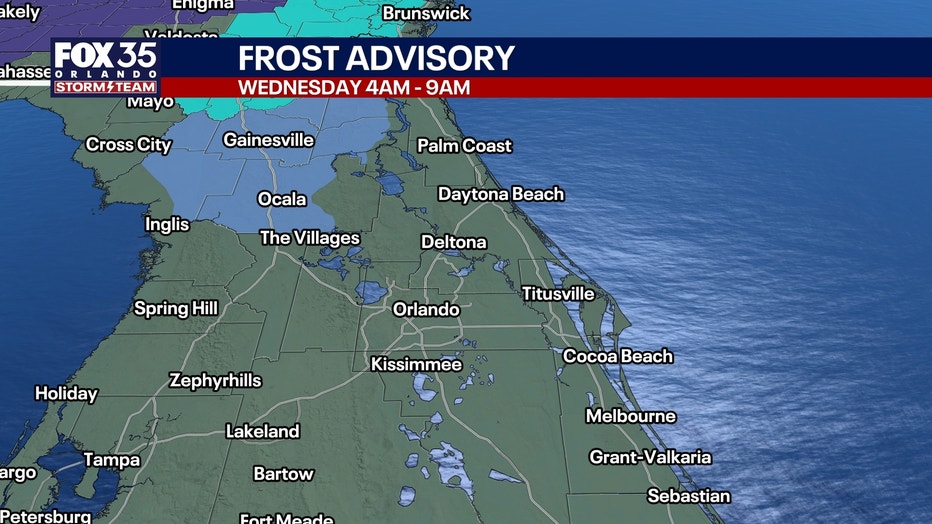
Temperatures will turn chilly once again tonight, you’ll certainly want the jacket once again as you make your way out the door tomorrow morning. We’ll see a broad range in lows by daybreak tomorrow.
Temperatures will dip into the mid 30s for areas like Marion to northern Lake and Sumter counties, this is where the slim chance of patchy frost will be possible. Areas along and near I-4 will be closer to the low and mid 40s, while Brevard County will be in the low and mid 50s.
High pressure continues to build, which will keep things dry and pleasant but still cooler.
Tomorrow’s temperatures will remain well below normal, but still an improvement as highs reach the low 70s.
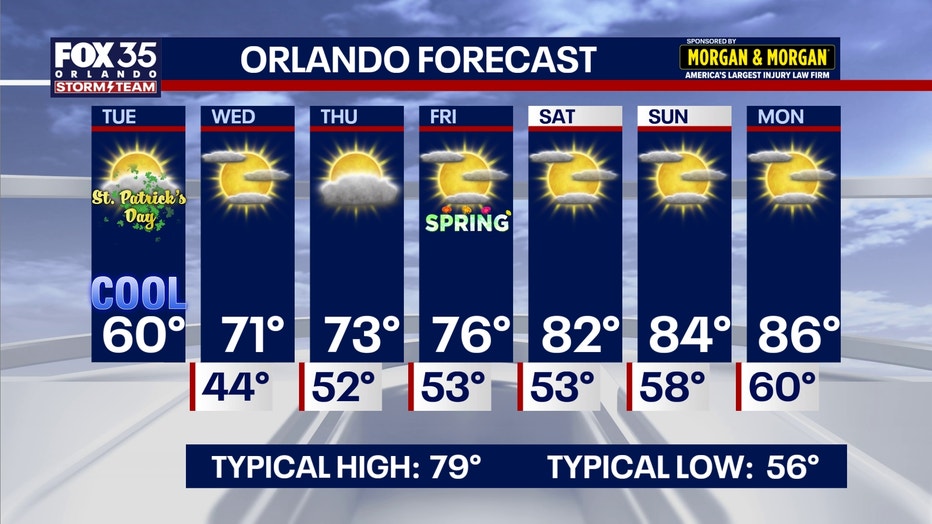
Temps will start to climb back closer to average, rising into the lower to middle 70s by the end of the workweek with plenty of sunshine on the table.
By this weekend, readings are seasonable, but back above average. Afternoon readings on Saturday are back up into the lower to mid-80s under just a few clouds.
The Source: This story was written with information from the FOX 35 Storm Team.