
The weekend is here and it’s going to come with a big breeze that will last both Saturday and Sunday.
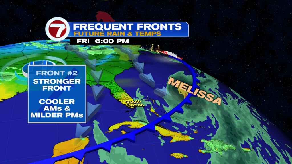
We can thank high pressure to our north, a front stalled on top of South Florida and strengthening Tropical Storm Melissa to our south for the whipping weekend winds.
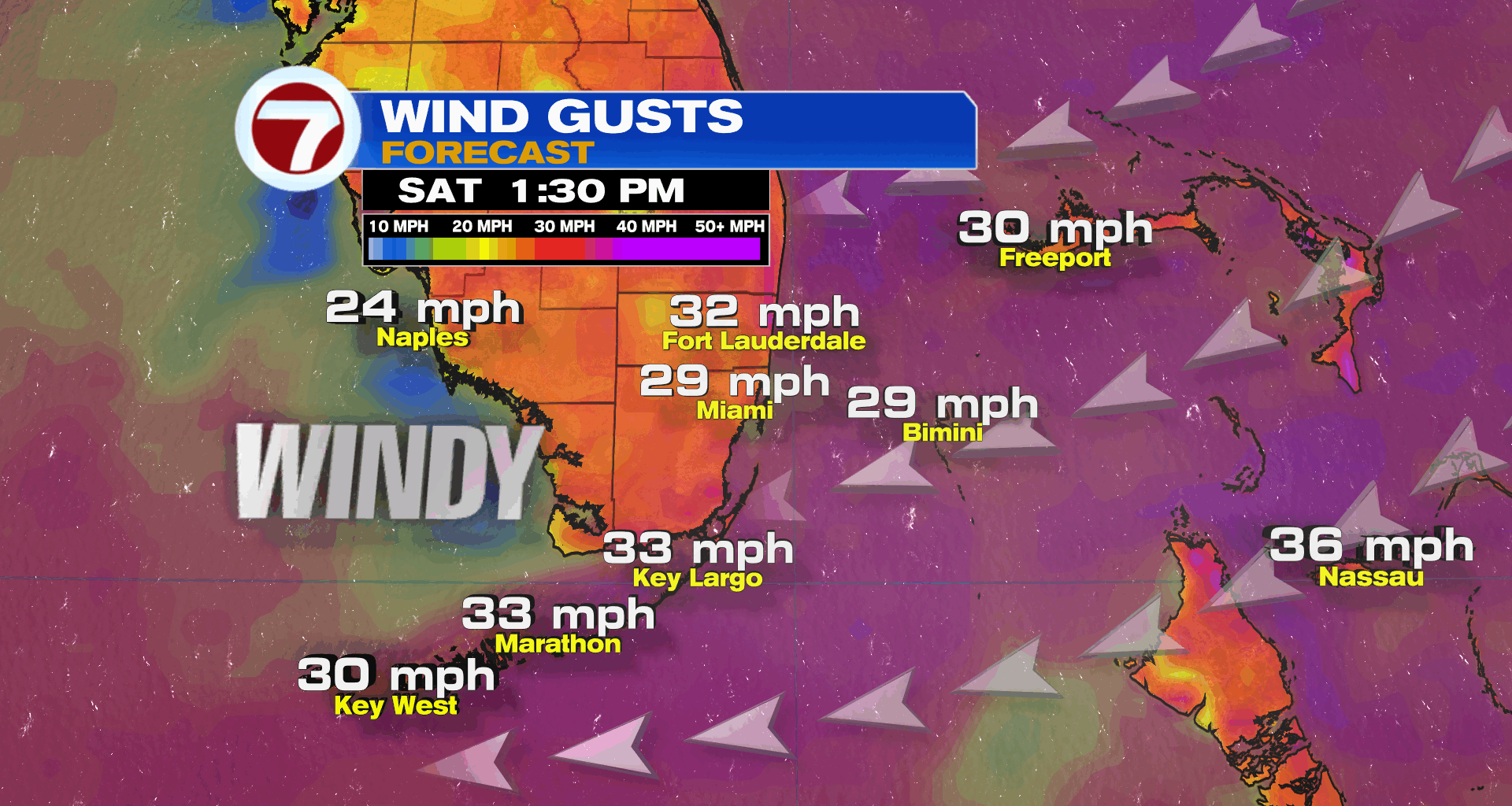
Winds are projected to be the strongest on Saturday with 15-30 mph sustained winds and gusts up to 40 mph, with the strongest winds near the coast. Winds will only turn slightly weaker on Sunday.

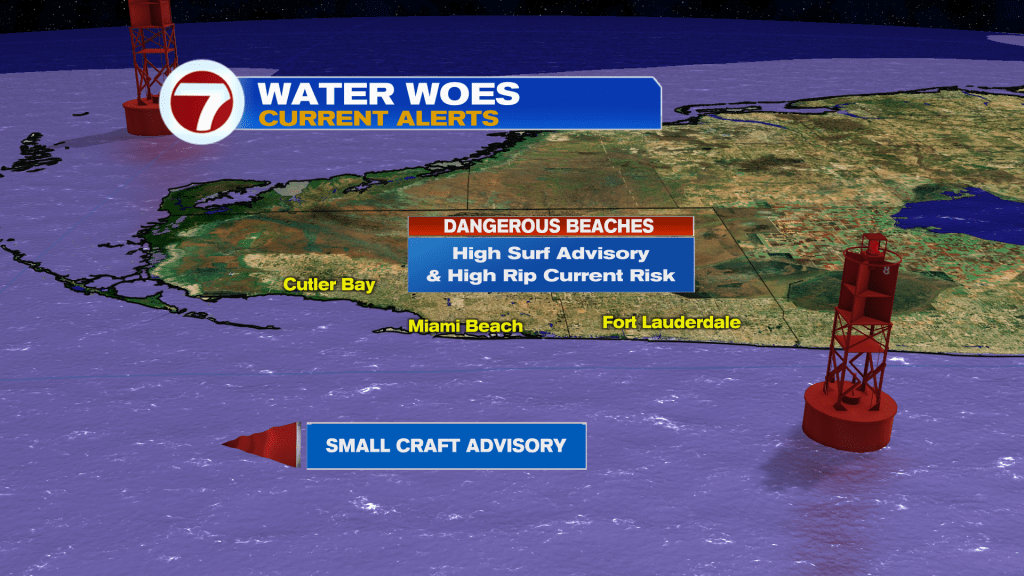
As a result, a Small Craft Advisory is in effect for all of our local waters. There is also a high risk for rip currents and a High Surf Advisory for 6-10 foot breaking waves at the beaches throughout the weekend.
On Saturday, expect a blend of sun and clouds with occasional, swift showers riding that strong breeze onshore. There will be lots of dry time for your outdoor plans. Otherwise, it will be warm with a bit more in the way of humidity.
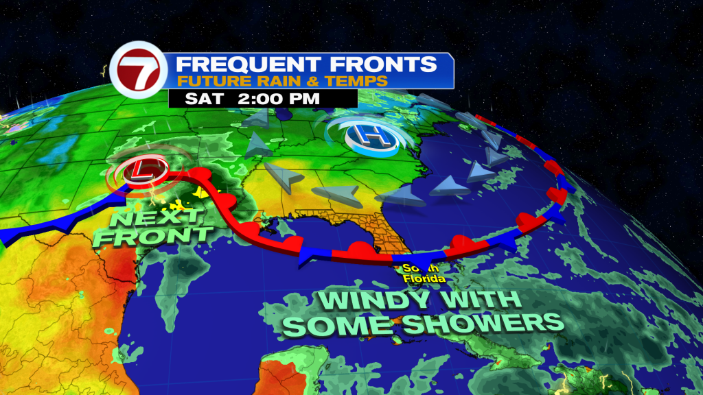
Humidity levels will rise some more come Sunday. Overall, Sunday will be quite similar as Saturday with sunshine and some clouds mixed in along with the shower chance given the stalled front allowing for moisture levels to increase from the south.
By Monday, the stalled front lifts out as a storm system rides eastward across the Gulf Coast states. This will lead to a warm and muggy Monday with scattered showers and thunderstorms, especially during the afternoon hours. With this change to our setup, winds will dramatically decrease to start the week.
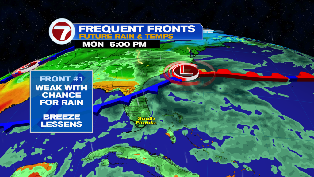
Attached to that storm system will be a weak front. That front will swing through come Tuesday, leading to a drop in rain chances.
It’s not until the Wednesday or Thursday time frame when a strong front arrives and this one has the potential to usher in the first notable temperature drop of the season to South Florida! It’s still unclear how much cooling may occur but lows in the 60s is seeming increasingly likely as well as highs at only around 80F.
At the very least, the forecast is looking promising and SPOOK-tacular for Halloween next Friday.
Tropical update
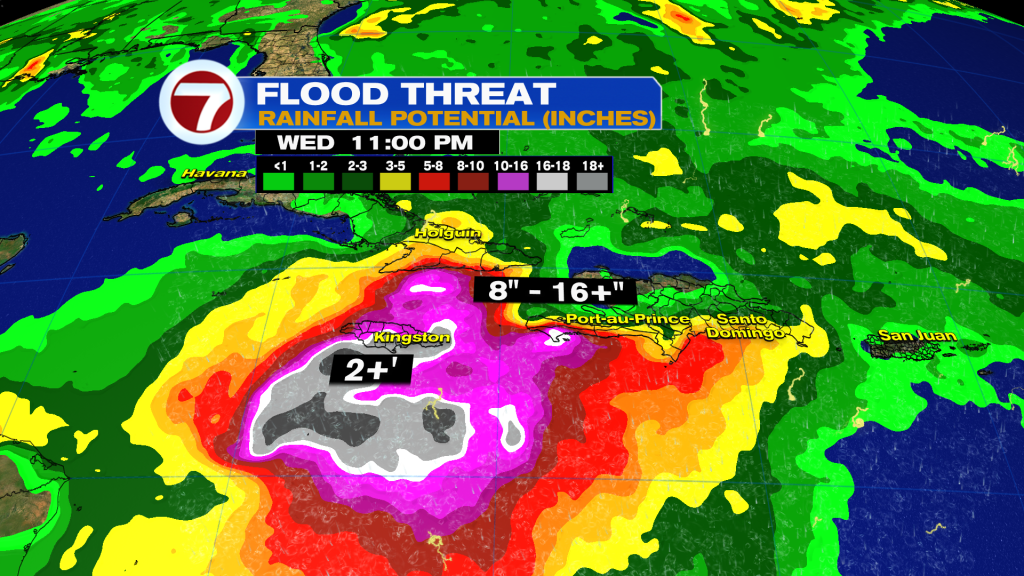
Tropical Storm Melissa is on the verge of becoming a hurricane this morning. As of the 5am Advisory, Melissa packs winds of 70 MPH. Melissa is expected to become a hurricane later today. Heavy rain from Melissa is already causing flooding in Hispaniola, Puerto Rico, Jamaica, and eastern Cuba.
Heavy rainfall leading to flooding and mudslides remains a big threat to the region into early next week with multi-foot rainfall totals possible in isolated locations.
Going forward, Melissa is forecast to strengthen significantly, becoming a hurricane later today and then a major hurricane by Sunday.
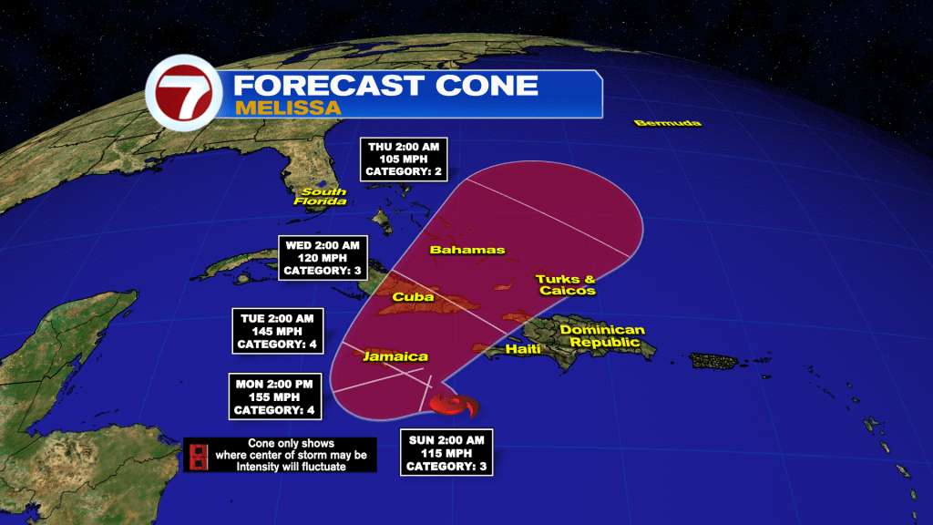
Early next week, Melissa is expected to pass near or over Jamaica as a powerful, Category 4 hurricane.
Then by the middle of next week, it is expected to strike eastern Cuba, the southeastern Bahamas and Turks and Caicos as a hurricane.
Join our Newsletter for the latest news right to your inbox