
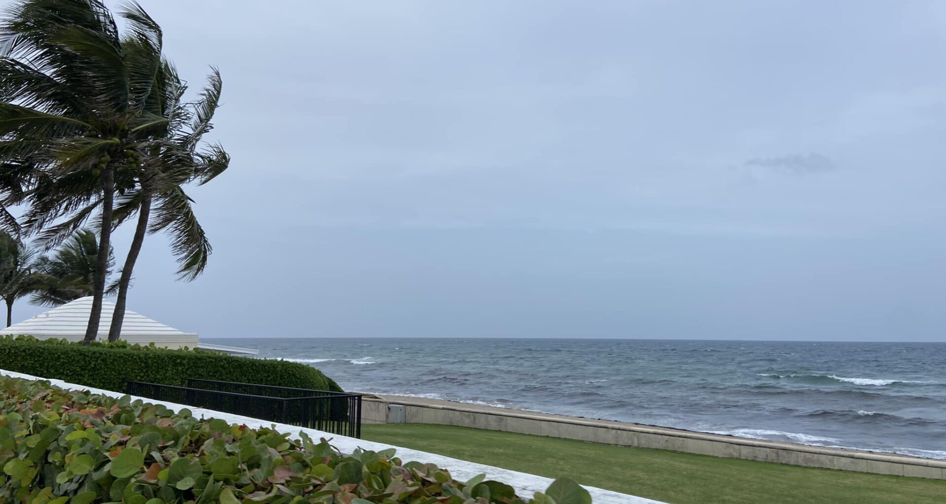
West Palm Beach, FLA. (WPEC) — South Florida residents can expect a breezy and wet weekend as several weather systems, including Tropical Storm Melissa in the Caribbean, influence conditions across the region.
A strong northeasterly wind is blowing across South Florida, creating hazardous conditions for boaters and beachgoers. Winds are expected to gust between 30 and 35 miles per hour, especially along the Atlantic coast. While these gusts are below the level that would trigger a formal wind advisory, forecasters are still warning of borderline hazardous conditions, especially near the coast.
The strong winds are being caused by a mix of weather systems:
Tropical Storm Melissa in the CaribbeanA high-pressure system over eastern CanadaA low-pressure system over the southern U.S.
Together, these systems are tightening the pressure gradient, which means the difference in air pressure between regions is increasing, causing winds to pick up.
Rain and thunderstorms possible
A decaying cold front near the Florida Straits is bringing moist air into the region. This will lead to scattered showers today, with rain chances increasing on Sunday as the front moves north. A few isolated thunderstorms are also possible, but most of the rain will be light to moderate.
Expect highs in the mid to upper 80s today, warming to the upper 80s and low 90s on Sunday. Overnight temperatures will stay mild, ranging from the low 70s inland to the upper 70s along the coast.
The Next Weather Maker
Melissa is expected to move north and then northeast through the Caribbean early next week. No direct impacts are expected for South Florida, but the storm is helping shape the weather pattern.
A cold front will move through South Florida around Tuesday, followed by another front late Wednesday into Thursday. These fronts will bring drier air, lower humidity, and cooler temperatures.
Monday will be the warmest day, with highs in the upper 80s to low 90s.
By late next week, highs will drop to the upper 70s to around 80, with cooler nights in the 50s inland and low to mid 60s near the coast.