
Melissa strengthened into a Category 1 hurricane on Saturday and is expected to rapidly intensify in the coming days, according to the latest forecasts.
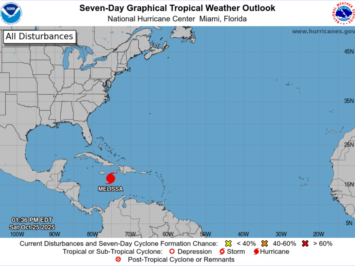
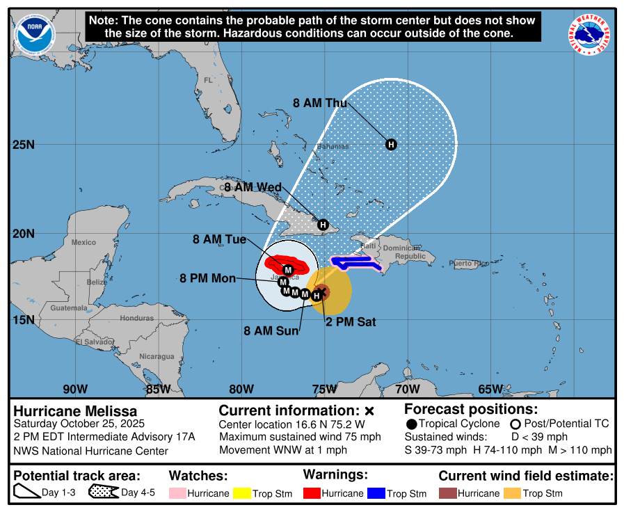
In a 2 p.m. update, the National Hurricane Center said Melissa was located about 145 miles southeast of Kingston, Jamaica and was slowly moving west-northwest at 1 mph with maximum sustained winds of 75 mph.
“A turn to the north and northeast is forecast on Monday and Tuesday,” NHC forecasters said. “On the forecast track, the center of Melissa is expected to move near or over Jamaica during the weekend and early next week, and it could be near or over eastern Cuba by the middle of next week.”
According to forecasters, rapid intensification is forecast to occur over the next couple of days and Melissa is forecast to become a major hurricane by Sunday.
The storm is first expected to make landfall around 3 a.m. Tuesday, along the southern shore of Jamaica, less than 40 miles west of Kingston.
The storm poses a historic threat to parts of Jamaica, Haiti, the Dominican Republic and Cuba with torrential rainfall, destructive winds and catastrophic flooding expected, forecasters said. As of Saturday afternoon, at least four fatalities have already been attributed to Melissa across Haiti and the Dominican Republic, according to an AccuWeather report.
“Melissa’s slow movement over the mountainous islands greatly increases the risk of catastrophic flash flooding and deadly mudslides. This can quickly escalate into a humanitarian crisis, where a large number of people are in need of basic supplies such as food, safe drinking water, housing and medical care,” said AccuWeather Meteorologist Alex Duffus.
Melissa is expected to remain a powerful hurricane as it moves through parts of the Bahamas next week. The storm could also come close enough to Bermuda to impact the island.
When Melissa decides to turn to the northeast will play the biggest role in how the storm impacts Florida. If it turns early, the more likely it will be that Florida remains unscathed, according to the Storm Prediction Center. If it turns later, which is a less likely scenario, the impacts could be greater.
The timing and strength of a dip in the jet stream over the eastern United States next week will also help determine the path that Melissa takes through the Caribbean and into the Atlantic, AccuWeather forecasters wrote.
“At this time, the odds of direct rain and wind impacts from Melissa reaching the U.S. East Coast are very low,” AccuWeather Lead Hurricane Expert Alex DaSilva said. “However, there are scenarios that could bring Melissa closer to South Florida, and at the very least, some indirect impacts from Melissa are anticipated, not only in South Florida but well to the north along the Atlantic coast.”
On Friday, Fox 13’s Paul Dellegatto wrote in a social media post that an expected cold front should keep Melissa east of Florida.
“It will take some time, but eventually a trough is going to ‘pick up’ Melissa and accelerate it northeast,” he wrote. “This trough will keep the storm to our east and should bring us some cooler weather towards the end of the month.”