
TALLAHASSEE, Fla. (WCTV) – Severe to exceptional drought will continue or worsen over the next several days as a warm, dry weather pattern takes over the southeast.
Little to no rain is expected over the next 7 days as high pressure becomes the dominant weather feature through the next 7 days, offering no significant reprieve from the ongoing drought affecting the Tallahassee area and surrounding regions.
Warm with a stray shower today
Today will see highs in the upper 70s to low 80s, with a few scattered showers possible, especially along the Interstate 75 corridor and Suwannee Valley. Any showers should be isolated, with only a 10% chance in those areas. Expect mostly cloudy skies with east winds, turning partly sunny this evening.
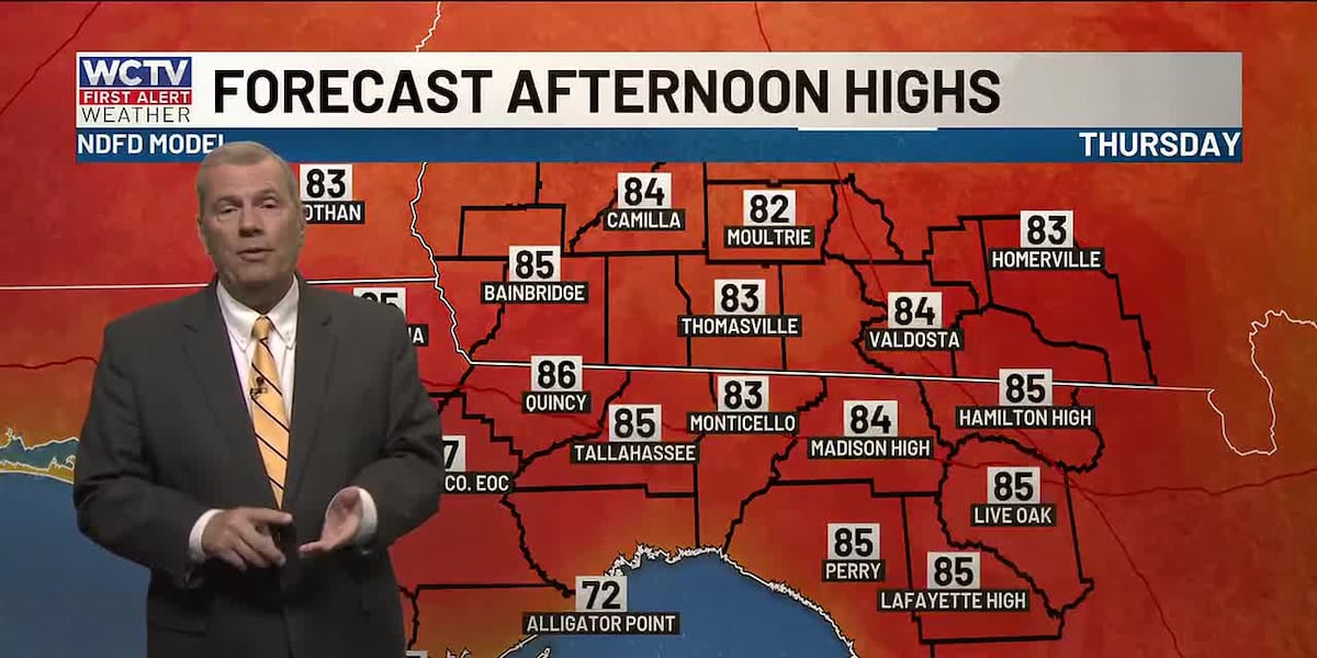
Back into the upper 80s
The warmth is back on to end your workweek. Thursday will see highs climb into the mid-80s, while Friday is expected to be the hottest day of the week with temperatures soaring into the mid-to-upper 80s. Some isolated spots could even reach 90 degrees.
The only weather hiccup will be some morning fog, which is likely on Thursday and Friday mornings. Some fog could become dense at times, so allow extra time for your morning commute if visibility becomes limited.
Rain-free cold front arrives
A dry cold front will move through late Friday night into Saturday, bringing a temporary break from the heat. Saturday highs will drop to the 70s north of the Florida state line, with low 80s possible to the south. Sunday will be even cooler, with highs in the mid-to-upper 70s and lows dropping to the low 50s.
Outside of a stray shower, any rain to help ease drought conditions is unlikely. The warming trend returns early next week as strong upper-level ridging develops, pushing highs back into the 80s.
Winds will turn breezy on Saturday and Sunday, bringing some dangerous marine conditions to boaters. Small crafts, be advised of rough waters.
To stay updated on all the latest forecasts and weather, follow WCTV First Alert Weather on Facebook and X (Twitter).
Click here to see all the latest weather headlines and here to view the First Alert Radar. Receive push alerts and watch the latest forecast anytime on the free WCTV First Alert Weather app. Click here to download it now.
Interested in becoming a WCTV First Alert Weather Watcher? Click here to join the team!
Copyright 2026 WCTV. All rights reserved.