
TALLAHASSEE, Fla. (WCTV) – A cold front that is diving through the southeast will be the focus of our weather impacts this weekend.
Fire danger to start the weekend
This morning, clouds are already on the increase ahead of the front. That is keeping temperatures on the mild side in the 60s.
Winds start to pick up as the front passes. Gusts between 15 and 30 mph, especially in the afternoon. The strong winds will make for rough waters this afternoon through tomorrow. Waves get as high as 3 feet this afternoon and up to 6 feet through tomorrow morning.
The cold front may also bring a stray rain shower or two in the area. Otherwise, mostly cloudy days. Highs in the mid-70s.
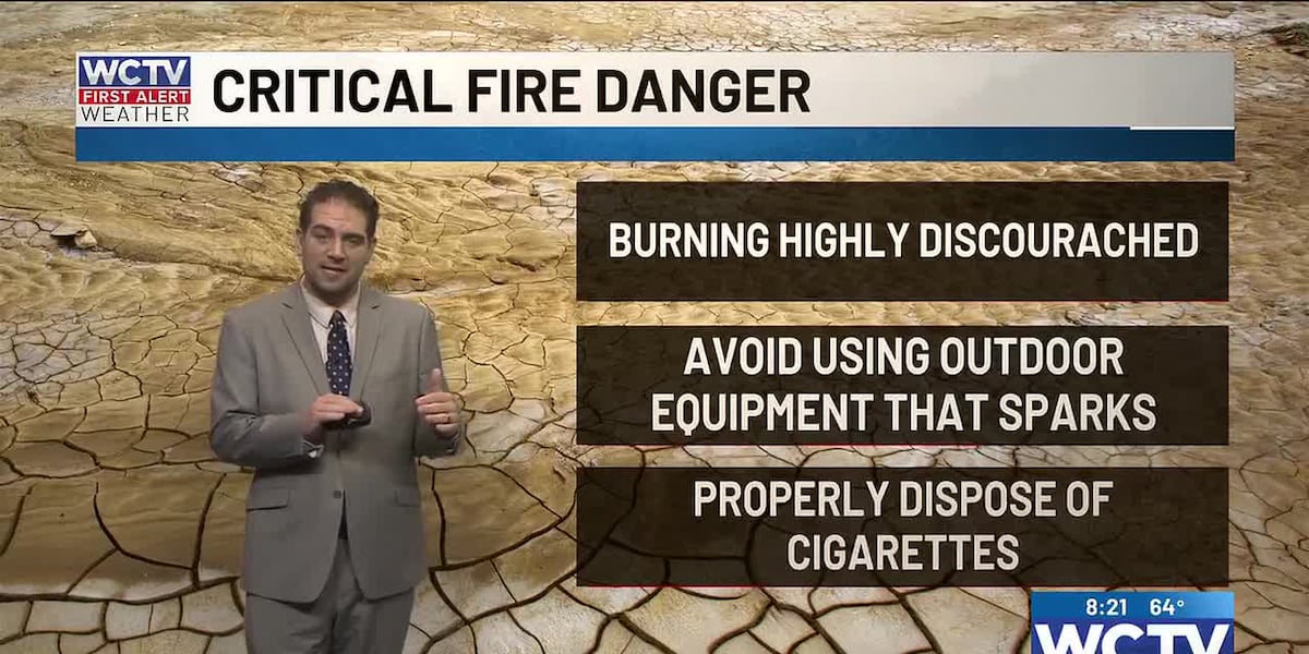
The strong winds and dry conditions make for higher fire danger across the Big Bend and South Georgia today. A red flag warning or fire weather warning is in effect due to the mix of drought, low humidity this afternoon and gusty winds. Avoid activities that could spark a fire and dispose of cigarettes properly. A little flame can turn into a wildfire very rapidly with the conditions expected today.
Still a decent breeze on Sunday
Staying mostly cloudy and breezy for your Sunday. Highs remain in the 70s. Not bad weather to be outside or get yardwork done as winds start to settle in the afternoon and evening.
Slowly returning moisture
I am not really excited about the rain chances next week, but with an east and southeast wind, it looks like slightly more moisture and a humid air mass will return to the region.
The clash between the Gulf and Atlantic sea breeze fronts will lead to isolated showers through much of next week. Rain chances look to be at most 20% for now. It is worth watching any weak upper-air disturbance that might help add some lift. It looks like upper-air high pressure should move most weather systems north around the ridge.
The lack of rain will only make drought conditions worse over the next week, but higher humidity should lower the fire risk at least a little.
Highs slowly climb back into the low and middle 80s. Morning lows will be humid in the low 60s.
To stay updated on all the latest forecasts and weather, follow WCTV First Alert Weather on Facebook and X (Twitter).
Click here to see all the latest weather headlines and here to view the First Alert Radar. Receive push alerts and watch the latest forecast anytime on the free WCTV First Alert Weather app. Click here to download it now.
Interested in becoming a WCTV First Alert Weather Watcher? Click here to join the team!
Copyright 2026 WCTV. All rights reserved.