
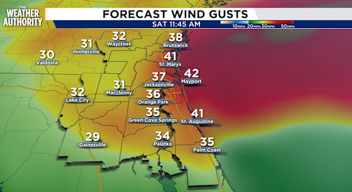
A windy weekend as another round of strong coastal winds and marine hazards impact our local beaches. The northeast wind will increase to 15 to 25 mph, with gusts reaching 35 to 45 mph possible east of I-95. The growing northeasterly flow will bring a slight chance of passing showers to coastal counties on Saturday and Sunday.
A Gale Warning will be in effect from Saturday at 8 a.m. through Sunday at 5:00 a.m.
A Wind Advisory will be in effect from 8 a.m. Saturday through midnight.
Tonight: Mostly clear and warm, with winds increasing from the northeast.
Saturday: Windy conditions expected, especially along our beaches. Marine and coastal hazards, including rip currents, are anticipated in coastal zones. Temperatures will be closer to seasonal norms, with lows in the 60s and highs in the 60s and 70s. Wind: NE 15-25 mph, with gusts of 30-45 mph. There is a slight chance of showers along the beaches.
. (.)
Sunday: Winds will be less intense, but a steady northeast breeze will maintain coastal hazards. The northeast wind will slow to 10-20 mph, with gusts up to 30 mph. Temperatures will be a bit cooler, with lows in the 40s and 50s for SE GA and in the 50s for NE FL. Afternoon highs will reach the upper 60s to 70s. Mostly clear overnight with lighter winds.
Looking ahead: Warming trend next week with a lighter southeasterly flow.
Sunrise: 7:21 a.m.
Sunset: 7:43 p.m.
Copyright 2026 by WJXT News4JAX – All rights reserved.