
JACKSONVILLE, Fla. — Here’s what the First Alert Weather Team said you can expect for the First Alert Weather forecast:
The windy, colder weather has arrived & will to a chilly night with some mist at times & temps. in the 50s. Wind gusts near 40 mph at the beaches/near the St. Johns River… 20-30 mph inland.Sunday will still be windy & rather cool with plenty of clouds & highs only 60-65 at the beaches to the lower 70s inland.A warming trend next week with increasing humidity will lead to isolated showers each day but a widespread soaker does not look to be in the cards. Highs in the mid to upper 70s on Monday will warm into the 80s the rest of the week.Easter weekend looks very warm & rather humid.
WATCH THE FORECAST | DOWNLOAD THE APPS
Follow Action News Jax Meteorologists on Twitter for updates:
Mike Buresh | Garrett Bedenbaugh | Corey Simma | Trevor Gibbs
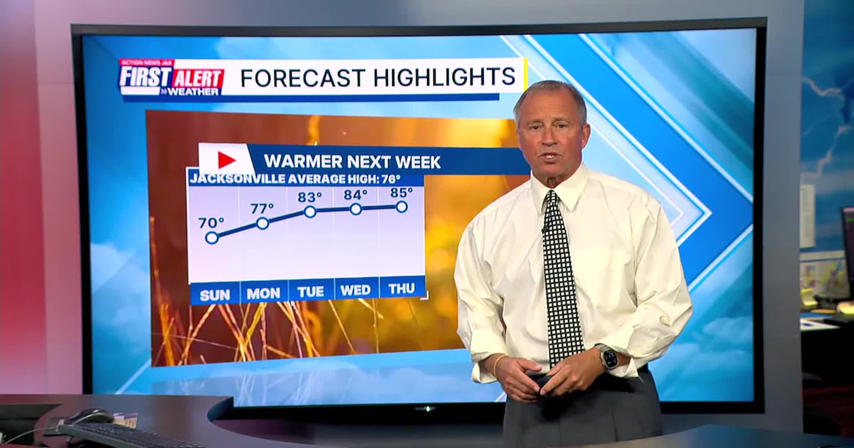
First Alert 7-day Forecast:TONIGHT: Cloudy, windy & chilly with some mist & drizzle at times. Low: 57SUNDAY: Mostly cloudy & windy. High: 70… 60-65 @ beaches.SUNDAY NIGHT: Mostly cloudy. Low: 57MONDAY: Partly cloudy, breezy with an isolated shower. High: 77TUESDAY: Partly cloudy, warmer, more humid… isolated inland shower. 59/83WEDNESDAY: Partly cloudy… isolated afternoon shower. 60/84THURSDAY: Partly cloudy, isolated afternoon shower. 60/85FRIDAY: Partly cloudy, isolated afternoon shower. 62/86SATURDAY: Partly cloudy, isolated afternoon shower. 64/86
ALLERGY TRACKER: See what the pollen counts look like in our area