
TALLAHASSEE, Fla. (WCTV) – After a nice first half of our Saturday, clouds have rolled into the region and will be featured in today’s weather for a good chunk of the day.
Not as warm today
As you head out the door, you will want to grab the light jackets, as the lower humidity is making the air feel a little cooler than Saturday morning. Temperatures this morning are in the upper 50s and low 60s. Highs will struggle to get out of the low and mid-70s for the Big Bend and South Georgia due to a mostly cloudy day. A few peeks of sun throughout the day. Clouds will slowly thin late in the day.
Winds will not be as strong today, but will still feature a light breeze up to 15 mph this afternoon. Gusts could reach 25 mph along the coast.
If you have plans to head to the coast, expect waves between 3 and 6 feet through the early afternoon. Small craft advisory until 2 p.m. Rip current risk is also high, so not ideal swimming conditions either.
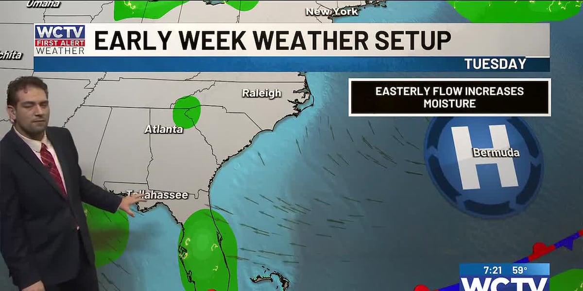
Moisture will slowly return to the Big Bend and South Georgia over the next week. High pressure will build off the Atlantic coast, turning winds east/southeast. This pattern will slowly increase moisture.
Isolated showers early this week
A sunny start to your Monday will transition to a partly sunny to mostly cloudy afternoon. Isolated showers develop in the afternoon from daytime heating along the sea breeze front. High temperatures climb into the low 80s.
A slightly higher coverage of showers on Tuesday as slightly higher moisture lingers over the Big Bend and South Georgia. The rain chance will be 30% for inland spots. Once again driven by daytime heating along the seabreeze fronts. Highs in the low 80s.
Staying warm and humid much of the week
I will keep a 10 to 20% chance of rain through the end of the week, as the pattern will not shift significantly, with sea-breeze activity. While spots will see rain from the sea breeze action, most will not see rain at all this week. Rain totals will NOT be significant enough to make any dent in the drought and extreme rainfall deficit we are in.
Highs will rise into the mid-80s midweek and be humid late-week. Morning lows will be in the low 60s.
Be sure to keep updated on all burn bans that are in place across the region. Leon County remains under a burn ban through midweek.
To stay updated on all the latest forecasts and weather, follow WCTV First Alert Weather on Facebook and X (Twitter).
Click here to see all the latest weather headlines and here to view the First Alert Radar. Receive push alerts and watch the latest forecast anytime on the free WCTV First Alert Weather app. Click here to download it now.
Interested in becoming a WCTV First Alert Weather Watcher? Click here to join the team!
Copyright 2026 WCTV. All rights reserved.