
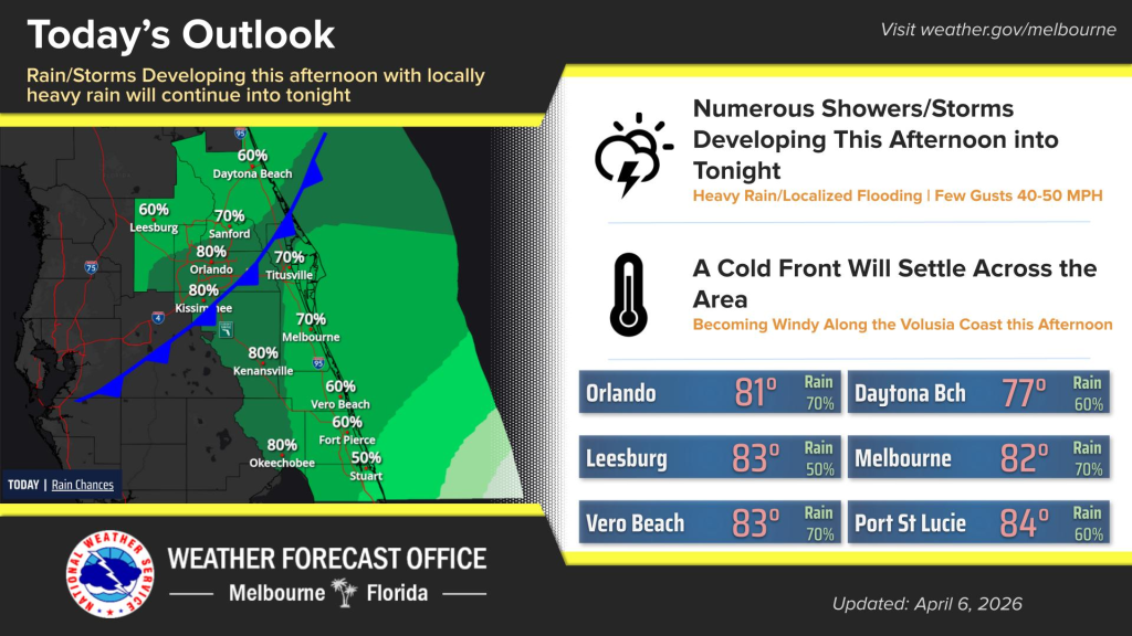
Numerous showers and storms are expected to develop Monday afternoon thanks to a cold front settling across Central Florida.
Those storms and showers may continue into the late evening, according to NWS Melbourne.
Locally heavy rainfall will occur with a chance for temporary flooding of urban and poorly drained areas.
Gusty winds up to 50 mph are also possible.
Skies will be cloudy with a high near 83 degrees across the region.
Area beaches have life-threatening rip currents throughout the week. Entering the surf is not advised.
Looking ahead, environmental conditions are favorable for multiple bands of heavy rainfall along the coast, according to NWS Melbourne.
Monday through Thursday are the most likely days for rainfall, with additional rain showers forecasted for Friday.