
A cold front will snag over Central Florida this week, bringing days of muggy, cloudy weather to the Tampa Bay area for much of the work week.
The cold front was over the Panhandle Monday, but it was expected to crawl down the state and stall around the middle of Florida by Tuesday. The front will bring mild temperatures and higher rain chances this week.
But don’t get too excited.
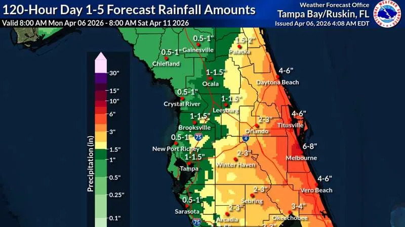
Accumulated rainfall over the next five days could be up to an inch and a half across Tampa Bay. While that would be a nice reprieve for parched lawns, it likely won’t be enough to pull the region out of an extreme drought.
The U.S. Drought Monitor showed all of Florida under drought conditions as of last week.
The drought has led to stricterwater restrictions across the region.
“We’ll get some beneficial rain, but … I don’t think it will be enough to actually help our drought, unfortunately,” said Stephen Shiveley, a meteorologist for the National Weather Service’s Tampa Bay office.
As we march toward summer, these cold fronts typically weaken and die around the middle of the state, Shiveley said. And that’s what this coming cold front is going to do, he said.
The front will park over Central Florida over the next few days and eventually dissipate.
Starting Tuesday, temperatures will drop to around the mid to upper 70s — a few degrees below normal — and slowly rise. By Thursday the high is likely to be in the low 80s.
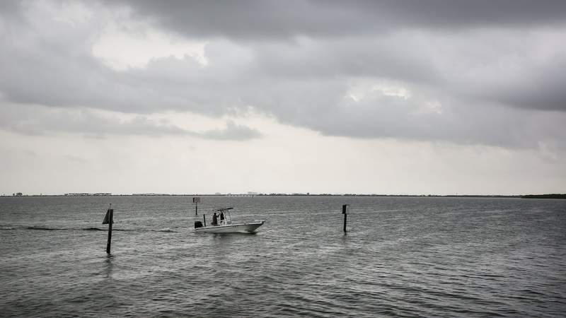
Tampa Bay has grown accustomed to cold fronts this year, but this one will be different. Instead of a dry chill, residents can expect cloudy, damp weather to mark the next few days.
“It will be cooler, but it’s going to be that more muggy-cloudy cooler,” Shiveley said.
Monday afternoon, ahead of the stalled front, Tampa Bay could be in for afternoon thunderstorms, Shiveley said.
Much of the east coast and Central Florida were under a level 1 “marginal risk of excessive rainfall” Monday, according to the weather service. Tampa Bay fell out of the warning, although parts of Polk and Hardee were within the risk area.
Rainfall has already plagued part of the state. Interstate 4 flooded near Kissimmee Sunday night from heavy rains, prompting the Florida Highway Patrol to close some lanes, according to the Orlando Sentinel.
By Monday morning, all lanes had reopened.
Florida’s east coast will receive the brunt of the state’s rain this week. Thanks to a favorable wind direction, that coast can expect up to 6 inches of rain, and even more in isolated spots over the next few days.
Starting Tuesday and running through Thursday, the weather service expects cloudy days coupled with on-again, off-again showers in the Tampa Bay area.
The weather service is not anticipating severe weather this week in Tampa Bay. Shiveley said residents can expect some breezy afternoons with winds gusts up to 20 mph.
Cold fronts like this one can continue to pop up as late as May, Shiveley said. Typically, these fronts don’t do much to cool the area, but they can bring severe weather.
By Friday, the area is expected to dry out and the sun will heat things up again with the mercury likely to climb back into the upper 80s.
• • •
The Tampa Bay Times launched the Environment Hub in 2025 to focus on some of Florida‘s most urgent and enduring challenges. You can contribute through our journalism fund by clicking here.