
Central Florida was hit with heavy rain over the weekend, and more is on the way on Monday. A flood watch has been posted for most of Central Florida until 7 p.m.Widespread showers will start rolling through at around 2 p.m. The areas that will see the greatest impact are Lake County, western Orange County, and northern Brevard County.Although intense downpours are anticipated in those regions, the showers are expected to move, meaning they won’t linger or cause significant ponding. Several regions are forecast to receive 2 to 3 inches of rain on Monday, a significant drop from the weekend, when some areas were projected to see 18 to 24 inches of rainfall.The biggest impacts are expected between 3 p.m. and 7 p.m.Looking aheadBeyond today, we track a few cold fronts that will help us turn much cooler late week and help the sun come out starting Tuesday. Chilly air arrives by late week, with morning lows in the 40s and 50s for the first time this seasonFirst Warning Weather Stay with WESH 2 online and on-air for the most accurate Central Florida weather forecast.RadarSevere Weather AlertsDownload the WESH 2 News app to get the most up-to-date weather alerts. The First Warning Weather team includes First Warning Chief Meteorologist Tony Mainolfi, Eric Burris, Marquise Meda and Cam Tran.What is Impact Weather?Impact Weather suggests weather conditions could be disruptive or a nuisance for travel and day-to-day activities.What is a Severe Weather Warning Day?A Severe Weather Warning Day suggests weather conditions that could potentially harm life or property.
ORLANDO, Fla. —
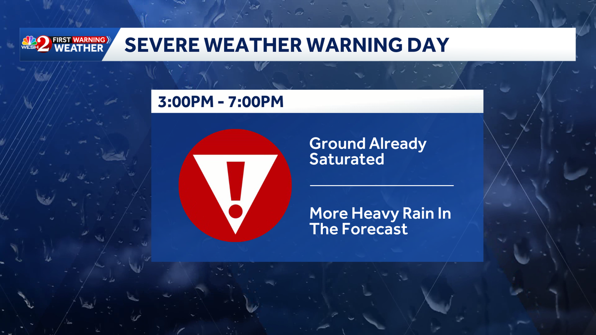
Central Florida was hit with heavy rain over the weekend, and more is on the way on Monday.
A flood watch has been posted for most of Central Florida until 7 p.m.
Widespread showers will start rolling through at around 2 p.m. The areas that will see the greatest impact are Lake County, western Orange County, and northern Brevard County.
Although intense downpours are anticipated in those regions, the showers are expected to move, meaning they won’t linger or cause significant ponding.
Several regions are forecast to receive 2 to 3 inches of rain on Monday, a significant drop from the weekend, when some areas were projected to see 18 to 24 inches of rainfall.
The biggest impacts are expected between 3 p.m. and 7 p.m.
Looking ahead
Beyond today, we track a few cold fronts that will help us turn much cooler late week and help the sun come out starting Tuesday.
Chilly air arrives by late week, with morning lows in the 40s and 50s for the first time this season
First Warning Weather
Stay with WESH 2 online and on-air for the most accurate Central Florida weather forecast.
Download the WESH 2 News app to get the most up-to-date weather alerts.
The First Warning Weather team includes First Warning Chief Meteorologist Tony Mainolfi, Eric Burris, Marquise Meda and Cam Tran.
What is Impact Weather?
Impact Weather suggests weather conditions could be disruptive or a nuisance for travel and day-to-day activities.
What is a Severe Weather Warning Day?
A Severe Weather Warning Day suggests weather conditions that could potentially harm life or property.