
ORLANDO, Fla. – It’s a wet and windy start to our morning across parts of Central Florida.
It’s our last day of dreary and damp conditions before improvements finally arrive into the weekend.
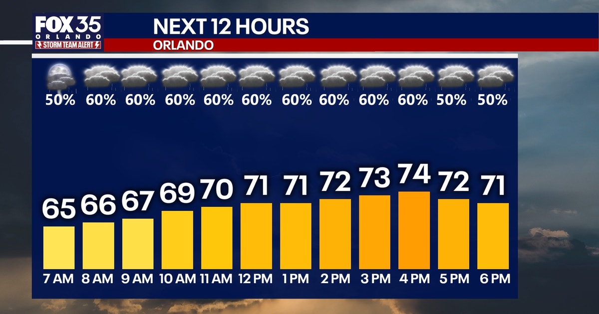
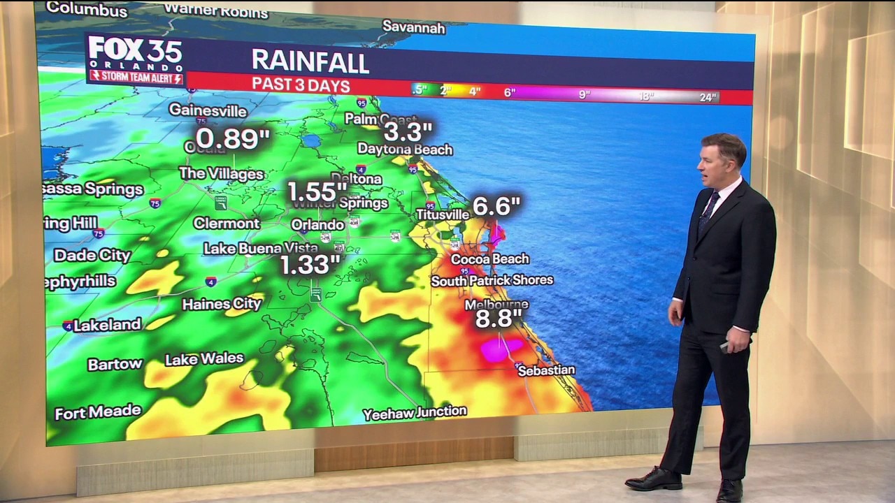
Scattered showers and a few isolated storms will be possible off and on throughout today. Best chances of rain will take place in Volusia and Brevard counties, where an additional 2-3 inches of rain could fall over areas that’ have already picked up several inches. The rain gradually fades this evening.
CLICK TO DOWNLOAD THE FOX LOCAL APP
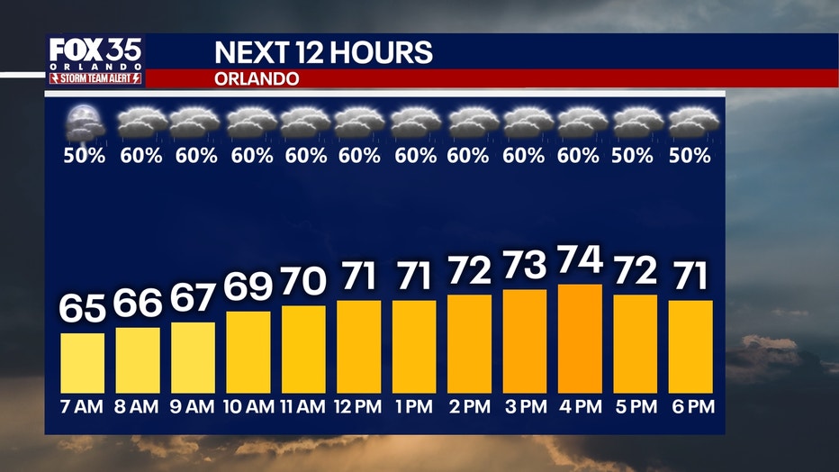
Temperatures today will remain below normal, as highs only reach the low and middle 70s.
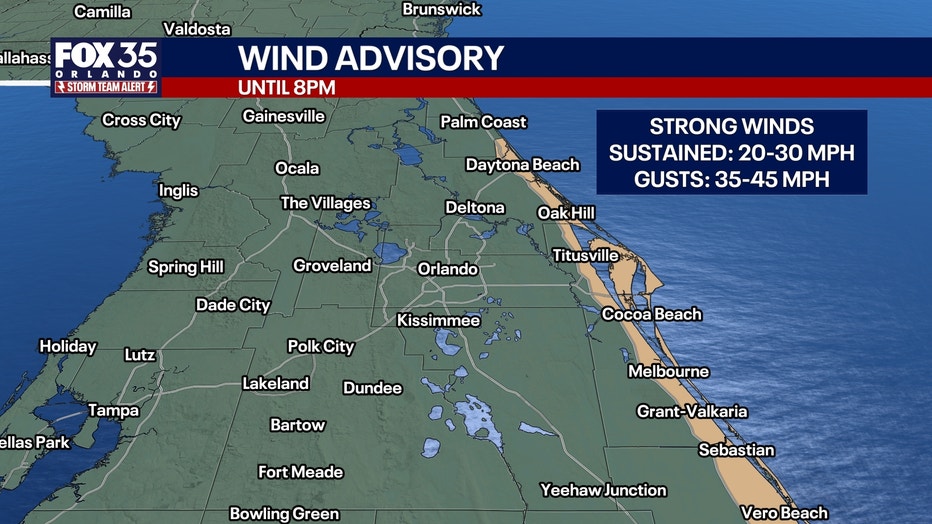
A Wind Advisory is in effect for Brevard and Volusia counties until 8pm. Sustained winds will reach speeds of up to 20-30 mph with gusts near the coast up to 45 mph.
SIGN-UP FOR FOX 35’S BREAKING NEWS, DAILY NEWS NEWSLETTERS
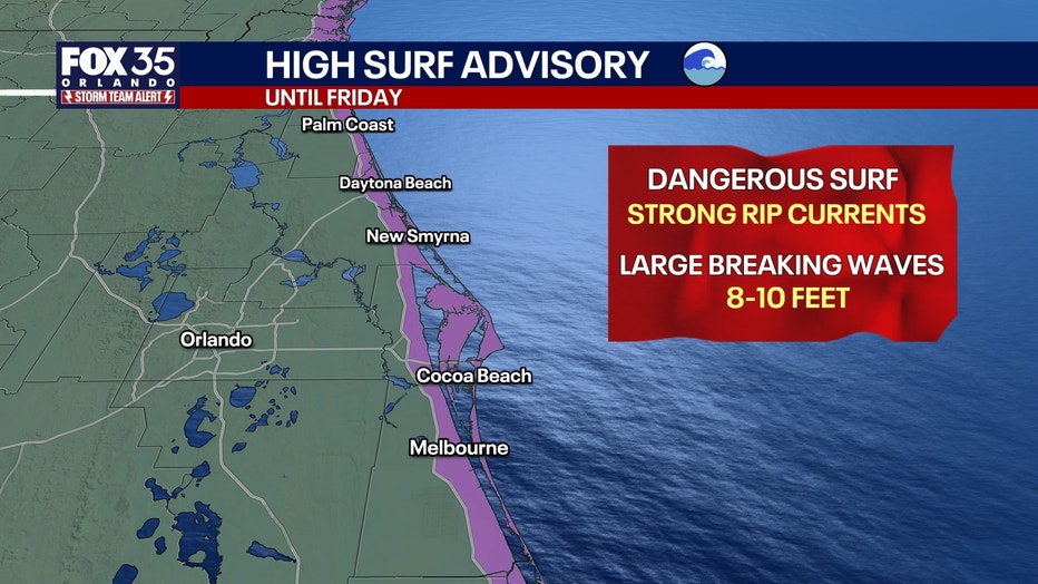
HIGH SURF ADVISORY: Rough surf conditions continue with large breaking waves of 8-10 feet along with strong and dangerous rip currents.
A few light and isolated showers are possible overnight. They’ll gradually fade, leaving us mostly dry for Friday morning. Temperatures will dip down into the upper 50s and low 60s for lows.
We finally will dry out as sunshine returns and carries us into the weekend.
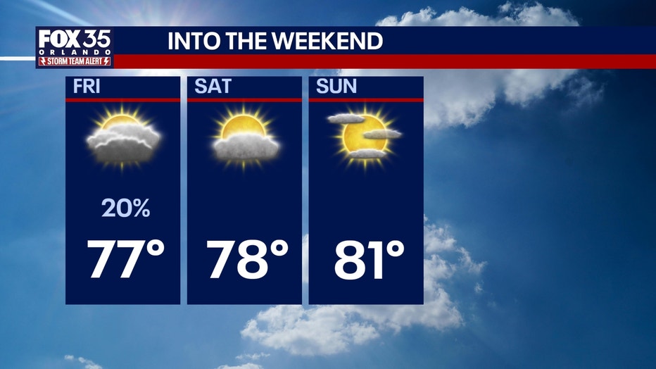
Tomorrow’s forecast features only a slim chance of a stray shower or two with increasing sunshine as temperatures climb into the upper 70s to near 80-degrees for highs.
It will be a beautiful stretch that lasts into early next week as temperatures steadily bounce back into the low and mid 80s for highs.
The Source: This story was written with information from the FOX 35 Storm Team.