
TALLAHASSEE, Fla. (WCTV) – A stubborn pattern of warm, dry weather will persist for the next several days.
Tonight Through Sunday Night
Quiet weather will stick around for Saturday night. We stay dry under a clear sky. Lows fall into the low-and-mid-50s by Sunday morning.
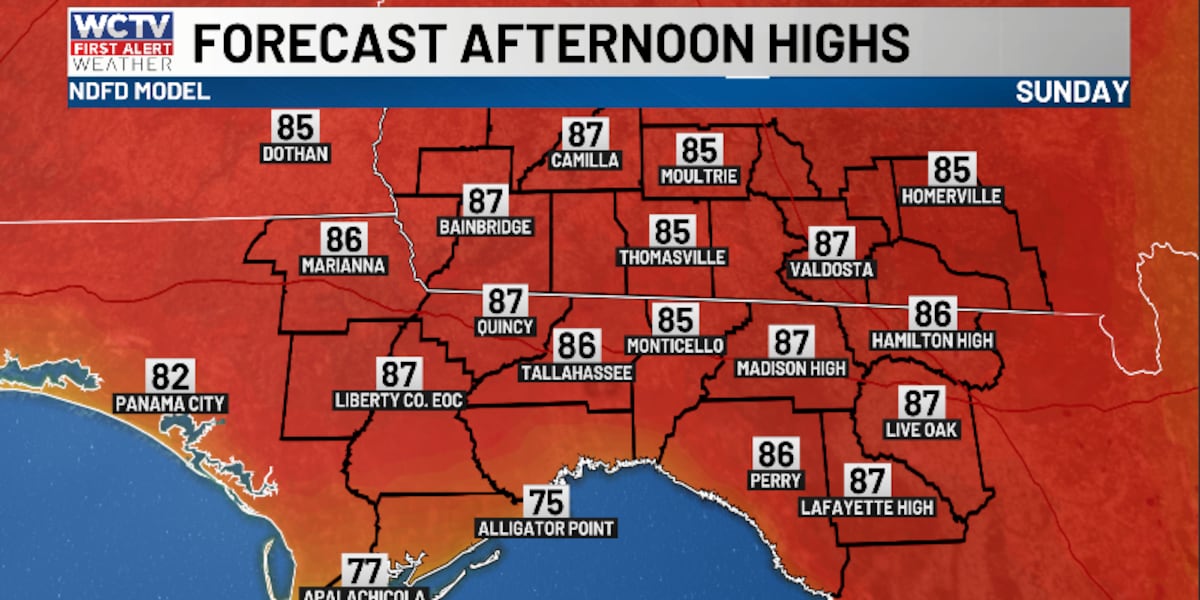
A “copy and paste” forecast is on tap for the second half of the weekend. We are dry, sunny and warm on Sunday. Highs climb into the mid-and-upper-80s.
Sunday night will be calm and comfortable. Lows settle in the low-to-mid-50s under a mostly clear sky.
Starting The New Week
High pressure will stay in control for much of the work week, so rain chances stay near zero and highs stay above average.
Temperatures on Monday top out in the low-to-mid-80s under a mostly sunny sky. Lows fall into the low-50s.
Tuesday is looking dry, sunny and warm. Highs reach the mid-to-upper-80s, with lows in the low-to-mid-50s.
More of the same is on the way for midweek. Temperatures on Wednesday soar into the upper-80s under some sunshine. Lows dip into the mid-and-upper-50s.
Extended Forecast
Looking down the road, we could be flirting with 90º to end the work week and move into the weekend.
Dry weather will continue for Thursday and Friday.
Temperatures climb into the upper-80s and low-90s under a mostly sunny sky.
Overnight lows bottom out in the mid-and-upper-50s to end the week.
To stay updated on all the latest forecasts and weather, follow WCTV First Alert Weather on Facebook and X (Twitter).
Click here to see all the latest weather headlines and here to view the First Alert Radar. Receive push alerts and watch the latest forecast anytime on the free WCTV First Alert Weather app. Click here to download it now.
Interested in becoming a WCTV First Alert Weather Watcher? Click here to join the team!
Copyright 2026 WCTV. All rights reserved.