
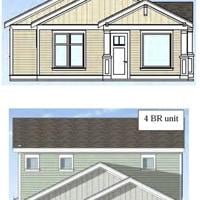
FORT PIERCE – The St. Lucie County Commission unanimously paved the way April 7 for a 165-unit rental community just south of Indrio Road that will offer a broad variety of housing types for for rent with nearly 50 percent common open space and a number of community amenities.
The Commission previously rezoned the 37-acre site to planned unit Development a year ago last December, with the applicant’s representatives and county staff working ever since on the final development plan. Planner Irene Szedlmayer reintroduced the item to commissioners that evening.
“This is a major site plan for 4540 N. Kings Highway,” she said. “The property is located about a quarter mile south of Indrio Road in the Towns, Villages & Countryside Future Land Use area. It’s also in the Airport Overlay Zone, and the preliminary development plan was approved in December of 2024.”
Szedlmayer emphasized several changes made to that plan in the interim, which included reducing the initially approved density of 5.22 dwelling units an acre, expanding the distance between units and adding more land to the common space areas.
“It provided about 47 percent common open space and dedicated 80 feet of right of way along the southern boundary of the property for a future east-west road,” she explained. “They reduced the density to 4.5 dwelling units an acre, about a 14 percent reduction. They have increased the spacings between the buildings to 15 feet. When they came in for preliminary development approval, they had eight-unit townhome buildings. It was requested they split that into buildings with no more than four units, so now we have three-unit and two-unit buildings.”
The planner also described the common open spaces while pointing to a map on the overhead monitor.
“The flow way makes up a big part of the open space,” she continued. “This will be dry detention. They have a community park here and a recreation and amenity center that has a children’s play yard. The building has a gym and a swimming pool. There’s another little pocket park over on this side.”
Szedlmayer wrapped up her presentation with a look at the area’s complicated traffic logistics, acknowledging that southbound left turns into the project might not be allowed by the Florida Department of Transportation in the future, which plans to four-lane that stretch of Kings Highway.
“We didn’t want people to have to travel north up to Indrio, make a U-turn and come back down, but that will have to be revisited at some time in the future with FDOT,” she concluded. “They have not started to acquire the right of way along here yet, so there’ll be time to work on that issue. Staff recommendation is that the Board of County Commissioners adopt the draft resolution approving the final development plan subject to the conditions identified in the resolution.”
The applicant’s contracted Land Planner Leah Heintzelman then provided her own presentation.
“Our professional team has been involved since December of 2024 and has worked closely to ensure the final site plan remains consistent while continuing to improve the overall design,” she said. “The project is located along the east side of Kings Highway within the Kings Highway Jobs Corridor District and is in close proximity to the Treasure Coast Regional Airport. The site is within the Urban Service Boundary and approximately 1.3 miles from a regional transit stop, making it a strong and appropriate location for attainable housing. The property consists of approximately 36.6 acres, which includes an 80-foot right of way donation along the southern boundary.”
Heintzelman also highlighted the reduction in density.
“The current plan proposes 165 units, well below the previously approved plan and the allowable density under the future land use designation,” she explained. “This reduction reflects a more thoughtful and balanced approach to the site design. The development accounts for roughly 3.2 parking spaces per dwelling unit, giving ample space for both residents and guests. Larger buildings were broken down into smaller groupings, creating a more human-scaled environment centered around the shared spaces. The plan now provides approximately 16.87 acres of a contiguous common open space, an increase of over two acres from the originally approved PUD.”
District 1 Commissioner James Clasby was the only Board member to pose questions afterward, noting that this would be the last final site plan to come before commissioners after they decided staff would handle them administratively from now on.
“What was the original entitled density?” he asked.
“The maximum density that could be considered would be nine dwelling units an acre,” Szedlmayer answered.
“They came down to 4.8, which I think is a big accomplishment,” Commissioner Clasby continued. “What is our minimum parking requirement on neighborhoods such as this?”
“Two spaces per dwelling unit,” Szedlmayer replied.
That answer pleased Clasby, who used it and other plan changes to challenge future developers.
“Two spaces per unit and they’re offering 3.2 spaces,” he exclaimed. “Any developer out there listening should take note that we want higher standards, not minimum standards. Neighborhoods like this always need more parking, and I greatly appreciate accommodating the building spacing, which is something I initially asked for.”
Commissioner Clasby then made a motion for approval, which was seconded by Commissioner Cathy Townsend and passed unanimously.