
Breezy and Seasonable for South Florida Today
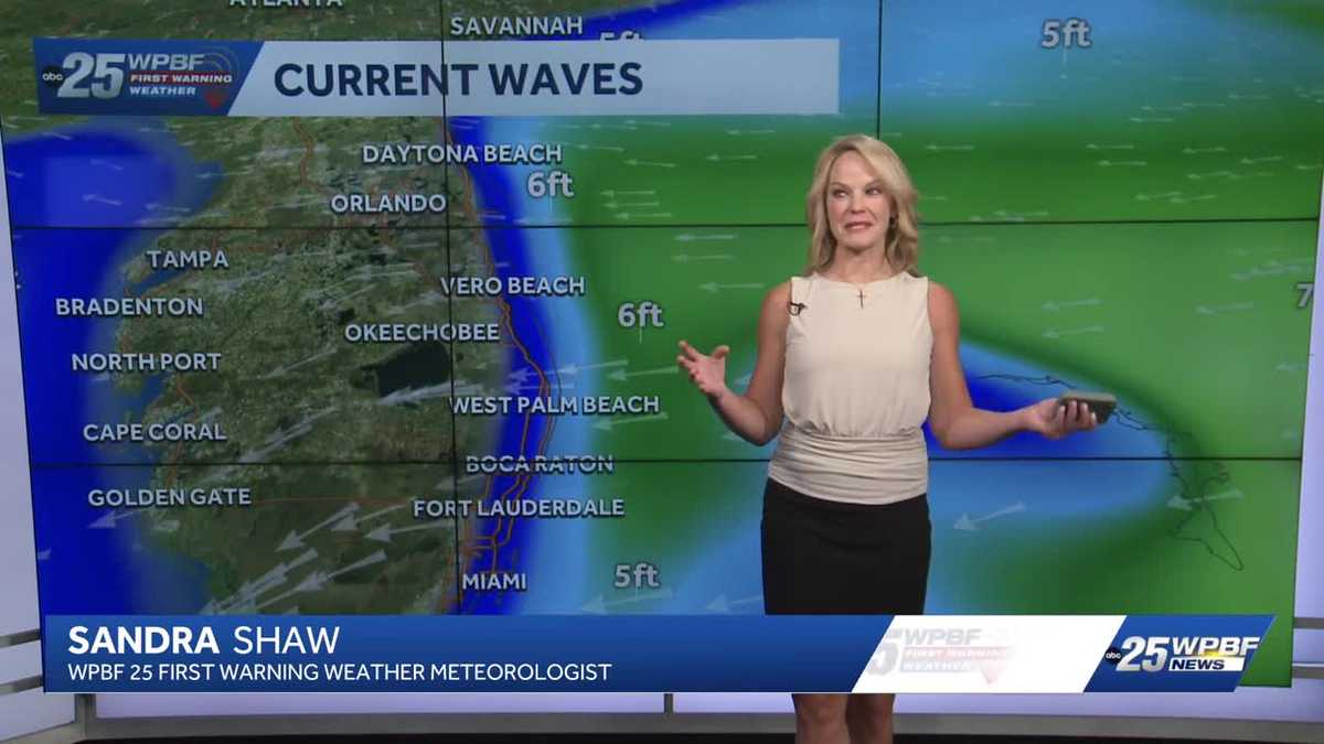
WATCHING THE ROADS WILL GET TO HER IN JUST A MOMENT, BUT FIRST, HERE’S SANDRA WITH A LOOK AS IF THAT NICE WEATHER IS GOING TO BE STICKING AROUND. SANDRA 100%. IT’S GOING TO BE STICKING AROUND. IN FACT, WE’RE GOING TO SEE ONE OF THE BETTER WEEKS THAT WE’VE SEEN. NOW WE NEED THE RAIN, BUT WE CERTAINLY CAUGHT UP A LITTLE BIT LAST WEEK. SO WE’RE GOING TO BE ONGOING WITH DRIER CONDITIONS BUT BREEZY CONDITIONS. THAT’S WHY WE HAVE THOSE 5 TO 6 FOOT WAVE HEIGHTS OFFSHORE AND ALSO A HIGH RISK OF RIP CURRENTS. THAT’S YOUR BIGGEST THREAT TODAY. OTHER THAN THAT, A COOL START IN OKEECHOBEE ONLY IN THE LOW 60S. RIGHT NOW IT’S 69 IN JUPITER FARMS, 71 OUT AT THE AIRPORT, 73 IN BOCA AND 72 IN VERO BEACH. VERY DRY. AS WE TAKE A LOOK AT OUR TREASURE COAST PLANNER WITH ABUNDANT SUNSHINE. JUST A FEW CLOUDS FOR TEXTURE HERE AND THERE AND BREEZY WITH HIGHS IN THE UPPER 70S TO LOW 80S. WE’RE GOING TO DO THE SAME THING FOR THE PALM BEACHES. I THINK YOU’LL LIKE IT. REALLY A SIGN OF STABILITY ALL WEEK LONG AND THEN JUST HOTTER BY THE WEEKEND. 86 ON SATURDAY, 85
WPBF 25 First Warning Meteorologist
South Florida will see stable conditions as high pressure moves across the state this week. It will be dry with highs in the lower 80s through Thursday. By Friday and through the weekend temperatures will hit the middle to upper 80s. East winds will fuel a high risk for rip currents in the Atlantic.
South Florida will see stable conditions as high pressure moves across the state this week. It will be dry with highs in the lower 80s through Thursday. By Friday and through the weekend temperatures will hit the middle to upper 80s. East winds will fuel a high risk for rip currents in the Atlantic.