
Warming up this week
Track the forecast highs with meteorologist Victoria Wisniewski
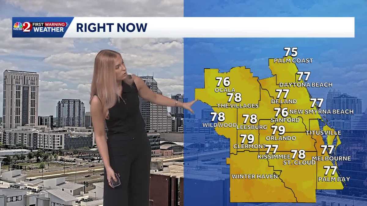
SNOW MELT. I’M REPORTING. ALL RIGHT, SO YOU HEARD THEY WERE TALKING ABOUT GEORGIA AND THE DROUGHT THERE. WE’RE FACING DROUGHT LIKE CONDITIONS HERE TOO. YEAH. EVEN IN SPITE OF ALL OF THAT RAIN THAT WE GOT LAST WEEK. YEAH. SO WE WERE JUST TALKING SANIKA. AND IT SEEMS THAT WITH ALL THE RAIN THAT WE RECEIVE, WE GOT ALL ABOUT FOUR MONTHS WORTH OF RAIN IN ABOUT A WEEK. SO YOU’RE THINKING, WHY HASN’T THE DROUGHT IMPROVED? WELL, IT REMAINS STABLE, WHICH IN THEORY IS GOOD NEWS, BUT WE NEED SO MUCH MORE RAIN TO MAKE A DENT IN THE DROUGHT. AND UNFORTUNATELY, WELL, THE FORECAST OVER THE NEXT COUPLE DAYS IS GOING TO BE WARMER AND WE ARE NOT GOING TO BE HAVING ANY RAIN IN THE FORECAST. WE ARE SEEING VERY MINIMAL CHANCES TO SEE THAT RAIN, MAYBE UNTIL NEXT WEEK. THAT’S WHEN WE COULD SEE SOME PRECIPITATION BACK IN THE FORECAST. BUT OTHERWISE WE ARE JUST GOING TO BE WARMING UP ACROSS CENTRAL FLORIDA. AND FOR SOME OF US, GOING TO BE SEEING THE 90S AS WE HEAD THROUGH THE MID WEEK AND LATE WEEK HERE IN ORLANDO, WE’RE GOING TO BE APPROACHING THE UPPER 80S LOW 90S AS WE HEAD TOWARDS THE END OF THE WORKWEEK. AND THEN BY THE SATURDAY, SUNDAY TIME FRAME. BUT IF YOU FIND YOURSELF FURTHER INLAND, WILDWOOD, OCALA AREAS AWAY FROM THE WATER, THAT’S WHERE YOU’RE GOING TO HAVE DRIER AIR MOVE IN. YOU CAN SEE THOSE TEMPERATURES EARLIER IN THE WEEK. SO ON AVERAGE, WE GET ABOUT 106 DAYS OF 90 DEGREE PLUS DAYS. BUT SO FAR WE’VE ONLY HAD THREE THIS YEAR. AND TAKE A LOOK AT THE SEVEN DAY FORECAST. CERTIFIED MOST ACCURATE. ACROSS CENTRAL FLORIDA. YOU’LL SEE THAT WE HAVE THAT CHANCE TO SEE THAT AS WE HEAD INTO SATURDAY AND SUNDAY. BUT BEFORE THAT GRADUAL WARMING OVER THE NEXT COUPLE DAYS, MOSTLY SUNNY SKIES, AND WE’RE STILL WATCHING THAT RIP CURRENT RISK ACROSS THE COASTLINE. AS WE HEAD INTO TOMORROW. IT WILL BE A MODERATE RISK, BUT THEN JUMPS RIGHT BACK UP INTO THE MIDDLE AND END OF THE WEEK. SO THE POOL IS GOING TO BE YOUR FRIEND OVER THE NEXT COUPLE DAYS FOR TODAY. AND TO FOLLOW WITH A LIVE LOOK. DOWNTOWN ORLANDO AT THIS HOUR, A COUPLE CLOUDS AND WE ARE MOSTLY DRY 78 TOWARDS THE VILLAGES, 76 IN SANFORD AND 79 AT THIS HOUR IN ORLANDO. WE’RE JUST ABOUT TO REACH THE 80S FOR MANY OF US. SO HERE’S THE THING. FIRST WARNING LIVE RADAR IS MOSTLY DRY, BUT I FOUND ONE ONE LITTLE CELL JUST NEAR SAINT CLOUD AND SOUTH OF KISSIMMEE. AT THIS HOUR THAT IS JUST PRODUCING A QUICK LITTLE SHOWER OFF OF THE LAKE. BUT EVERYONE ELSE, THEY ARE NICE AND DRY. THE 12 HOUR FORECAST BRINGING US TO THE LOW 80S IN ORLANDO. THOSE OF YOU ALONG THE COASTLINE WILL BE IN THE UPPER 70S LIKE NEW SMYRNA BEACH, COMING IN AT 78, TITUSVILLE COMING IN AT 80, AND THE PALM COAST IS 79. BUT YOU SEE THOSE OF YOU BY OCALA, THE VILLAGES, LEESBURG, THOSE ARE THE ONES THAT ARE GOING TO BE SEEING THE WARMEST CONDITIONS TODAY. AND OVER THE NEXT COUPLE OF DAYS. AND WE’RE GOING TO CONTINUE TO WATCH THE ALLERGIES AND THE POLLEN OVER THE NEXT COUPLE DAYS AS WELL. THE LACK OF RAIN, BOTH FOR THIS WEEK BUT ALSO UPCOMING. YOU’RE GOING TO NOTICE THAT ORLANDO IS GOING TO BE JUST IN THE BELOW AVERAGE CATEGORY. SO WE’RE GOING TO BE WATCHING WHAT THAT TREND WILL BE LOOKING LIKE ACROSS CENTRAL FLORIDA. I CAN TELL YOU THIS WEEK IS GOING TO BE BRIGHT, SUNNY, AND CERTAINLY WARM. AS WE TAKE A LOOK AT YOUR SEVEN-DAY FORECAST ALONG THE COASTLINE. IT WILL BE A COUPLE DEGREES COOLER
Warming up this week
Track the forecast highs with meteorologist Victoria Wisniewski

Updated: 1:33 PM EDT Apr 13, 2026
Central Florida is sure feeling the heat this week. Low 80s to start, but mid to upper 80s to end the work week; some locations will reach the 90s.Rain chances will remain low and will potentially re-enter by next week, but overall, the rain trend is below average as we near the end of the month.First Warning Weather Stay with WESH 2 online and on-air for the most accurate Central Florida weather forecast.RadarSevere Weather AlertsDownload the WESH 2 News app to get the most up-to-date weather alerts. The First Warning Weather team includes First Warning Chief Meteorologist Tony Mainolfi, Eric Burris, Marquise Meda, Cam Tran and Victoria Wisniewski. ————————————————DOWNLOAD the free WESH 2 News app for your latest news and alerts on breaking news, weather, sports, entertainment and more on your phone or tablet. And check out the Very Local app to stream news, entertainment and original programming on your TV.
ORLANDO, Fla. —
Central Florida is sure feeling the heat this week. Low 80s to start, but mid to upper 80s to end the work week; some locations will reach the 90s.
Rain chances will remain low and will potentially re-enter by next week, but overall, the rain trend is below average as we near the end of the month.
First Warning Weather
Stay with WESH 2 online and on-air for the most accurate Central Florida weather forecast.
Download the WESH 2 News app to get the most up-to-date weather alerts.
The First Warning Weather team includes First Warning Chief Meteorologist Tony Mainolfi, Eric Burris, Marquise Meda, Cam Tran and Victoria Wisniewski.
————————————————
DOWNLOAD the free WESH 2 News app for your latest news and alerts on breaking news, weather, sports, entertainment and more on your phone or tablet. And check out the Very Local app to stream news, entertainment and original programming on your TV.