
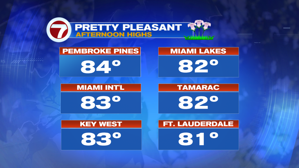
As Tax Day arrives, our south Florida weather (you could say) is giving us a nice refund. Keep in mind, last week at this time we had our fair share of damp and dismal days. It was mainly due to a pesky front that stalled to our south. Now, that’s a distant memory and we’re back under the grip of High Pressure. For the time being, it’s just a fine-feeling pattern that has us with typical mid April temperatures.
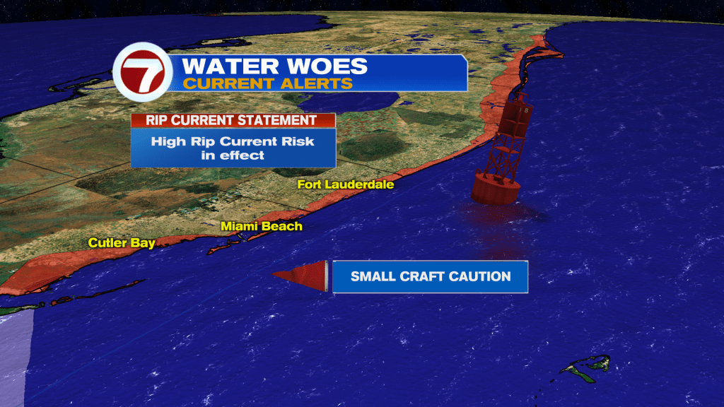
We’ll want to savor this comfortable weather. In just a couple of days, temperatures are expected to notch higher with humidity readings on the rise, too. Meanwhile, local winds and seas still pose the main (and only) problem. Rip Currents remain a high danger along the Atlantic beaches while boaters are urged to use caution (especially smaller type vessels). We’re still patiently waiting for lighter winds.
That’s looking more promising, beginning Wednesday.
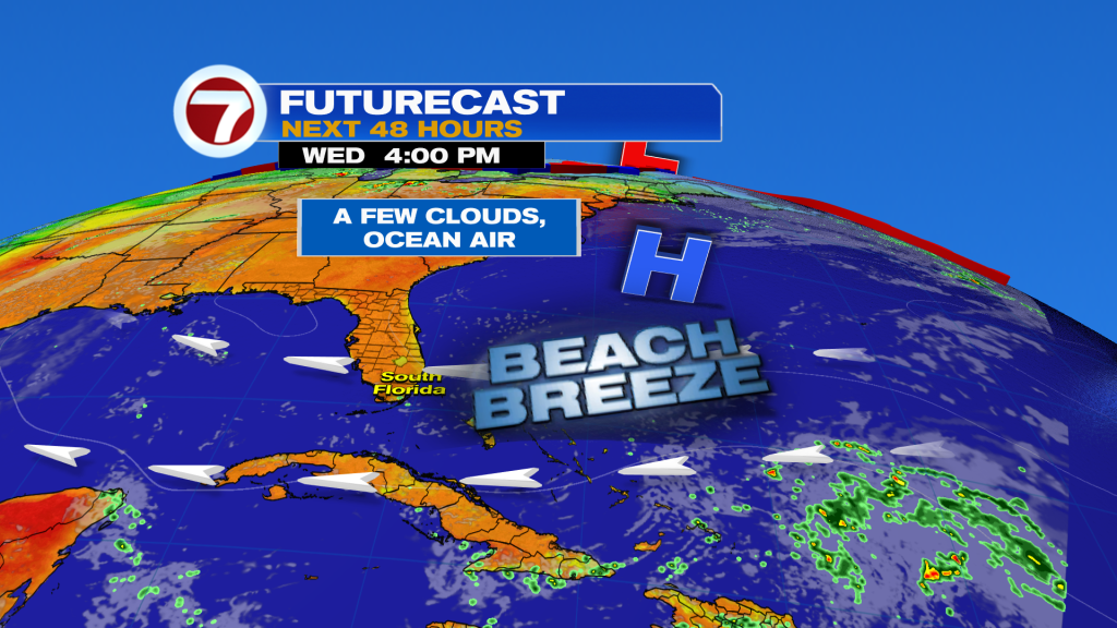
The main takeaway is that High Pressure (centered northeast of the Bahamas) will continue to “bridge” into Florida. As such, it’ll be in weaker fashion than earlier this week. While Winds decrease it’s still an ongoing onshore flow. Some of our forecast models show a brief sprinkle, or two, passing along the same breeze. For most locations? Mild and generally dry from Wednesday through the end of the week!
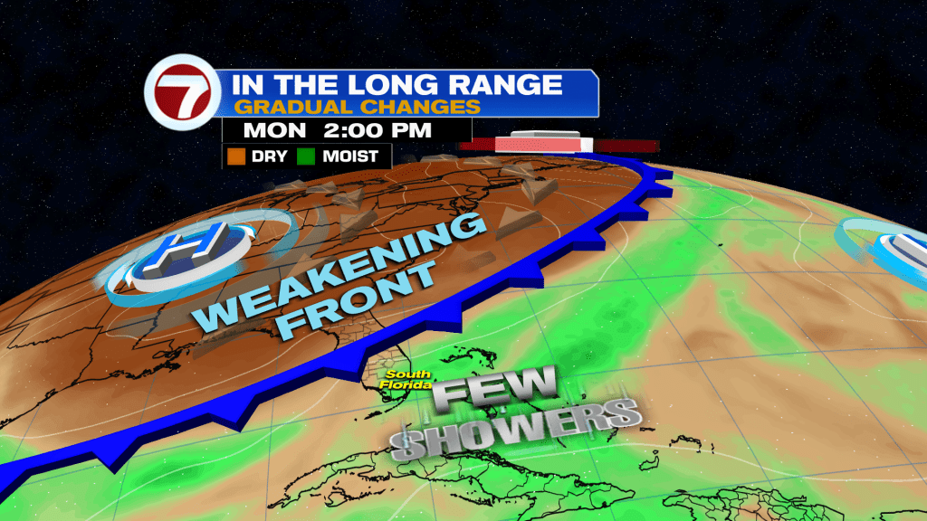
In the long range, we’ll have to focus on a sagging front moving into Florida (early next week). It’ll be weak but seemingly have the potential for tapping moisture for times of rain.
Copyright 2026 Sunbeam Television Corp. All rights reserved. This material may not be published, broadcast, rewritten or redistributed.
Join our Newsletter for the latest news right to your inbox