
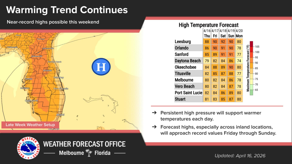
Central Florida is getting hotter by the day, thanks to a high pressure system settling over the state.
Wednesday begins with a patchy fog before 9 a.m., and then skies will be mostly sunny.
Inland afternoon temperature highs will be in the upper 80s to lower 90s, according to NWS Melbourne.
These near record values are expected to extend from Friday through Sunday.
There is a high risk of rip currents at all Central Florida beaches. Entering the ocean is strongly discouraged.