
PINELLAS COUNTY, Fla. — Seagrass is a vital part of Tampa Bay’s ecosystem. For decades, the Southwest Florida Water Management District has monitored the health and growth of the plant.
What You Need To Know
An extensive survey of seagrass is underway
The study is conducted every two years to check the health of seagrass
2018 saw a major decline in seagrass in some areas after a rough hurricane season
A major decline in seagrass in 2018 came after a notable storm season and red tide that was followed by a rebound in growth earlier this decade. Now, for the first time since the 2024 hurricanes, scientists are gathering data to update their seagrass maps.
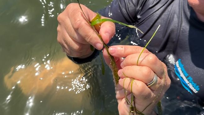
In the scenic waters off Fort De Soto State Park, researchers are checking on seagrass.
“This year we are mapping from Tampa Bay to Charlotte Harbor — so it’s the area that we call the Suncoast,” said Dr. Chris Anastasiou, who leads the survey.
Anastasiou says seagrass plays a critical role in the marine environment.
“Seagrass is home to about 70 or 75 percent of commercially and recreationally important species of fish according to the FWC. Seagrass helps with attenuating surge and helps keep the sediments in place and is also pretty important for carbon storage,” he said.
Researchers monitor the vegetation both from the air and up close.
“You can see the quality of the grass — the color of it — it tells us a lot about the quality and health of the seagrass. Our maps are designed to show overall distribution of the grass but it doesn’t really say anything about the health of the grass, and getting in the water is really important to visually inspect the grass and see how they are doing,” Anastasiou said.
Environmental scientist Tara Carter uses a simple tool to assist in the survey.
“This is called the seagrass hunter — it’s basically got a plexiglass window viewer on the bottom of it so we can see what kind of community we’re in before we deploy any of our GoPros, try to find the right seagrass we are looking for,” Carter said.
The work is part of the 2026 Seagrass Mapping Program. It started in 1988 and is now conducted every two years. The data helps determine how seagrass is faring.
Anastasiou says the program is vital.
Seagrass provides food for dozens of species, helps clean the water itself, and serves as an indicator if something might be wrong in an area, such as pollution.
This is the first survey since the 2024 hurricanes, and researchers will use the data to see if those storms had a major impact on the seagrass.
“Seagrass not only helps to regulate and improve water quality, but they are also very sensitive to changes in water quality — so we use them as a sort of way to keep a pulse on the estuary,” Anastasiou said.
Monitoring Tampa Bay’s ecosystem so it stays healthy for years to come.
The data gathered is still being analyzed. Final results of the latest mapping should be released next year.