
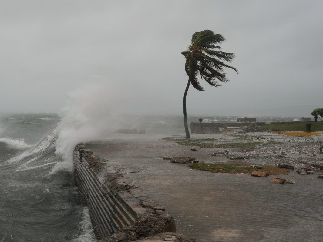
Hurricane Melissa made landfall in New Hope, Jamaica on Tuesday afternoon as a catastrophic Category 5 storm with winds of 185 mph, forecasters said.
With a pressure of 892 mb, “this is the strongest landfall on record in the Atlantic Basin, tied only with the 1935 Labor Day Hurricane 90 years ago,” Matt Devitt with WINK weather in Southwest Florida wrote in a social media post just after 1 p.m.
Several hundred feet up into the storm, Hurricane Hunters recorded a wind gust of 252 mph on Tuesday, he said.
Find out what’s happening in Tampafor free with the latest updates from Patch.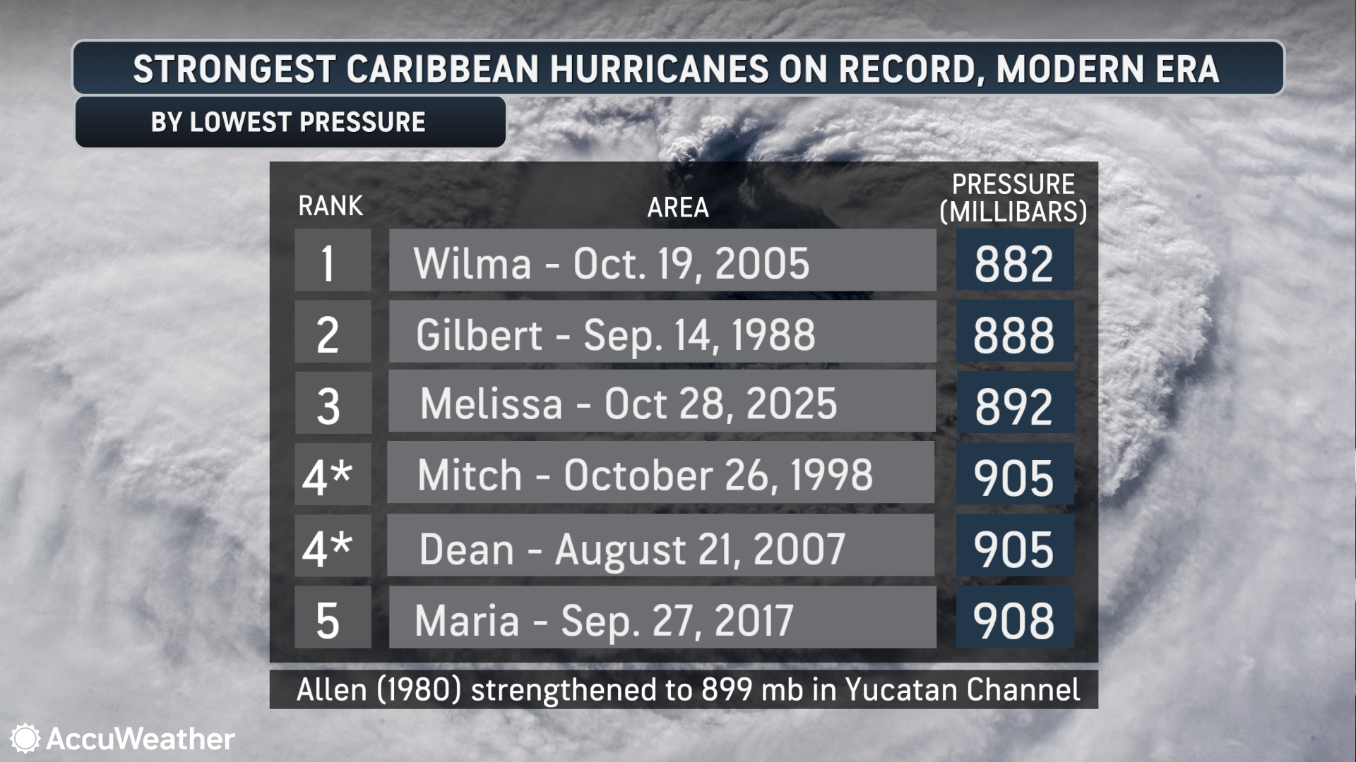 Image courtesy of AccuWeather
“This is a worst-case scenario for Jamaica. Melissa is basically equivalent to a 30-mile wide EF-4 tornado moving inland,” Devitt added.
The powerful storm is forecast to remain well east of Florida and the U.S. mainland after pummeling Jamaica. It’s expected next to take aim at Cuba before moving toward the Bahamas and the Turks and Caicos, forecasters said.
Find out what’s happening in Tampafor free with the latest updates from Patch.
Melissa poses “little to no risk to Florida or the continental U.S.,” said Dr. Ryan Truchelut, chief meteorologist at WeatherTiger, who works with the USA TODAY Network, said, according to the News-Press.
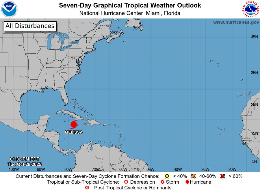 With sustained winds of 185 mph and a wind gust even hitting 252 mph, Cat. 5 Hurricane Melissa made landfall in Jamaica. It’s one of the most powerful Atlantic storms ever. Image via: National Hurricane Center
“Odds of any outer bands of Melissa even minimally scraping southeast Florida on its way out (into the Atlantic) are around 5 [percent,]” he said.
So far this season, Florida and the U.S. East Coast has been spared a direct hit by a hurricane.
Typically, by this time in the Atlantic hurricane season, at least three hurricanes or tropical storms would have made landfall in the U.S., the New York Times said. This year, the only named storm to come ashore in the U.S. was Tropical Storm Chantal in South Carolina.
Up to 18 feet of storm surge, catastrophic wind gusts up to 215 mph, and 3 feet of rain or more is possible across parts of Jamaica Tuesday, according to AccuWeather.
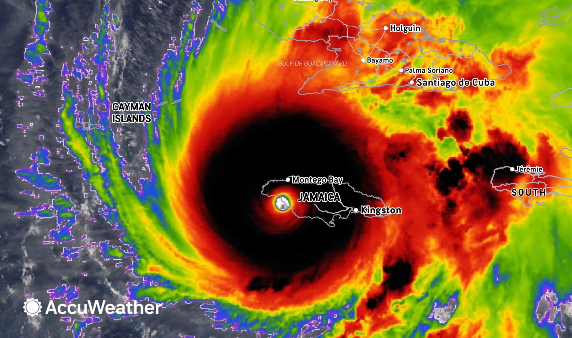 Image courtesy of AccuWeather
Wind gusts within the eyewall of the hurricane will continue to be comparable to an E-F3 or E-F4 tornado, the agency said. These gusts could last for hours in the hardest-hit areas.
“The intense storm surge, extreme rain, and destructive winds can damage critical infrastructure across Jamaica. A catastrophic storm surge up to 18 feet is possible, just east of where the storm makes landfall. Key power plants, water treatment facilities, airports, shipping ports, and fuel terminals are all at risk of extensive damage or destruction in the hardest hit areas,” AccuWeather’s chief meteorologist Jonathan Porter said. “Especially in the areas where the core of the destructive winds travel, from south to north across the island, some communities may be unrecognizable given the level of catastrophic damage.”
As the world watches, “a humanitarian disaster is unfolding for parts of the island with power outages likely for weeks…potentially even months,” Devitt said. “Normal resources and communication will be a challenge or completely unavailable. Lives and communities will be changed forever after the storm. Let’s remember to help out our friends in Jamaica ahead, they will need it.”
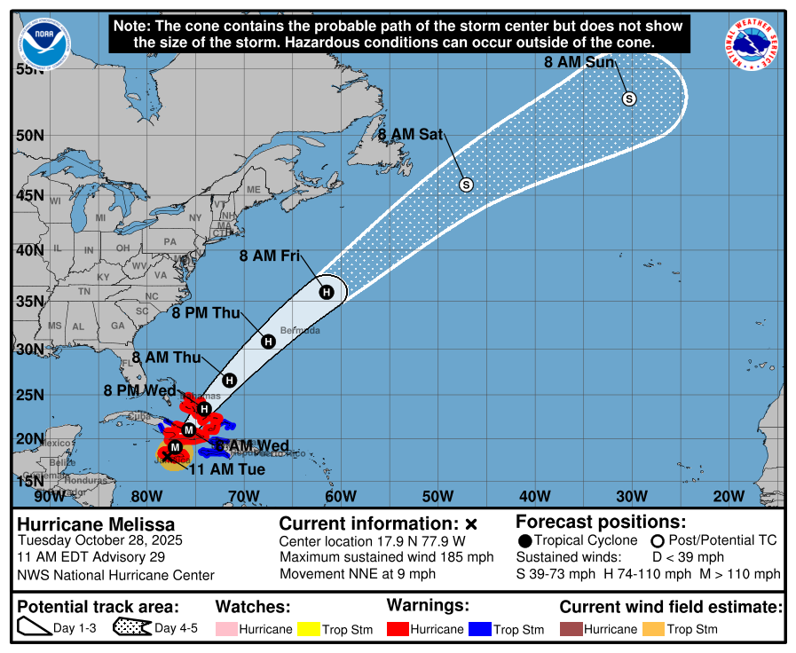 Image via National Hurricane Center
There is one bright side as the storm ravages Jamaica — the worst of Melissa is staying clear of the island’s most populous areas, Denis Phillips, chief meteorologist for Tampa Bay 28, wrote in a social media post. “Fortunately, the worst of the winds will remain well to the West of Kingston, the capital with nearly a million residents.”
Still, there will be a lot of recovery ahead for those impacted by the storm, he added, saying, “There are no words to convey the conditions folks in the Western part of the island are going through. So we only can offer our thoughts and prayers today, but offer our humanitarian efforts starting tomorrow. The good people of Jamaica will desperately need it.”
As of Tuesday afternoon, roofs had already been torn off multiple buildings on the island, including at St. Elizabeth Technical High School, the New York Times reported.
“Quite a few buildings have lost their roofs — teachers’ cottages, some of the main classrooms. The entire roofs have been removed,” Principal Keith Wellington told a local television station, the Times reported.
Some Florida communities, especially in South Florida, which, after New York, is home to the second-largest Jamaican population in the U.S., are already stepping up to compile donations the island will need as it recovers.
“We here in South Florida understand this very intimately, with our experience with Hurricane Andrew and others,” Marlon A. Hill, the lead volunteer mobilizer for South Florida Caribbean Strong, a disaster relief fund, told the Times, referring to the Category 5 storm that devastated southern Miami-Dade County in 1992. “We’re trying to convert that experience into action.”
Volunteers at a Doral warehouse put together several pallets of emergency kits on Saturday. They’ll fly the pallets, each holding 40 kits that can each feed two people for four days, to Jamaica after the storm passes. The group is also gathering and organizing hygiene items and other supplies.
There are several fundraisers under way in Central Florida as well, according to Fox 35. Mark’s Jamaican Bar & Grill in Orange County via GoFundMe and the Jamaican American Association of Central Florida are both already accepting donations to send supplies and money to those on the island who are affected by the storm.
“That’s the beauty about our community,” Mark Jathan, the bar and grill’s owner, said. “Especially here in Central Florida. The generosity, the love, the kindness, and they share with our culture back home in Jamaica.”
Get more local news delivered straight to your inbox. Sign up for free Patch newsletters and alerts.