
Florida is growing fast. A thousand people move to the state every single day, and that pace is projected to continue for the next 45 years. By 2070, Florida’s population could reach 33 million. For conservationists, that means one thing: the clock is ticking on protecting the landscapes that make Florida wild.
At the center of that effort is the Florida Wildlife Corridor Foundation, and at the center of their work is a tool most people associate with tech companies and urban planners: Geographic Information Systems, or GIS.
A Map-Driven Mission
Kristen Nowak, Corridor Implementation Manager, puts it plainly: “If we didn’t have GIS, I don’t know how we would do our job. We are in the map all day long.”
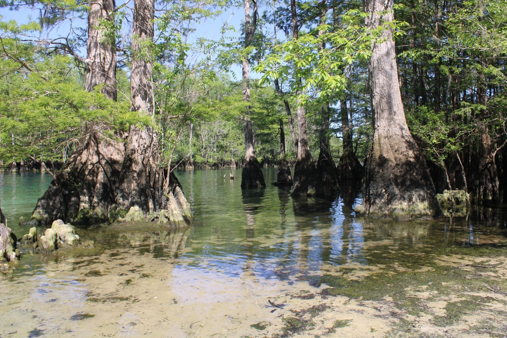
The Florida Wildlife Corridor spans 18 million acres of connected networks of forests, wetlands, ranchlands, and wildlife habitat stretching across the state. Of that, roughly 10 million acres are already protected. The remaining 8 million acres are what the Foundation calls “opportunity areas” – lands that could still be conserved before development claims them. Within that 8 million, an urgent subset of 900,000 acres is projected to be lost to development by 2030 or 2050.
GIS allows the team to zoom in on those red zones, track conservation progress quarter by quarter, and identify exactly where the corridor is most vulnerable.
Pinch Points and Parcels
Conservation Planning Specialist Dylan Rigsby focuses on the granular side of GIS work: parcel-level data that reveals who owns what, how land is being used, and whether there’s an opening for conservation.
“Parts of the corridor are really wide and some are really narrow,” Rigsby explains.
“For the narrow pieces, it just takes a little bit of development to functionally disconnect two ecological hubs where wildlife might be moving back and forth.”
When a critical gap in the corridor comes down to a single large parcel owned by one landowner, the Foundation can use GIS to identify who that owner is, whether they have connections to local extension agents or land trusts, and what the realistic pathway to conservation might look like.
That approach recently paid off near Tallahassee, where the team identified a key gap in the corridor and, through relationship-building and careful spatial analysis, helped move a willing landowner toward a conservation easement application.
Making the Abstract Visible
One of the persistent challenges in conservation work is translating complex data into decisions people can act on. Models that predict future development pressure, for instance, involve layers of ecological indicators, probabilistic projections, and compound variables. Communicating that to a county commissioner or a landowner requires more than a spreadsheet.
“The idea of development pressure is a very abstract idea,” says Rigsby.
“Giving people concrete examples of where it is, what it looks like, and how it impacts their regions – we need to visualize that in some way.”
Maps are the bridge. When the Foundation brings stakeholders together around a printed corridor map, something shifts. People point, recognize landmarks, share local knowledge, and start asking the right questions.
As Nowak describes it: “People love getting there and coming up with ideas.”
Mind the Gaps: Participatory Mapping in Action
Three to four times a year, the Foundation convenes regional workshops called Mind the Gaps. These workshops bring together local governments, water management districts, landowners, land trusts, academics, and nonprofits around large printed maps of corridor gaps.
The workshops are designed around a core insight: the people who live and work in these landscapes know things that statewide databases might not. They know who owns the land adjacent to a pinch point, whether a rancher is open to a conversation, and what the community’s appetite for conservation really is.
At a recent workshop focused on Florida’s Nature Coast – Citrus, Hernando, and Sumter counties – that local knowledge translated into action. Stakeholders gathered around the map, identified a critical unprotected area, realized someone in the room had a relationship with the landowner, and initiated an outreach process that is now moving toward an easement application.
“That’s kind of the proof of concept of what we’re trying to do,” says Rigsby. “If we weren’t mapping these things out as a group with these communities, maybe that moment of realization – about who has the relationships, who knows the land, who knows about easements – might never happen.”
Working Lands, Wildlife Future
More than half of the corridor’s opportunity areas are working lands: ranches, citrus groves, timber operations. That means conservation isn’t just about buying land; it’s about giving farmers and ranchers the financial tools to keep their land productive and undeveloped.
“Protecting working lands is protecting the corridor,” says Nowak.
Programs like conservation easements and payment-for-ecosystem-services can give landowners a reason to maintain their land’s rural character rather than sell to developers.
It’s a framing the Foundation is actively promoting, especially as state acquisition programs, like those run by the Florida Department of Environmental Protection and the Department of Agriculture and Consumer Services, begin to prioritize urgent areas in response to the Foundation’s workshops and analysis.
“They have asked us to write a white paper showing our analysis of which projects fall in those urgent areas,” says Nowak.
“It’s really encouraging to see them starting to take into account the things we’re sharing.”
What’s Next for GIS and the Corridor
Looking ahead, both Nowak and Rigsby see room to push GIS further. Rigsby envisions more automation: streamlining map production so that partner requests don’t require hours of manual work. He also sees potential in interactive web platforms: collaborative online hubs where stakeholders could contribute local knowledge without waiting for an in-person workshop, as well as dynamic tools like split-screen “before and after” maps that make change over time viscerally clear.
“It’s hard to see that when looking at one static map,” says Rigsby.
“More interactive web spaces would make it easier for people to really understand the stakes.”
For now, the Foundation’s four-person conservation team, an environmental scientist, a social scientist, a planner, and a science educator, keep the maps running, the workshops going, and the corridor moving toward connection.
The puzzle is enormous, but piece by piece, they’re putting it together.
The Florida Wildlife Corridor Foundation works to protect and connect Florida’s remaining natural lands. Learn more at https://floridawildlifecorridor.org/