
Our windy pattern is winding down, south Florida. Still, the breeze made for a comfortable Earth Day, and daytime temperatures were running about 5-degrees cooler than average.

Along with mild temperatures, quiet conditions remain intact. The proof can be seen in the satellite – radar view (shown below).
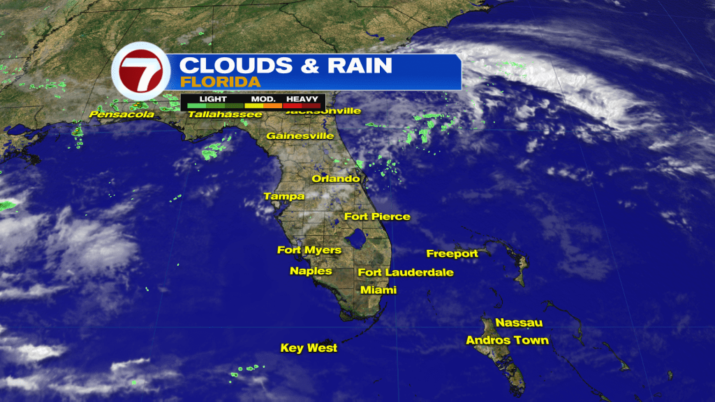
Despite some passing clouds over the Peninsula, most spots are dry. This Drier trend isn’t expected to last too much longer, though.
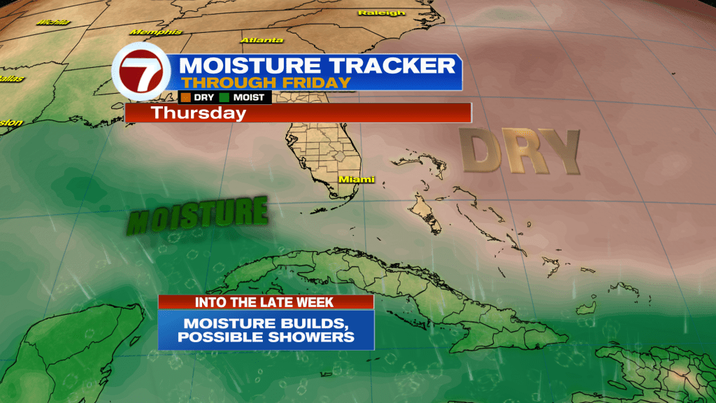
Notice (on our Moisture Tracker) there’s a stark division between Dry Air and Moisture, south and west of the state. The moist plume from the Gulf and Caribbean will expand by late Thursday and Friday. The result? Rain showers along with the chance for scattered thunderstorms.
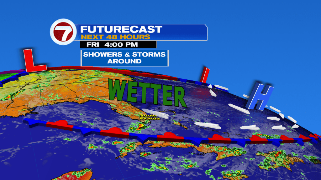
Notice the Friday weather map (above) and the setup for wetter conditions. We’ll find a “Florida merger” taking shape as moisture links with a lingering Front. Meanwhile, High Pressure retreats deeper into the Atlantic.
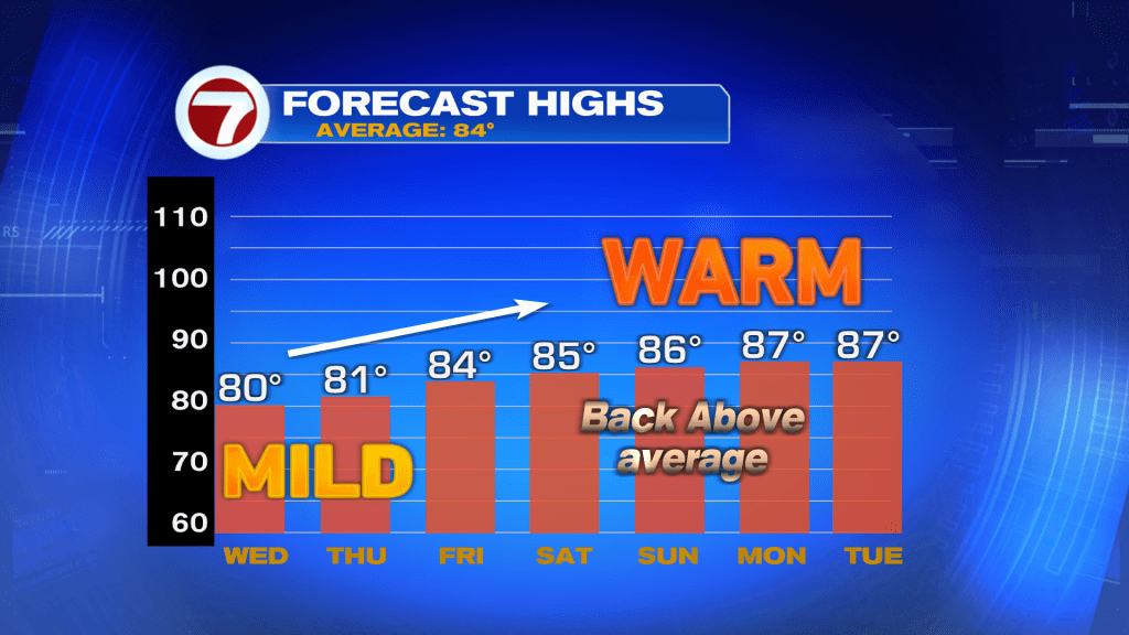
Finally, it’s noteworthy that warmer air is forecast to build back. Over the next few days we’ll tap into increasing warmth and humidity from the tropics. As such, temperatures are forecast to get well into the 80’s by early next week. Some inland locations will probably even reach 90-degrees with enough sunshine. We’re still 2 months from the official start of summer but it’ll seem as though “coming attractions” have begun ahead of the main show!
Join our Newsletter for the latest news right to your inbox