
JACKSONVILLE, Fla. – A cold front currently sitting over northern Georgia will sag southward through the day and should be near the FL/GA line by late evening before slipping just south of our area overnight.
Ahead of that, expect isolated to widely scattered showers and thunderstorms this afternoon and evening, mainly across northeast Florida, where the daytime heat and the east‑coast sea breeze collide.
Sunday 3k
Temperatures will reach into the upper 80s, low 90s inland. Beaches will stay in the upper 70s, low 80s under partly cloudy skies. Westerly winds will be in the 5-10 mph range.
Sunday futurecast
Through the evening, the front will continue dropping south, keeping shower and storm chances possible. Can’t rule out isolated thunderstorms with gusty winds and heavy downpours, but not likely to be severe.
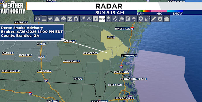
Smoke from the Highway 82 fires in Brantley County is likely to be shifted toward and along the I‑10 corridor for several hours into the start of Sunday night, producing hazy skies and reduced visibility.
Copyright 2026 by WJXT News4JAX – All rights reserved.