
Sunny Skies with Above Average Temperatures for South Florida
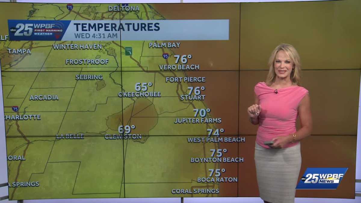
YEAH. THANKS SO MUCH FOR WAKING UP WITH US. WE ARE HALFWAY TO THE WEEKEND. WE HAVE YASMINE HERE WATCHING THE ROADS FOR US. WE’LL GET TO HER IN JUST A MOMENT. BUT FIRST, HERE’S SANDRA WITH THAT FORECAST. SANDRA IT’S GOING TO BE HOT, BUT SOMETHING WE SHOULD REMEMBER WHEN IT’S COLD. FOR THOSE OF US WHO DON’T LIKE THAT COLD WEATHER. OH YEAH. I ACTUALLY PERSONALLY LOVE THE HEAT. BUT ANYWAY, WE ARE GOING TO GET A COLD FRONT ON SUNDAY. THIS IS IT. YOU CAN SEE THURSDAY. IT’S NOWHERE NEAR US, BUT ONCE THE FRONT COLLIDES WITH THAT HOT AIR OVER THE WEEKEND, WE’LL SEE IMPACT STORMS SUNDAY AFTERNOON. SO THAT’S THE NEXT BIG HEADLINE ON THE HORIZON. MEANWHILE, THAT GRADUAL WARM UP ENSUING. WE BEGIN WITH GOOD TERRITORY THIS MORNING IN THE MID 70S, 76 IN VERO AND DOWN INTO STUART AND PORT SAINT LUCIE AT 75 IN BOYNTON, 74 IN WEST PALM, MID 60S IN OKEECHOBEE. HEADED FOR AT LEAST 85 TO 87. TODAY, ACROSS THE PALM BEACHES. AGAIN, JUST THESE AWESOME SKY CONDITIONS. I LOOKED AT THE SKY YESTERDAY AND IT WAS SO INCREDIBLY BLUE. IT’S JUST BEAUTIFUL. 87 FOR PORT SAINT LUCIE LATER ON THIS AFTERNOON. CLEAR SKIES THIS MORNING, 93 ON SATURDAY. THIS IS GOING TO BE OUR EXCLAMATION POINT WITH THE HEAT, SO WE M
WPBF 25 First Warning Meteorologist
South Florida will see mostly sunny skies today with highs surging a few degrees above average. The normal high is 84 but forecast highs today are in the upper 80s. Dry, stable conditions will persist through Saturday with temperatures reaching the low 90s by the weekend. Impact storms are likely on Sunday afternoon.
South Florida will see mostly sunny skies today with highs surging a few degrees above average. The normal high is 84 but forecast highs today are in the upper 80s. Dry, stable conditions will persist through Saturday with temperatures reaching the low 90s by the weekend. Impact storms are likely on Sunday afternoon.