
Highs to Hit Near 90 for South Florida
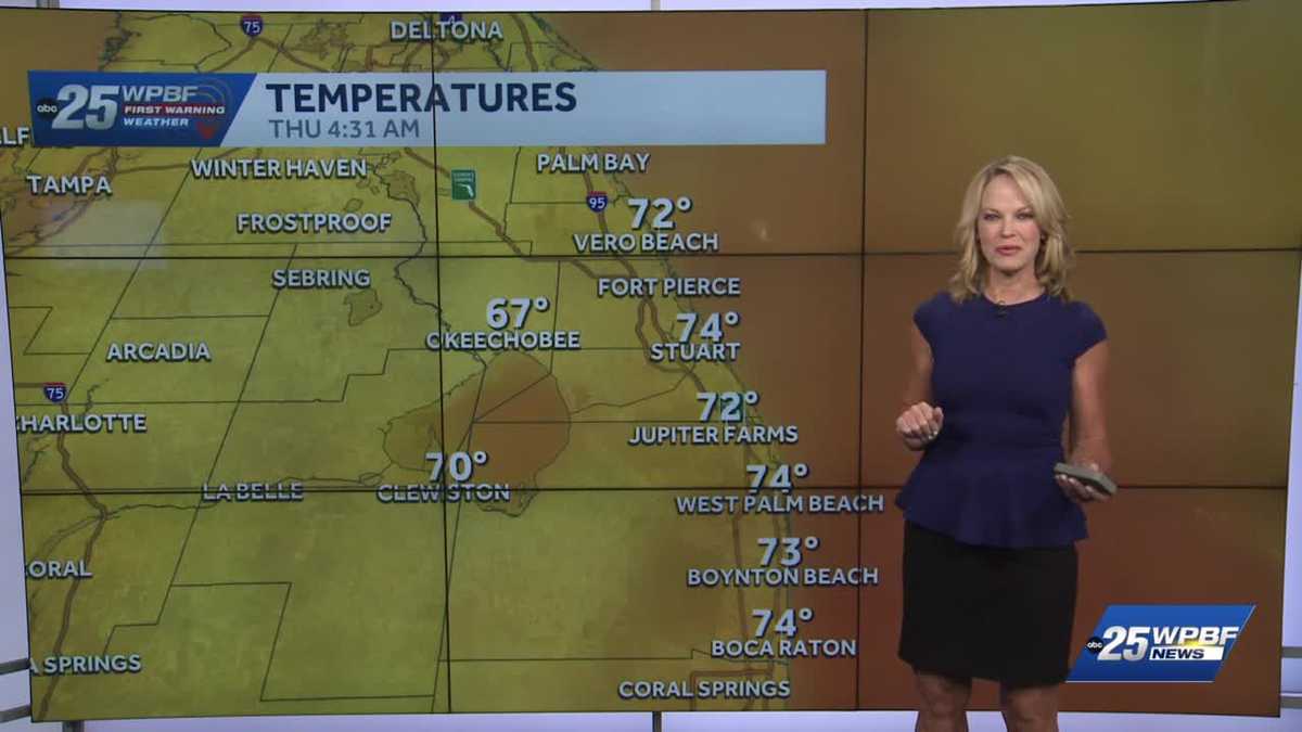
WITH US ON THIS THURSDAY. OUR TEAM, OF COURSE, IS HERE GETTING READY TO HEAD OUT THE DOOR YASMINE WATCHING THE ROADS. SANDRA WITH THAT WARM UP. THAT’S RIGHT. SO WE ACTUALLY ALWAYS ASSESS THE HEAT RISK. THEY DO THIS WITH THE NATIONAL WEATHER SERVICE OFFICES. AND SO TODAY YOU CAN SEE WE’VE GOT SOME ORANGE SOME MODERATE FOR REALLY THE FIRST TIME THAT WE’VE SEEN IN A WHILE. AND SO THAT REALLY IS FOR INLAND PALM BEACH COUNTY WEST OF THE TURNPIKE. JUST BE AWARE OF ALL THOSE SYMPTOMS OF HEAT EXHAUSTION AND HEAT RISK, DIZZINESS, REAL EXTREME THIRST, NOT SWEATING OR EVEN NAUSEA. SO BASICALLY WE HAVE THAT SLIGHTLY TODAY BECAUSE WE’RE HEADED FOR 90 AS A HIGH. CURRENTLY WE’RE IN THE MID 70S IN WEST PALM, LOWER 70S ON THE TREASURE COAST, AND EVEN UPPER 60S AROUND THE LAKE THIS MORNING, UP TO 89 TO 90 FOR THE TREASURE COAST. YOU CAN SEE THAT POPPING AT ABOUT 4:00, 89 TO 90 WITH PLENTY OF SUNSHINE, DRY CONDITIONS FOR THE PALM BEACHES TODAY AS WELL. NOW THE WEEKEND 94. THIS COULD TIE OR SET A NEW RECORD SATURDA
WPBF 25 First Warning Meteorologist
South Florida will see above average highs this afternoon of about 90 degrees. The warm up will continue through Saturday, when record heat is possible. The high for Saturday is expected to reach 94 degrees. On Sunday storms will invade the area with impact weather forecast.
South Florida will see above average highs this afternoon of about 90 degrees. The warm up will continue through Saturday, when record heat is possible. The high for Saturday is expected to reach 94 degrees. On Sunday storms will invade the area with impact weather forecast.