
ORLANDO, Fla. – FRIDAY: The heat is on—and it’s not letting up. Expect another sweltering afternoon with temperatures soaring into the lower 90s inland and upper 80s along the coast. With little to no rain in sight, heat risk levels stay elevated, making it feel even more intense as the day wears on.
SATURDAY: It’s shaping up to be the hottest day of the year so far for Central Florida, with temperatures climbing fast under increasingly breezy conditions.
Highs tomorrow
The day kicks off windy, with strong south winds pulling in deep moisture across the region.
Wind forecast
By afternoon, west-southwest winds strengthen, with gusts reaching 30 to 35 mph. Highs surge into the low 90s both inland and along the coast.
Then, attention shifts to the sky—storms are expected to develop into the evening, some turning strong to severe.
Approaching cold front
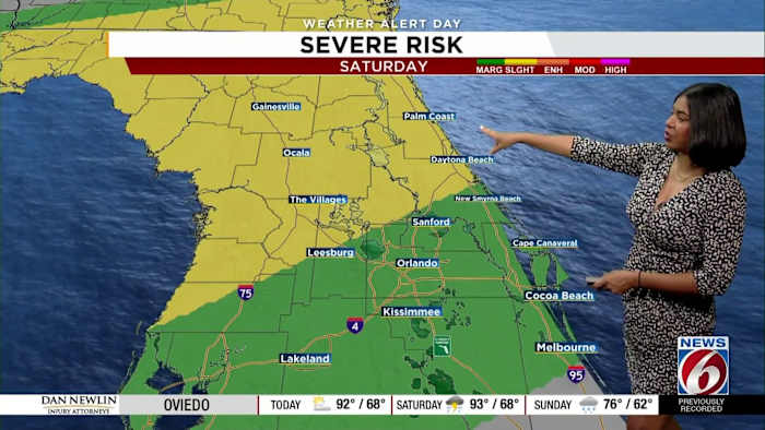
Northwestern counties are under a slight risk for scattered severe storms, while southeastern areas sit under a marginal risk for isolated severe activity.
Severe risk this weekend
The main threats: damaging wind gusts and hail, though a brief, isolated tornado can’t be ruled out.
Because of the potential for impactful weather, the News6 Weather Team has declared a Weather Alert Day from Saturday evening through Sunday morning. Stay weather-aware—conditions could change quickly.
Copyright 2026 by WKMG ClickOrlando – All rights reserved.