
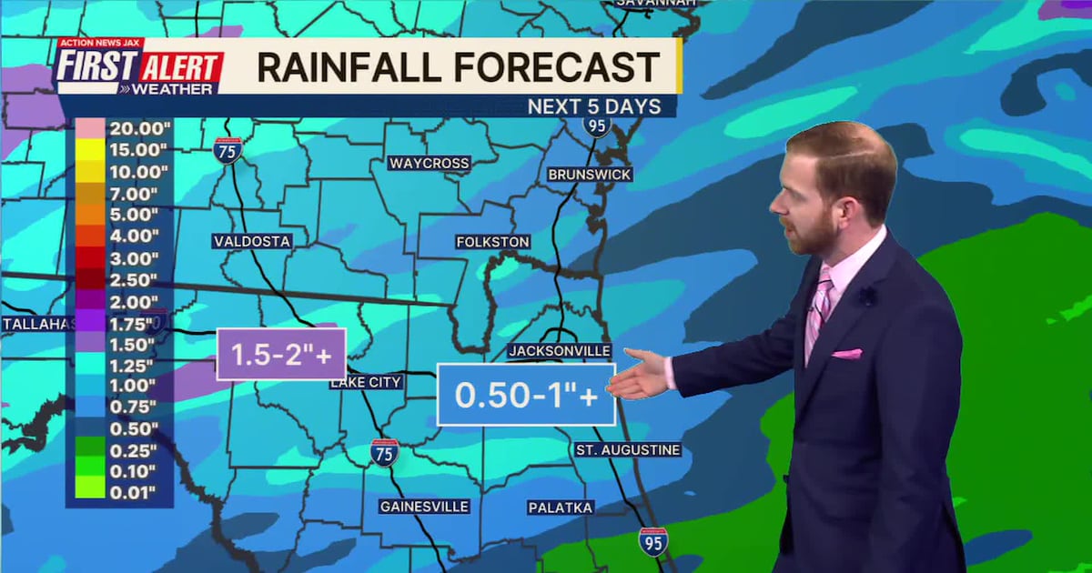
JACKSONVILLE, Fla. — The Action News Jax First Alert Weather Team has declared a First Alert Weather Day on Saturday due to widespread rain and storms.
The rain will arrive in the morning to the west of Jacksonville and late morning/midday along the coast.
WATCH THE FORECAST | DOWNLOAD THE APPS
Strong storms producing gusty winds are possible along the leading edge of the line of storms.
Here’s what the First Alert Weather Team said you can expect:
Saturday will begin dry, warm, and breezy then heavy showers and thunderstorms will spread west to east from mid-morning through the afternoon. A few strong storms will be possible, but the big story will be the much-needed soaking. Everyone will get rain with amounts averaging a half inch to 1.5”, locally 2”+.Skies will clear later Saturday night leading to a beautiful day Sunday; cooler, breezy, less humid, and lots of sun with highs only in the 70s.The workweek will begin nice and cool with temperatures inland in the 40s early Monday then afternoon highs near 80 with comfortable humidity.Temperatures warm again by Tuesday and Wednesday – 80s to near 90. The next front arrives Thursday with another opportunity for at least some rain.
INTERACTIVE RADAR: Keep track of the rain as it moves through your neighborhood
TONIGHT: A few evening showers, isolated thunderstorm … partly cloudy. Low: 68
SATURDAY: Breezy & warm early with heavy showers, a few thunderstorms spreading west to east from mid-morning through the afternoon. High: 77
SATURDAY NIGHT: Clearing & cooler. Low: 53
SUNDAY: Sunny, cooler & less humid – nice! High: 76
MONDAY: Mostly sunny & nice. 50/79
TUESDAY: Partly sunny. 55/86
WEDNESDAY: Partly sunny, very warm. 64/90
THURSDAY: Partly cloudy with an afternoon shower/thunderstorm. 67/86
FRIDAY: Mostly cloudy & cooler with a few showers. 62/77

Follow Action News Jax Meteorologists on Twitter for updates:
Mike Buresh | Garrett Bedenbaugh | Corey Simma | Trevor Gibbs
ALLERGY TRACKER: See what the pollen counts look like in our area