
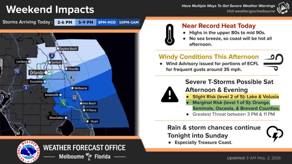
Central Florida is in store for near record heat Saturday before a storm front with strong thunderstorms moves into the region in the afternoon and evening, according to the National Weather Service in Melbourne.
Temperatures will hit the upper 80s and mid 90s including along the coast because of a lack of seabreeze that will keep conditions hot longer.
Winds will also begin to kick up to about 20 mph with gusts of 30-35 mph in the late morning and afternoon.
Severe thunderstorms will then move into the area with a greater risk in Orange, Seminole, Osceola and Brevard counties as rain chances increase into Saturday night and into Sunday.
The primary storm hazard will come from wind gusts that could hit 60 mph and associated lightning, although there is also a low chance for hail and a tornado. Heavy rainfall could also lead to local flooding.
Wind issues and a low relative humidity mean critical fire weather conditions continue for Osceola, southern Brevard, Indian River, Okeechobee, St. Lucie, and Martin counties. The NWS has issued a red flag warning in effect from noon through 7 p.m. while very sensitive fire weather conditions continue to the north.