
Heat builds through week; records possible in Central Florida
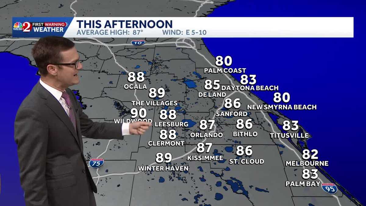
ABSOLUTELY HAVE TO STAY DIALED IN. THAT’S ONLY A MERE WEEKS AWAY. NOTICE HOW OUR FORECAST PATTERN SHIFTS FROM DRY TO HOT TO HOT AND STORMY. WE’RE REALLY ON SETTING THIS THING. WE’RE GETTING INTO THAT SUMMER PATTERN. WHEN WE LOOK TO THURSDAY. JUST FOR PERSPECTIVE PURPOSES, ORLANDO IS 96 DEGREES FORECAST HIGH IS JUST SHY OF THE 98 DEGREE RECORD, BUT EVERY OTHER ONE OF OUR REPORTING STATIONS DOES LOOK TO EITHER TIE A RECORD OR BREAK A RECORD. AND SOME OF THEM DAYTONA BEACH, FOR EXAMPLE, GOING BACK TO THE 1950S. SO YEAH, RECORD HEAT IS BUILDING. AND THEN WE START UP THE SUMMERTIME RAIN MACHINE. EVEN IF IT’S NOT HERE TO STAY, WE’RE BUILDING THAT UP. THERE’S A WEAK FRONT THAT BASICALLY MOVES IN. AND WHAT IT DOES IS IT LEAVES US WITH MOISTURE. SO HERE’S FRIDAY AFTERNOON ON OUR LONG RANGE FUTURECAST, SHOWING THOSE SHOWERS AND THUNDERSHOWERS TRYING TO DEVELOP. AND THAT PATTERN CONTINUES. LOOKING AHEAD TO MOTHER’S DAY. DO NOT FORGET. OKAY, BREAKFAST IN BED LOOKS GREAT, BUT LUNCH TIME INTO DINNER TIME, WE START WATCHING THOSE SHOWER AND THUNDERSTORM OPPORTUNITIES THIS MORNING. NO STORMS. IT’S A REALLY NICE QUIET START. WE’RE AT 65 DEGREES DOWNTOWN ORLANDO DAYTONA BEACH AT 61 LOWER 60S AS WELL FOR PORT CANAVERAL. LOOKS GREAT. FEELS GREAT THIS AFTERNOON. 87 DEGREES IN THE CITY, 89 IN THE VILLAGES, 85 FOR DELAND AND 80 DEGREES IN NEW SMYRNA BEACH. IF YOU’RE LUCKY ENOUGH TO HEAD OVER TO THE BEACHES, MODERATE RIP CURRENT RISK. NOT LOW, NOT HIGH. STILL THERE THOUGH. SURF BREAKING ABOUT 2 TO 3. WATER TEMPERATURES NOW IN THE UPPER 70S AND TEMPERATURES RIGHT ON THE BEACH. SAND HANGING OUT IN THE UPPER RANGE OF THE 70S AS WELL. SO IT’S GOING TO FEEL FANTASTIC. BUT LOOK AT THAT HEAT BUILD BEFORE THOSE STORMS ONSET, FRIDAY, SATURDAY AND SUNDAY. COASTAL SEVEN-DAY FORECAST DOESN’T LOOK MUCH DIFFERENT. I MEAN, E
Heat builds through week; records possible in Central Florida

Updated: 6:07 AM EDT May 5, 2026
A beautiful morning is ahead, but temperatures are set to climb and won’t let up.Highs will reach around 87 degrees today, which is average for this time of year. From there, temperatures continue to rise, with highs near 93 degrees tomorrow and around 95 degrees by Thursday. Record highs could be challenged.By Friday and into the weekend, a weak front is expected to stall over the area, helping to set up a summer-like storm pattern. It’s too early to know if that pattern will stick, but it will feel more like summer.First Warning Weather Stay with WESH 2 online and on-air for the most accurate Central Florida weather forecast.RadarSevere Weather AlertsDownload the WESH 2 News app to get the most up-to-date weather alerts. The First Warning Weather team includes First Warning Chief Meteorologist Tony Mainolfi, Eric Burris, Marquise Meda, Cam Tran and Victoria Wisniewski.
ORLANDO, Fla. —
A beautiful morning is ahead, but temperatures are set to climb and won’t let up.
Highs will reach around 87 degrees today, which is average for this time of year. From there, temperatures continue to rise, with highs near 93 degrees tomorrow and around 95 degrees by Thursday. Record highs could be challenged.
By Friday and into the weekend, a weak front is expected to stall over the area, helping to set up a summer-like storm pattern. It’s too early to know if that pattern will stick, but it will feel more like summer.
First Warning Weather
Stay with WESH 2 online and on-air for the most accurate Central Florida weather forecast.
Download the WESH 2 News app to get the most up-to-date weather alerts.
The First Warning Weather team includes First Warning Chief Meteorologist Tony Mainolfi, Eric Burris, Marquise Meda, Cam Tran and Victoria Wisniewski.