
Hopes are rising for a potential split-level roadway entering and exiting Key Biscayne.
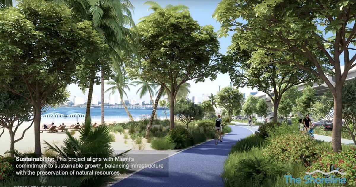
The design calls for a continuous flow of traffic for the estimated 28,000 daily commuters into the Village and beyond, safer distances between pedestrians, bicyclists and vehicles and enhanced green space with 160% more beach space below.
“We’re so excited with the work that’s been done,” said County Commissioner Raquel Regalado, who planted the seed for “The Shoreline” about a year ago, earning the plaudits of Village Council members, who decided to chip in as much as $950,000 late last year to finance a seven-step feasibility project to see if the project has merit. “This is really a stress test of this idea of The Shoreline.”
This past week at a Village workshop, Regalado was joined by Juan Mullerat of Plusurbia’s design team, Javier Manso of HDR’s engineering and consulting firm and Eulois Cleckley, the CEO of the Friends of the Underline, whose own project just surpassed the halfway point of a 10-mile linear park (to be completed in October) and urban trail that could connect to The Shoreline.
In addition, it was announced that the Rebel Group, a well-known economic firm, has been brought on to study funding mechanisms and also revenue-generating opportunities once the project is completed on the Rickenbacker Causeway.
Of the seven task steps, two have been completed since February, including a technical baseline assessment. Officials said this study would be completed in October, although more public meetings would still take place beforehand.
Highlights of what was learned last Tuesday in Village Chambers:
• The viaduct (split level) ramps would begin near the Rusty Pelican Marina entrance and end upon the entrance to Bear Cut Bridge, with vehicles and fast-moving bicycle peloton packs taking the high road before a final descent.
• The bottom (existing roadway) would become four lanes of 30 mph traffic, with safe access points to such venues as Virginia Key, the rebuilt Miami Seaquarium (it was noted that entry might be moved), Miami Marine Stadium and MAST Academy, with roundabouts (turnoffs) in place as well.
• Vehicles would exit left to the lower roadway, while pedestrians and bikes would exit to the right to minimize conflicts.
• Wide medians, called “refuge zones,” especially at MAST Academy, would safely separate bicyclists and students from vehicles.
• The petrified groves near Crandon Park are a strict “no-touch zone,” limiting how far north the bridge structures can extend.
• The William Powell Bridge would remain unchanged, while the project could start after the Bear Cut Bridge is replaced, if that decision is finalized.
“We’re trying to model it as a concrete beam bridge because it’s cheaper,” Manso said. “But, we could go steel … it would just change the makeup of the viaduct.”
Mullerat said the decision on how wide the bike lanes will be on the “residential-type” street below is still at the discussion stage, so as not to lose room for parking.
Also, Mullerat said he was unsure how the access point intersections below would pause traffic, whether it’s a stop-control system, or traffic lights, but that would have to be determined by transportation officials.
One option being explored to alleviate some traffic is the expanded use of water taxis, Regalado said, especially getting to and from Crandon Marina and the Marine Stadium, whatever the future holds for that iconic venue. Water taxis on the other side of what was once the Seaquarium (plans are in the works for a row of shops and a marina there) is also a possibility.
Tom McCormick is working closely with the Key Biscayne Community Foundation and their ties with local stakeholders.
Reglado said much of the information being gathered — including details of a 102-inch sewer pipe that cannot be moved and must be worked around — is news to county and city officials, some who did not have this type of information available.
“They’re excited about this information,” she said, regarding the age of structures, access points and how infrastructure impacts their property.
Feasibility and other assessment reports are due by this summer.
To view the Master Plan presentation from May 2025, click here.
To view the updated Shoreline plan presentation from April 2026, click here.