
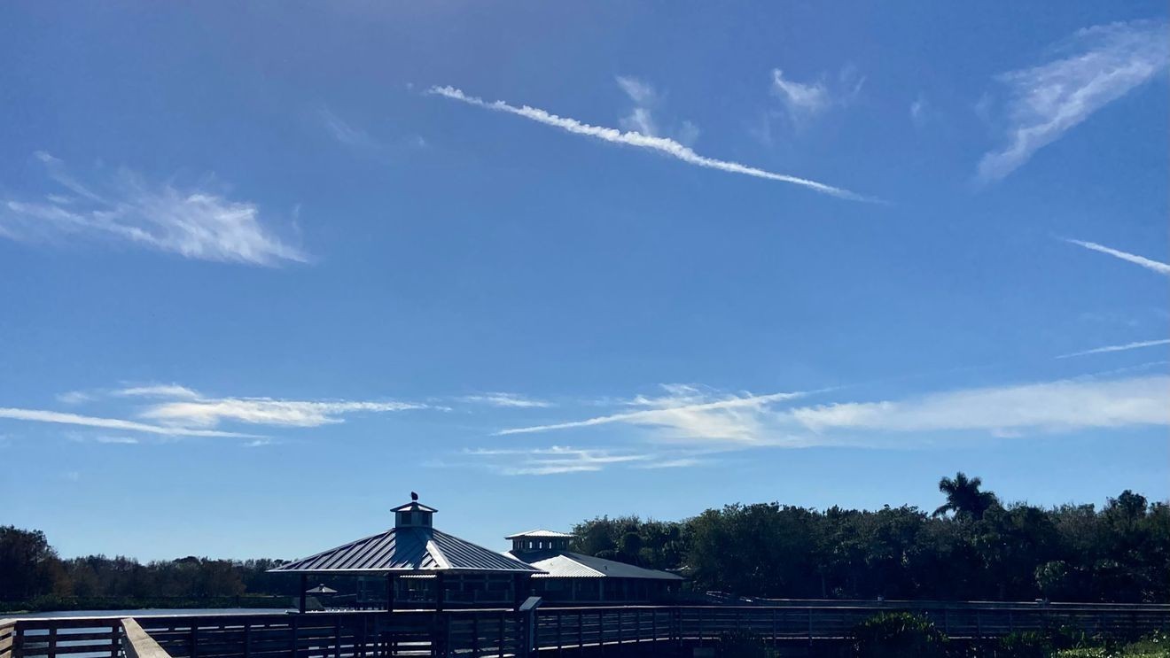
WEST PALM BEACH, Fla. (WPEC) — South Florida remains in the grip of unseasonable heat, with little relief expected through the weekend.
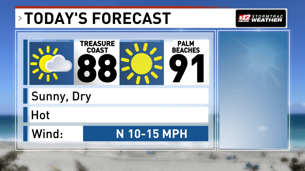
Sunny skies and dry conditions will dominate both today and tomorrow as high pressure stays firmly in place. A light sea breeze—winds moving inland from the coast—will develop each afternoon, but it won’t be enough to bring meaningful rain. At most, a brief and isolated shower could form inland on Saturday.
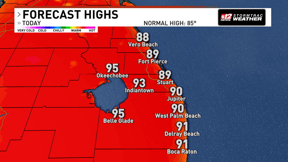
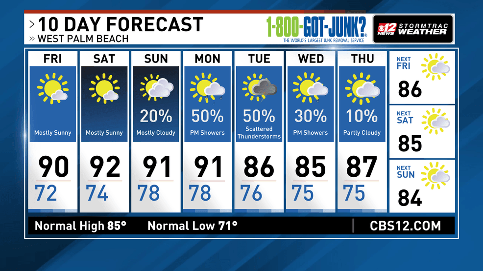
Temperatures will be the main concern. Highs will reach the upper 80s to low 90s along the coast and climb into the low to mid-90s inland. It will feel even hotter, with heat index values nearing the upper 90s today and pushing into the low 100s by Saturday. This level of heat can increase the risk of heat-related illness, especially in urban areas where heat builds more quickly.
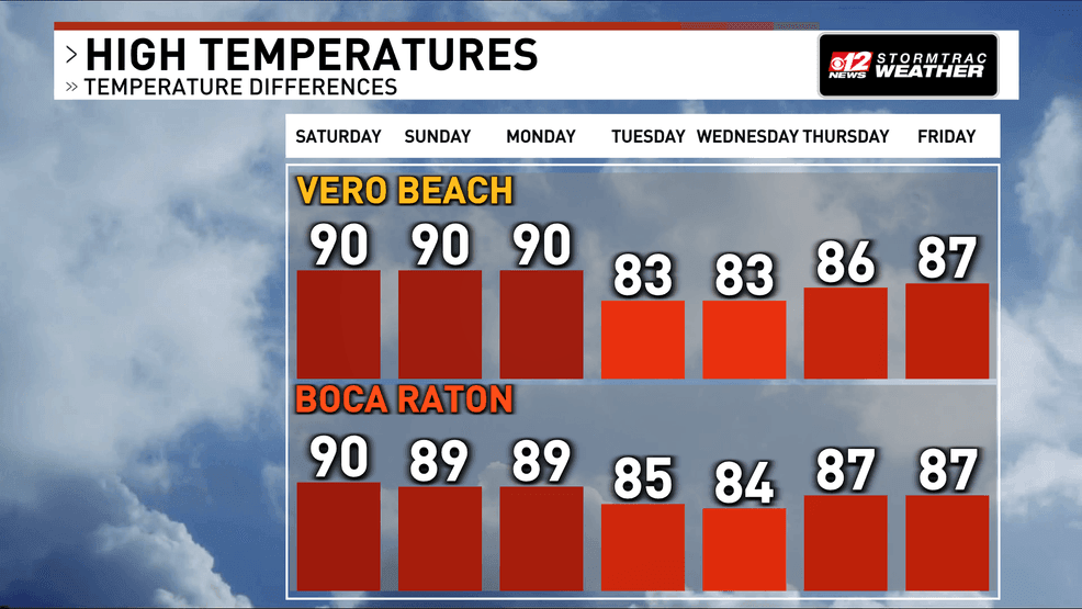
7 Day Temps MultiCity pm.png
Overnight conditions won’t offer much relief either. Temperatures will stay warm and humid, with lows in the upper 70s to near 80 degrees, particularly along the coast.
The heat intensifies further on Sunday, with widespread 90s and the potential for even higher heat index values. While most of the weekend stays dry, a slight increase in moisture could bring a few showers, mainly across northern areas late in the day.
10 Day Forecast – AM Impact.png
Rain chances remain low through the weekend, but a more noticeable change arrives early next week as a front approaches, bringing increasing chances for showers and thunderstorms along with the possibility of slightly cooler conditions behind it.