
Hot and Sunny for South Florida
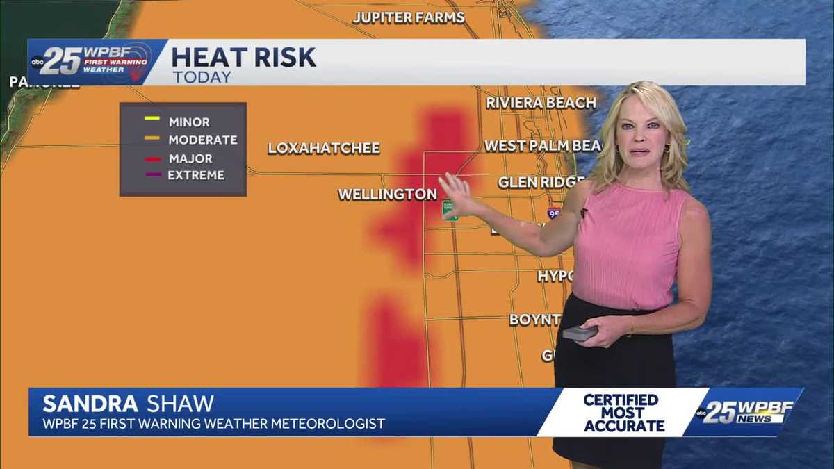
THIS FRIDAY. LET’S GET OVER TO SANDRA FOR WHAT CAN EXPECT TODAY AND ALSO THE WEEKEND. ALL RIGHT. WELL WHEN YOU SEE RED UP HERE ON THE HEAT MAP, YOU’RE LIKE, OH, PRELUDE TO SUMMER. AND THAT’S WHAT IT IS. I MEAN, WE HAVE A MAJOR HEAT RISK HERE WEST OF THE TURNPIKE. WE’RE TALKING WELLINGTON ROYAL PALM WAY THESE INLAND AREAS THAT DON’T GET AS MUCH AIR CIRCULATION AND ARE TYPICALLY HOTTER BECAUSE THEY’RE NOT AS CLOSE TO THE WATER. SO BETWEEN LOXAHATCHEE WELLINGTON AND INLAND PALM BEACH COUNTY, JUST ANYWHERE WEST OF THE TURNPIKE, A MAJOR HEAT RISK. IT’S A MODERATE HEAT RISK ELSEWHERE. SO WE’RE GOING TO HIT THE LOW 90S, BUT FEEL HOTTER THAN THAT. SO, YOU KNOW, BEAUTIFUL SUNNY SKIES, BUT ABOVE AVERAGE, WHICH IS 85. WE’VE GOT 65 IN OKEECHOBEE RIGHT NOW, 75 OUT OF PBIA, 77 ALREADY IN BOCA. SO WE’RE WELL ON OUR WAY. WE’LL HIT AT LEAST THE UPPER 80S, BUT MOST SPOTS WILL EXCEED THAT AND HIT THE LOW 90S THIS AFTERNOON IN THE PALM BEACHES ON THE TREASURE COAST. TAKING A LOOK AT A BEAUTIFUL CLEAR SKY CONDITION IN PORT SAINT LUCIE, MID TO UPPER 80S BY NOONTIME 90 TO 92 BY 2:00 THIS AFTERNOON. 12 HOUR FORECAST OVERALL IS SHOWING THE HEAT 93 SATURDAY AND FO
WPBF 25 First Warning Meteorologist
South Florida will see sunny skies this Friday with highs in the lower 90s. The average for this date is 85 degrees. The above average temperature trend will hold over the weekend. Mother’s Day will be in the low 90s with just a slight chance of a fast shower. A weak cold front will clear the area Monday, bringing with it a chance of showers for the start of next week.
South Florida will see sunny skies this Friday with highs in the lower 90s. The average for this date is 85 degrees. The above average temperature trend will hold over the weekend. Mother’s Day will be in the low 90s with just a slight chance of a fast shower. A weak cold front will clear the area Monday, bringing with it a chance of showers for the start of next week.