
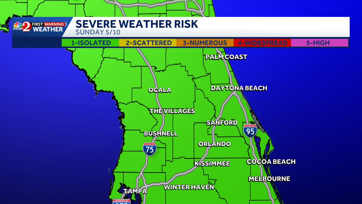
The First Warning Weather Team is watching several chances for storms this weekend and into next week. This is what you need to know to stay safe as you plan your day. Humid conditions will be present through most mornings as dewpoints stick in the upper 60s and 70s, providing energy for afternoon storms.Timing out Saturday; those having plans outdoors should keep rain gear handy between 3:00 PM and 9:00 PM Some lingering showers are possible through the overnight. For Mother’s Day, another sticky start with a small chance of rain in Marion, Flagler, and Vousia during the late morning hours, with stronger to severe storms hugging the I-95 corridor during the afternoon and into the evening. The Storm Prediction Center has Central Florida in a 1/5 Marginal risk for severe storms. The largest threat will be gusty winds and heavy downpours East of Orlando, beginning around 4 PM through at least 8 PM. Plan ahead to avoid disruptions.By Monday, more showers are forecasted to continue ahead of a cold front that will approach by Tuesday, cooling us down to the upper 80s.Stay with WESH 2 online and on-air for the most accurate Central Florida weather forecast.RadarSevere Weather AlertsDownload the WESH 2 News app to get the most up-to-date weather alerts. The First Warning Weather team includes First Warning Chief Meteorologist Tony Mainolfi, Eric Burris, Marquise Meda, Cam Tran, and Victoria Wisniewski.What is Impact Weather?Impact Weather suggests weather conditions could be disruptive or a nuisance for travel and day-to-day activities.What is a Severe Weather Warning Day?A Severe Weather Warning Day suggests weather conditions that could potentially harm life or property. ————————————————DOWNLOAD the free WESH 2 News app for your latest news and alerts on breaking news, weather, sports, entertainment and more on your phone or tablet. And check out the Very Local app to stream news, entertainment and original programming on your TV.
ORLANDO, Fla. —
The First Warning Weather Team is watching several chances for storms this weekend and into next week. This is what you need to know to stay safe as you plan your day.
Humid conditions will be present through most mornings as dewpoints stick in the upper 60s and 70s, providing energy for afternoon storms.
Timing out Saturday; those having plans outdoors should keep rain gear handy between 3:00 PM and 9:00 PM
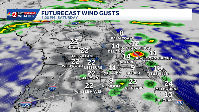
Hearst Owned
6:00PM Saturday
Some lingering showers are possible through the overnight.
For Mother’s Day, another sticky start with a small chance of rain in Marion, Flagler, and Vousia during the late morning hours, with stronger to severe storms hugging the I-95 corridor during the afternoon and into the evening. The Storm Prediction Center has Central Florida in a 1/5 Marginal risk for severe storms. The largest threat will be gusty winds and heavy downpours East of Orlando, beginning around 4 PM through at least 8 PM. Plan ahead to avoid disruptions.
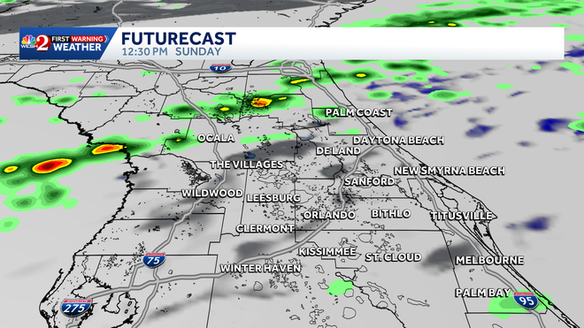
Hearst Owned
12;30PM Sunday
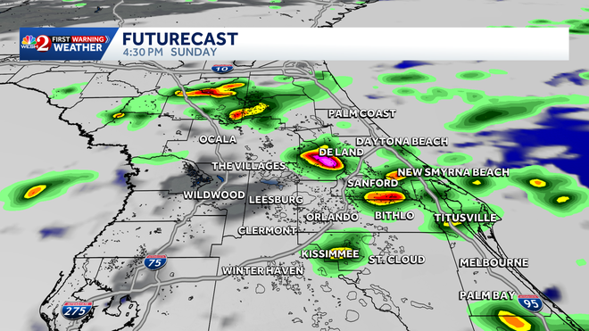
Hearst Owned
4:30PM Sunday
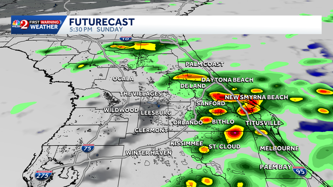
Hearst Owned
5:30PM Sunday
By Monday, more showers are forecasted to continue ahead of a cold front that will approach by Tuesday, cooling us down to the upper 80s.
Stay with WESH 2 online and on-air for the most accurate Central Florida weather forecast.
Download the WESH 2 News app to get the most up-to-date weather alerts.
The First Warning Weather team includes First Warning Chief Meteorologist Tony Mainolfi, Eric Burris, Marquise Meda, Cam Tran, and Victoria Wisniewski.
What is Impact Weather?
Impact Weather suggests weather conditions could be disruptive or a nuisance for travel and day-to-day activities.
What is a Severe Weather Warning Day?
A Severe Weather Warning Day suggests weather conditions that could potentially harm life or property.
————————————————
DOWNLOAD the free WESH 2 News app for your latest news and alerts on breaking news, weather, sports, entertainment and more on your phone or tablet. And check out the Very Local app to stream news, entertainment and original programming on your TV.