
The First Warning Weather Team is tracking multiple chances for storms Sunday and into early next week.Mother’s Day will start warm and humid, with light showers possible around noon in Marion County.Otherwise, the main threat for afternoon and evening storms will be near Palm Coast and along the Interstate 95 corridor.The Storm Prediction Center has placed Central Florida under a Level 1 of 5 Marginal Risk for severe weather.The primary concerns will be gusty winds, hail, and heavy rainfall east of Orlando, with the highest chances of storms between 4 p.m. and 8 p.m.Be sure to plan ahead, as storms could disrupt travel and outdoor dining during the evening hours.Rain chances will gradually decrease through the week after a cold front brings storms on Monday and cooler temperatures for a couple of days before highs return to the 90s.What is Impact Weather?Impact Weather suggests weather conditions could be disruptive or a nuisance for travel and day-to-day activities.What is a Severe Weather Warning Day?A Severe Weather Warning Day suggests weather conditions that could potentially harm life or property.————————————————DOWNLOAD the free WESH 2 News app for your latest news and alerts on breaking news, weather, sports, entertainment and more on your phone or tablet. And check out the Very Local app to stream news, entertainment and original programming on your TV.
ORLANDO, Fla. —
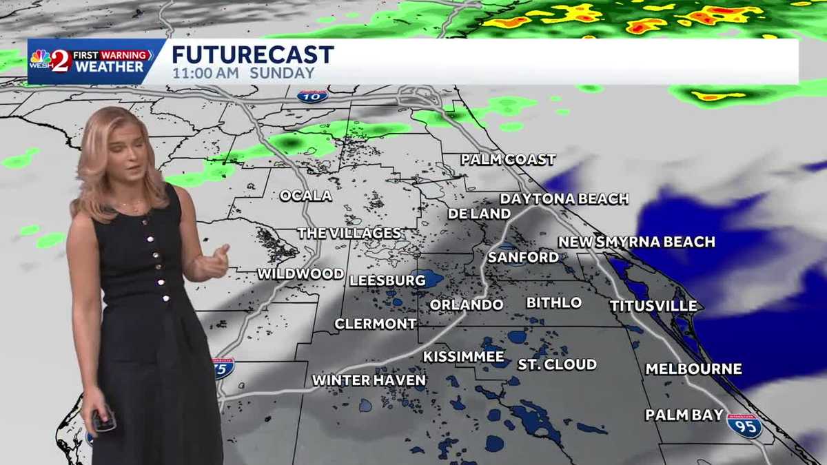
The First Warning Weather Team is tracking multiple chances for storms Sunday and into early next week.
Mother’s Day will start warm and humid, with light showers possible around noon in Marion County.
Otherwise, the main threat for afternoon and evening storms will be near Palm Coast and along the Interstate 95 corridor.
The Storm Prediction Center has placed Central Florida under a Level 1 of 5 Marginal Risk for severe weather.
The primary concerns will be gusty winds, hail, and heavy rainfall east of Orlando, with the highest chances of storms between 4 p.m. and 8 p.m.
Be sure to plan ahead, as storms could disrupt travel and outdoor dining during the evening hours.
Rain chances will gradually decrease through the week after a cold front brings storms on Monday and cooler temperatures for a couple of days before highs return to the 90s.
What is Impact Weather?
Impact Weather suggests weather conditions could be disruptive or a nuisance for travel and day-to-day activities.
What is a Severe Weather Warning Day?
A Severe Weather Warning Day suggests weather conditions that could potentially harm life or property.
————————————————
DOWNLOAD the free WESH 2 News app for your latest news and alerts on breaking news, weather, sports, entertainment and more on your phone or tablet. And check out the Very Local app to stream news, entertainment and original programming on your TV.