
TALLAHASSEE, Fla. (WCTV) – A nice steady rain for much of the region on Saturday. While it is not a drought-busting rain, it is certainly beneficial. Totals between 1 and 2 inches in South Georgia and sporadic parts of the Big Bend, including a daily record 2.93″ in Apalachicola. Some folks didn’t pick up more than a trace of rain.
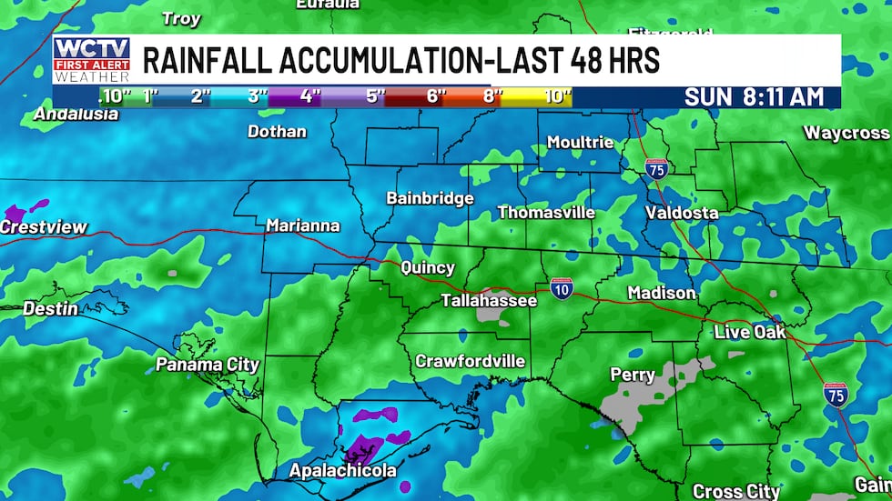 The last two days of rainfall have been beneficial, with record daily rainfall in Apalachicola, FL.(WCTV)Mother’s Day showers
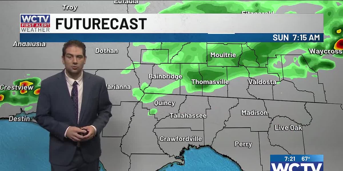
Computer models are still struggling with today’s weather. Given the weather pattern, there should be some hit-or-miss showers or thunderstorms today. NOT everyone will get rain today.
The rain and storms will be random, so there will be no particular time your town might see rain. I will keep a 30 to 40% chance of rain through the evening, before clearing skies out overnight. High temperatures in the 80s.
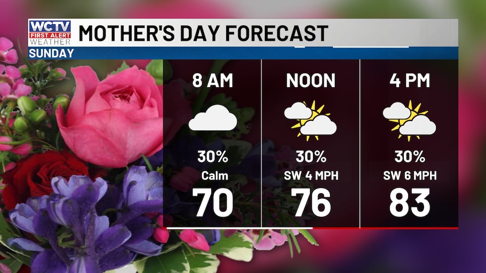 Hit or miss showers for your Mother’s Day(WCTV)
As for boating conditions, the waters will be smooth with only light winds nearshore around 5 knots. Not a bad morning or afternoon to be on the waters, but be sure to check the radar and be back with us tomorrow morning to avoid running into storms on the Gulf.
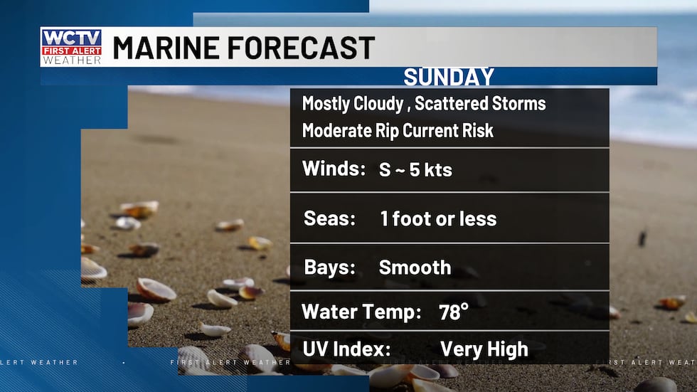 Decent boating conditions tomorrow, but will have to dodge one or two storms through the afternoon.(WCTV)Front early next week
Monday morning will be mild with temperatures near 70 as you head out the door. Temperatures will slowly climb into the low 80s before a cold front arrives midday. The front will bring numerous showers and thunderstorms to the area. Heavy rain, lightning and gusty winds look to be the biggest impacts from these storms.
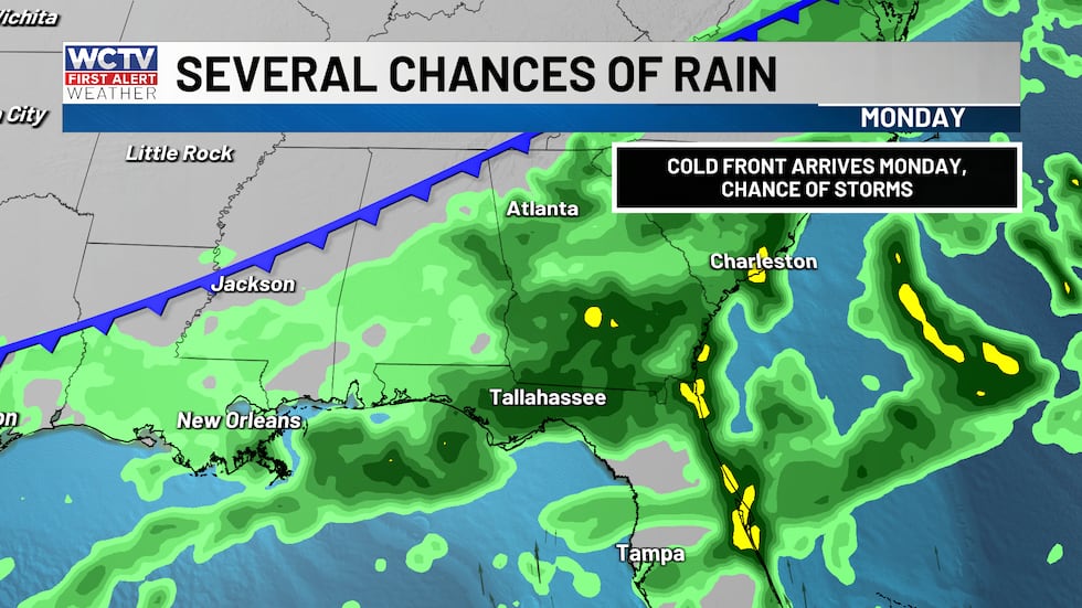 A chance for showers and storms on Monday.(WCTV)
Right now, the severe weather risk looks pretty low, but there is a marginal (level 1/5) risk for the Big Bend and South Georgia for the possibility of a few strong storms.
Some showers linger into your Tuesday, along with low-lying stratus clouds. If the thick clouds stick around, we will be stuck in the 70s most of the day. A tiny rain chance in the morning hours. Additional rain up to 0.5 to 1.5″ through Tuesday morning.
Clearing throughout the week
Skies start to clear through the middle and end of next week as drier air starts to filter back in. Partly to mostly sunny through the end of the week. Temperatures will also be on the rise into the upper 80s. Lower humidity and hot conditions may warrant some higher fire danger late next week. We will see how much rainfall impacts the ongoing drought.
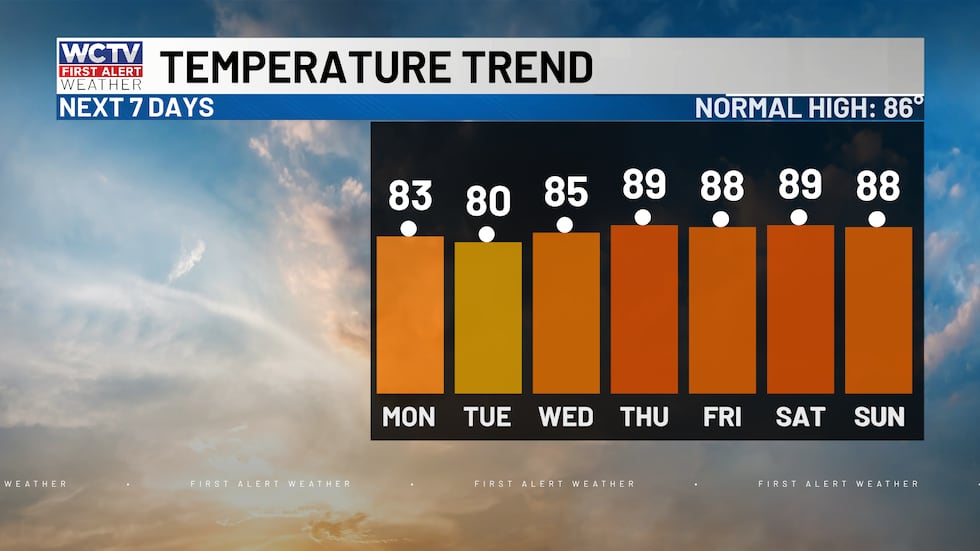 Temperatures are on the rise next week.(WCTV)
To stay updated on all the latest forecasts and weather, follow WCTV First Alert Weather on Facebook and X (Twitter).
Click here to see all the latest weather headlines and here to view the First Alert Radar. Receive push alerts and watch the latest forecast anytime on the free WCTV First Alert Weather app. Click here to download it now.
Interested in becoming a WCTV First Alert Weather Watcher? Click here to join the team!
Copyright 2026 WCTV. All rights reserved.