

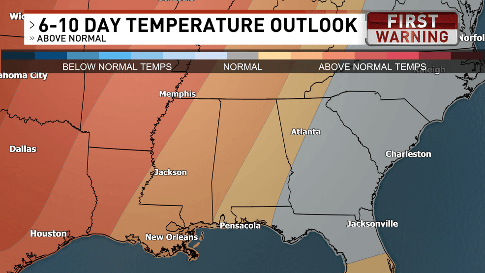
According to the latest outlook from the Climate Prediction Center, temperatures across northwest Florida are expected to stay close to or slightly above normal over the next few weeks, with no strong signal leaning toward a long stretch of colder or warmer-than-average weather.
CPC 6-10 DAY TEMP.png
In other words, the recent cool, crisp air isn’t expected to completely stick around.
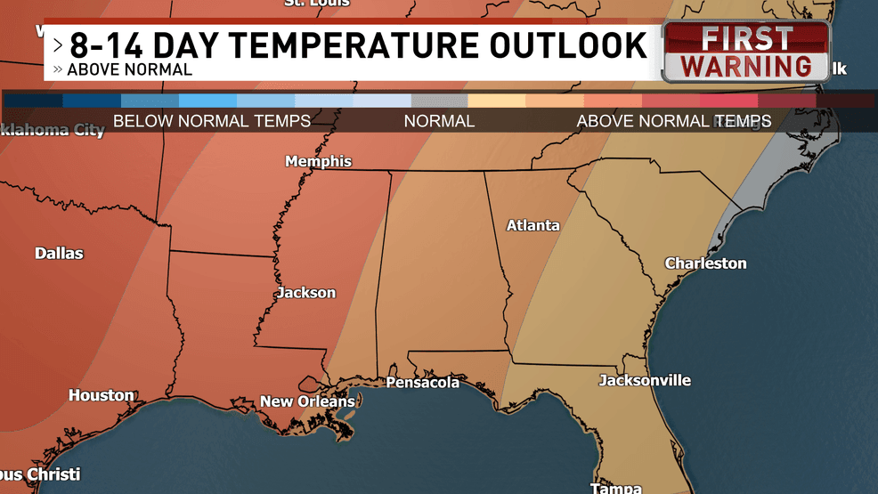
Looking ahead through the next 2 weeks, temperature will rebound to be back above normal.
CPC 8-14 DAY TEMP.png
Although, mornings will likely stay on the cool side, with lows dipping into the upper 40s and low 50s on some days, especially inland. Afternoons should feel comfortable, generally topping out in the 70s, which is right about where we should be for this time of year.
The big takeaway here is that we’re entering a transition phase, where cold fronts will continue to slide through from time to time, bringing short-lived bursts of cooler air, followed by brief periods of milder weather in between.
We see that in the 3-4 week outlook where those temperatures are expected to fall back near or below normal. This is a pattern typical for late fall along the Gulf Coast.
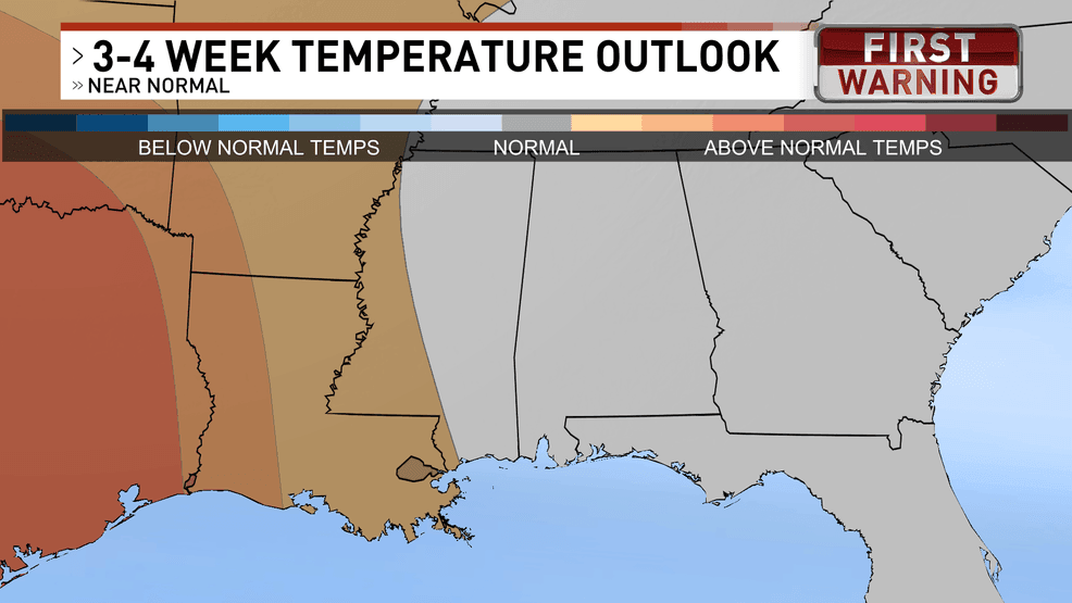
CPC – 3 to 4 Week Cutout.png
So, while the cold air won’t be locked in for the long haul, don’t put away the jackets just yet because those crisp mornings and cool evenings will still be coming and going.
Comment with Bubbles
JOIN THE CONVERSATION (1)
Overall, northwest Florida looks to stay seasonable and pleasant, with temperatures fluctuating around normal as we move through the next couple of weeks.