
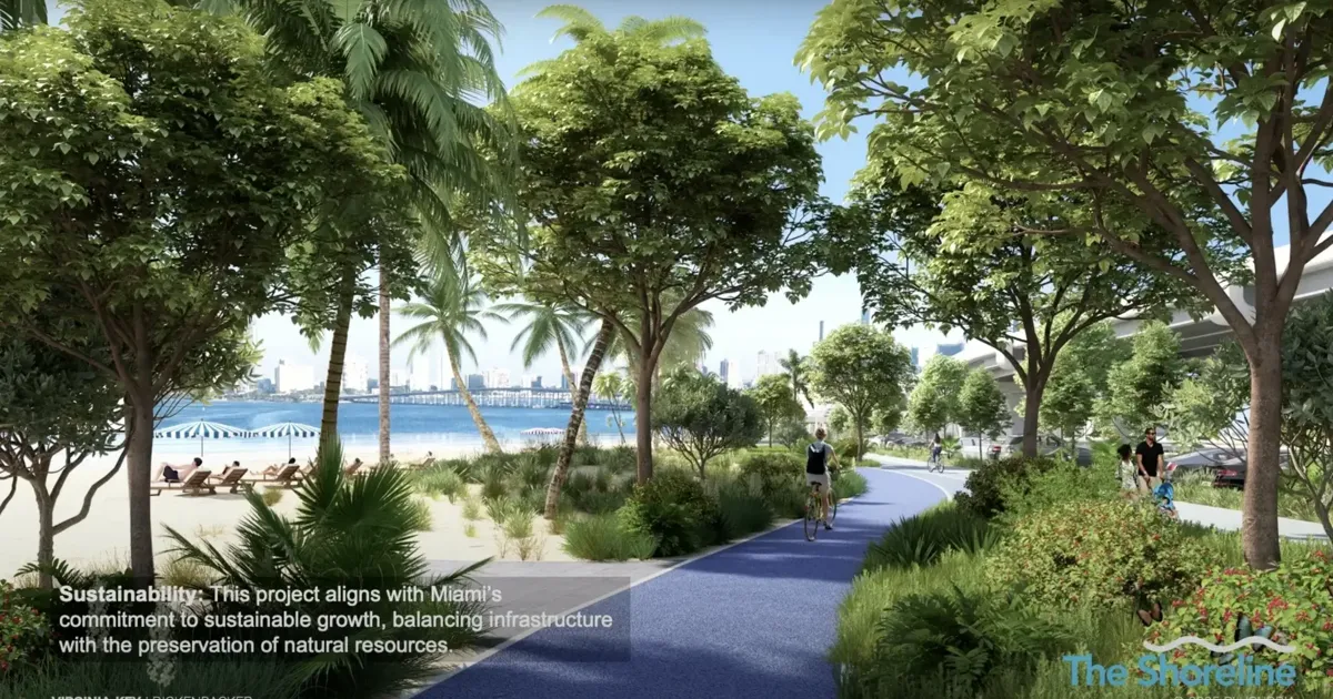
Key Biscayne residents learned a little more this week about “The Shoreline” proposal that could provide a “bold vision” for the Rickenbacker Causeway, where an estimated 28,000 daily vehicles could find a smoother path in and out of the Village.
Hosting a virtual public meeting last week, County Commissioner Raquel Regalado — the driving force for a split-level highway and more beach access — said, “We’re very excited about this project and how well it’s being received.”
Regalado thanked Key Biscayne’s management team for its support, including the Village Council, which authorized up to $950,000 late last year to proceed with a seven-step feasibility analysis to see if construction and funding mechanisms will actually work.
“This is a great project, one that our community is excited about,” Key Biscayne Mayor Joe Rasco said on the 30-minute Zoom call. “(There are) a lot of streams still to cross but, certainly, we’re going in the right direction. Everyone is excited about the possibilities … something we look forward to developing and working with all of you.”
The timetable for such a project, when compared to similar projects, would be an estimated 10 years dating back to last year’s introductory concept of “The Shoreline,” officials said.
“We’re still not there (for a final timeline),” Regalado said, because environmental factors and funding mechanisms (even long-term revenue-generating projects) are still not known at this point.
What is known is that the project would create about 160 percent additional beach area with reclaimed land from asphalt, something Village Council members learned at a recent workshop regarding some of the technical aspects.
Follow-through vehicles (and bicycle peloton packs) would follow the 45 mph speed limit from the William Powell Bridge (a 30 mph limit would be set on the road below that allows for access intersections (either signalized or not) to Miami Marine Stadium and MAST Academy, with a couple more roundabouts possibly in place before getting to Bear Cut Bridge.
“This is a fantastic opportunity to move cars and people efficiently and solve (traffic tie-ups and safety issues),” said Eulois Cleckley, CEO of the Friends of the Underline, which serves as the project manager.
Cleckley said the project not only solves current needs but also takes into consideration future development as Miami Marine Stadium and the former Seaquarium are likely to expand their capacities.
Javier Manso, of HDR’s engineering and consulting firm, noted that during the technical assessment, an 102-inch sewer line runs parallel to the causeway and cannot be relocated. So, that part of the permitting would have to include where columns could be placed for the viaduct.
He showed the area where MAST students could park and their much shorter crossing to the school. With this concept, the parking area at the Seaquarium would likely be kept intact to allow visitors to park and have access to the corridor.
Juan Mullerat of Plusurbia’s design team showed illustrations of the roughly 28 acres of trail area being proposed (the existing beach area from the William Powell Bridge to the Seaquarium is 11 acres), which could include several tiers of amenities, including open space for food trucks, playgrounds, courts, kiosks, recreational rentals, bike repair stations, shelters and other beach amenities.
Natural beach dunes would be included, as well as multi-modal paths, similar to the Underline for casual walkers and bicyclists.
“We continue to work well with the stakeholders and, of course, our partners at Key Biscayne,” Cleckley said.
Another “in-person” meeting with the general public will take place over the summer.
“We should be wrapping up this study by late fall,” Cleckley added. “We’re on track.”
(Note: To ask questions about the project, please e-mail them to district7@miamidade.gov)