

TAMPA, Fla. (WFLA) — Scattered storms return each afternoon and evening across Tampa Bay as the sea breeze stays active and plenty of moisture remains in place.
The best chance for storms today will be late this afternoon into this evening, especially near and just east of I-75. Some storms may drift back toward the coast before winding down later tonight.
Thursday and Friday look very similar. The mornings start warm and muggy, with temperatures in the mid to upper 70s. Highs climb into the low 90s, then scattered storms develop during the afternoon and evening.
Rain chances increase a bit over the weekend. Saturday brings scattered afternoon storms, while Sunday looks like the stormiest day of the stretch with storms likely during the afternoon and evening.
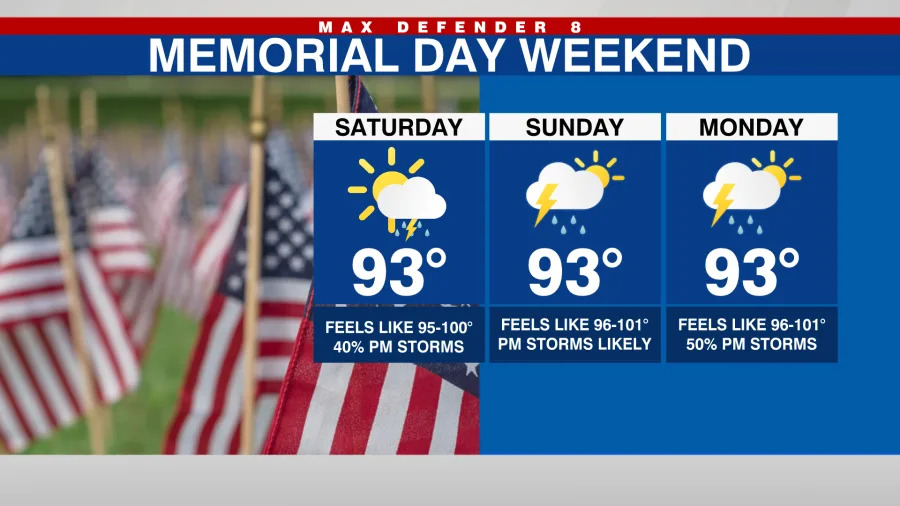
Memorial Day stays unsettled, too. Expect a warm and humid day with highs in the low 90s and scattered afternoon storms. It will not rain all day, but outdoor plans should include a backup option and a way to check Max Defender 8 radar.
This pattern continues into next week with highs near 90 degrees and daily storm chances around 50%. Severe to extreme drought conditions continue for many areas, so the rain will be helpful, but not enough to erase the drought quickly.
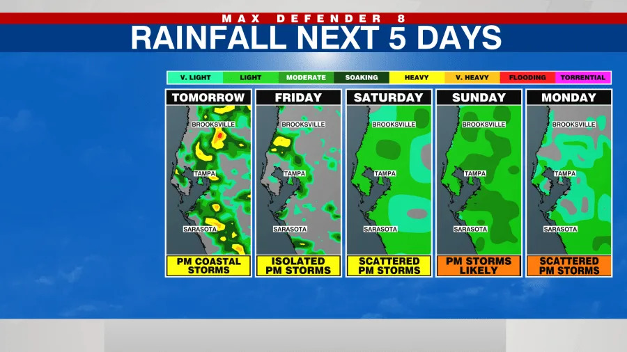
Showers and storms will develop each afternoon as well with the highest chances Sunday.
Thanks for signing up!
Watch for us in your inbox.
Subscribe Now
Copyright 2026 Nexstar Media, Inc. All rights reserved. This material may not be published, broadcast, rewritten, or redistributed.
For the latest news, weather, sports, and streaming video, head to WFLA.