
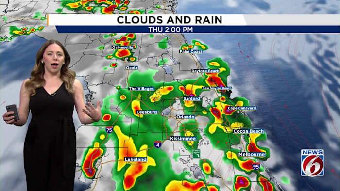
ORLANDO, Fla. – A wetter, more tropical weather pattern is settling into Central Florida and could stick around through early next week.
Deep tropical moisture surging in from the Gulf and Caribbean will fuel widespread showers and storms beginning today, with rain chances running 70-80% through the weekend.
While it will not rain all day, numerous afternoon and evening storms are expected each day, especially along and east of Orlando toward the coast.
Some storms could produce:
Frequent lightning
Wind gusts 40-50 mph
Torrential downpours
Localized flooding
Widespread rainfall totals of 3 to 5 inches are expected through the weekend, with isolated spots seeing more than 8 inches where storms repeatedly move over the same areas.
The rain is welcome news for drought conditions across Florida, but localized flooding may develop in urban and poorly drained areas.
Temperatures stay seasonable in the upper 80s to low 90s, but humidity will push heat index values near 100 degrees at times.
The active pattern may continue into next week as another front approaches the Southeast, keeping storm chances elevated across Central Florida.
Daily Forecast
The News 6 Weather team ensures you’re always on top of the day’s weather.
Copyright 2026 by WKMG ClickOrlando – All rights reserved.