
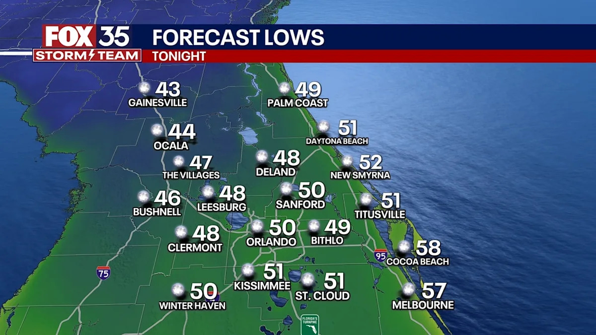
ORLANDO, Fla. – The cold front has come through! Coldest Halloween night in 32 years tonight with low temperatures in the 40s and 50s across central Florida. Not a cloud in the sky and the winds will stay calm.
Looking Ahead
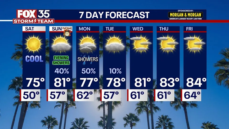
Much cooler than normal weather continues for Saturday with abundant sunshine and very low humidity. Sunday morning and midday will be totally sunny and nice, but clouds will increase Sunday afternoon and evening.
A few rain showers are now expected to move in from the Gulf just after sunset Sunday. Major rain or storms does not look to be in the cards as of now, but we will watch for any changes given recent extreme flooding in Lake and Brevard from last weekend.
Monday offers a tricky forecast early next week. A few showers, maybe a thunderstorm should be around. Coverage should be scattered at best but some data suggests more than that – we will fine tune as we get closer. But expecting a partly to mostly cloudy day Monday, with a few passing showers around anytime of the day.
Next week, the big story shifts to King Tide. The King Tide cycle from Nov 4-10 is the highest of this fall, which peaks on Nov. 6. The tides will be a full 1-2′ above the previous king tides a few weeks ago that produced erosion and no beach at times of high tide. Should be warming back up nicely with a return to sunshine by the end of next week as temperatures climb back into the 80s.
 Turning to the Tropics
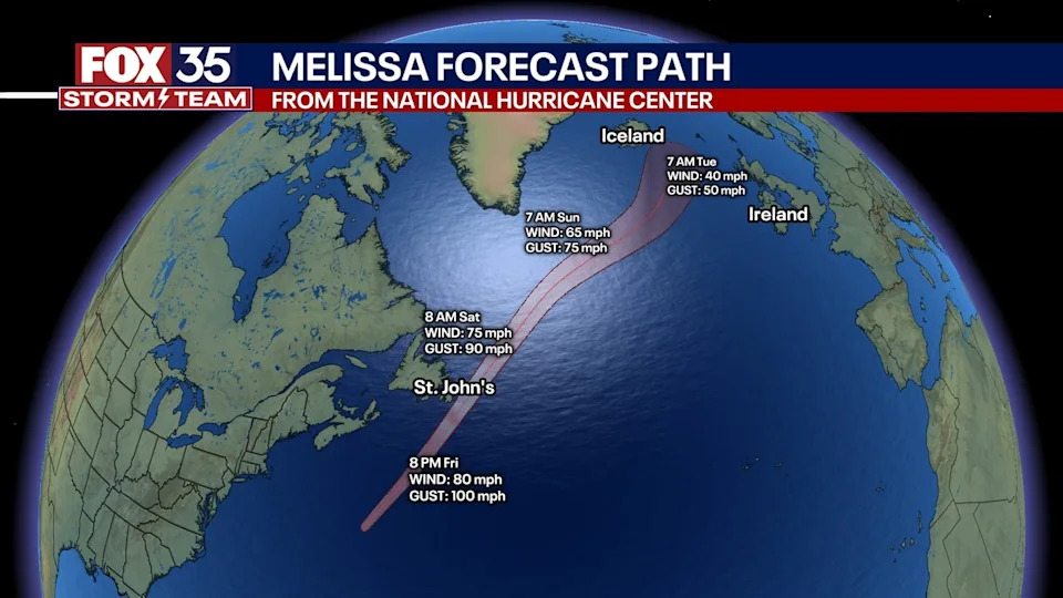
Melissa is now a “post-tropical” storm, meaning it still is producing tropical storm force winds (39+ MPH) — but it is not a storm of tropical characteristics anymore. It will brush by St. John’s in Newfoundland tonight into tomorrow. After Melissa, the tropical Atlantic is quiet for the next 7 days. The next name up: “Nestor” then “Olga.”
The Source
The information used to write this story was provided by the FOX 35 Weather Team.