
STILL SOME RAIN IN THE FORECAST, BUT WE’RE NOT SEEING THE COVERAGE NEARLY AS HIGH. WE ARE FINALLY MAKING SOME IMPROVEMENTS TO OUR DROUGHT. HERE IS WHERE WE STAND HEADING INTO THIS FIRST STRETCH OF JUNE. WE FINALLY SAW SOME AREAS JUST TO THE EAST OF I-75 IMPROVEMENTS TO OUR EXTREME DROUGHT. LAST WEEK WE WE’RE ALL UNDER EXTREME DROUGHT AND NOW STARTING TO SEE SOME OF THOSE SUBTLE IMPROVEMENTS. AND IF YOU THOUGHT IT WAS ACTIVE IN MAY, JUNE, OUR AVERAGE RAINFALL SHOOTS OUT TO OVER 9 INCHES FOR THE MONTH. SO LIKELY GETTING INTO MORE OF OUR REAL RAINY SEASON PATTERN DAY IN AND DAY OUT MAY COMING IN AS OUR SECOND HOTTEST MAY ON RECORD AND THE HEAT IS WITH US ARE AVERAGE JUNE TEMPERATURES, 91 FOR OUR HIGHS. USUALLY THIS TIME OF YEAR. OUR MORNING SHIFT TO 74 DEGREES. SO NO LONGER SEEING THAT RELIEF, EVEN AS I DO TRACK SOME OF THOSE DRIER AIR FILTERING ON IN AFTER A COLD FRONT LATER ON WEDNESDAY, THURSDAY, FRIDAY. WE’RE NOT GOING TO SEE A BIG TEMPERATURE DROP. IT WILL MAKE FEELS LIKE CONDITIONS A LITTLE BIT MORE MANAGEABLE, THOUGH. TRIPLE DIGIT FEELS LIKE VALUES TODAY TOMORROW AND THEN BACK DOWN TO THE 90’S THROUGH THE REST OF THE WEEK. THAT
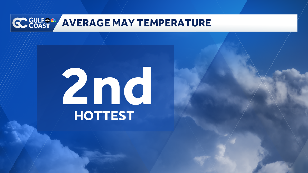
May ranks 2nd hottest on record for Southwest Florida
The hottest May on record for Southwest Florida was 2024.

Updated: 9:30 AM EDT Jun 1, 2026
If you felt like May was particularly hot, you’re not imagining it! The average temperature came in at 82.1 degrees, ranking as the second hottest May on record for Southwest Florida. Keep in mind, the average temperature factors in the overnight lows. The hottest May was in 2024 with an average temperature of 83.2 degrees. As far as rainfall, many communities surpassed the average May rainfall though we didn’t receive enough to eliminate drought. Many areas east of I-75 saw some improvement though most of the Gulf Coast is still facing extreme drought. The average monthly rain for June jumps to over 9 inches as the rainy season ramps up. Last year, it took until August to finally eliminate drought. Count on your Gulf Coast Most Accurate Forecast to keep you informed on drought updates through the rainy season. Your Gulf Coast Weather TeamChief Meteorologist Allyson RaeMeteorologist Caroline CastoraMeteorologist Jim DickeyMeteorologist Lauren HopeMeteorologist Raphael TavernierMeteorologist Rob DunsMeteorologist Sara BlueFollow on Social: Follow, like and subscribe to Gulf Coast News on social media to share your tips and be part of the conversation with Southwest Florida’s most experienced, trusted weather team: Facebook | Instagram | YouTube | TikTok | Threads | Bluesky | Nextdoor | X
FORT MYERS, Fla. —
If you felt like May was particularly hot, you’re not imagining it! The average temperature came in at 82.1 degrees, ranking as the second hottest May on record for Southwest Florida. Keep in mind, the average temperature factors in the overnight lows. The hottest May was in 2024 with an average temperature of 83.2 degrees.
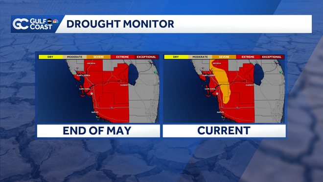
As far as rainfall, many communities surpassed the average May rainfall though we didn’t receive enough to eliminate drought. Many areas east of I-75 saw some improvement though most of the Gulf Coast is still facing extreme drought.
Gulf Coast News
Drought Monitor
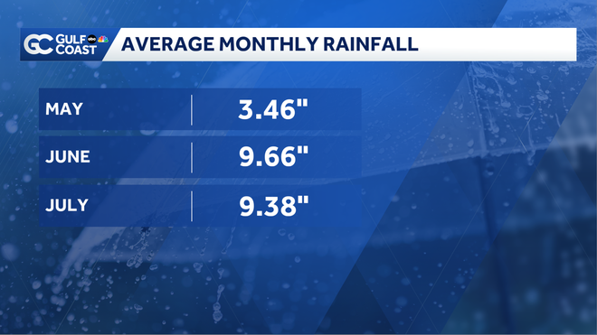
The average monthly rain for June jumps to over 9 inches as the rainy season ramps up.
Last year, it took until August to finally eliminate drought. Count on your Gulf Coast Most Accurate Forecast to keep you informed on drought updates through the rainy season.
Your Gulf Coast Weather Team
Follow on Social: Follow, like and subscribe to Gulf Coast News on social media to share your tips and be part of the conversation with Southwest Florida’s most experienced, trusted weather team: Facebook | Instagram | YouTube | TikTok | Threads | Bluesky | Nextdoor | X