
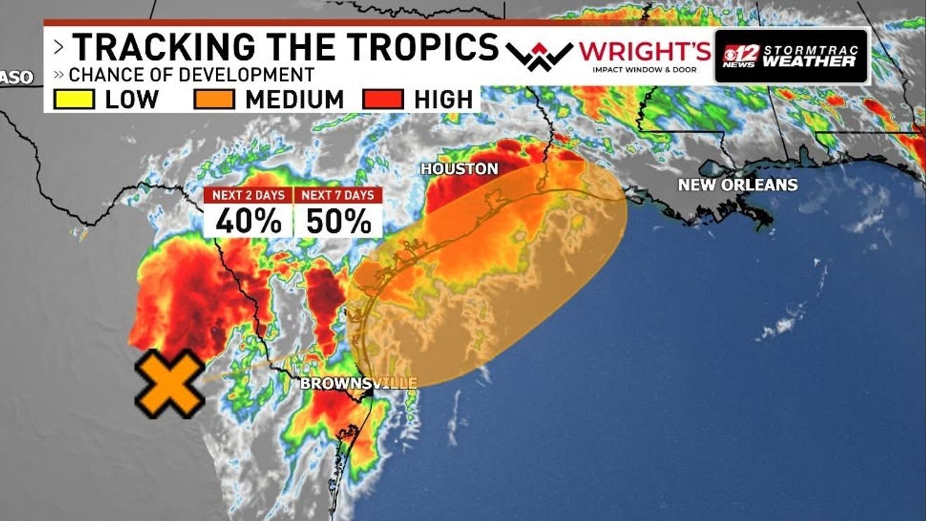
WEST PALM BEACH, Fla. (CBS12) — A developing weather system in the Gulf is drawing some attention from forecasters, with the National Hurricane Center indicating on Monday afternoon a medium chance of tropical development over the next several days.
Identified by the NHC as “Disturbance 1,” it currently carries a 40% chance of formation within the next 48 hours and a 50% chance within the next seven days. While the system is not expected to organize in the immediate term, conditions could become more favorable as it tracks toward the northwestern Gulf later this week.
As of the NHC’s 2 p.m. update Monday, the disturbance is centered over northeastern Mexico. The system is associated with a broad trough of low pressure producing widespread, disorganized showers and thunderstorms. Because it remains inland, development is not anticipated in the short term. However, forecasters say the system could re-emerge over water by late Tuesday or Wednesday, where slightly more conducive environmental conditions may allow for limited strengthening.
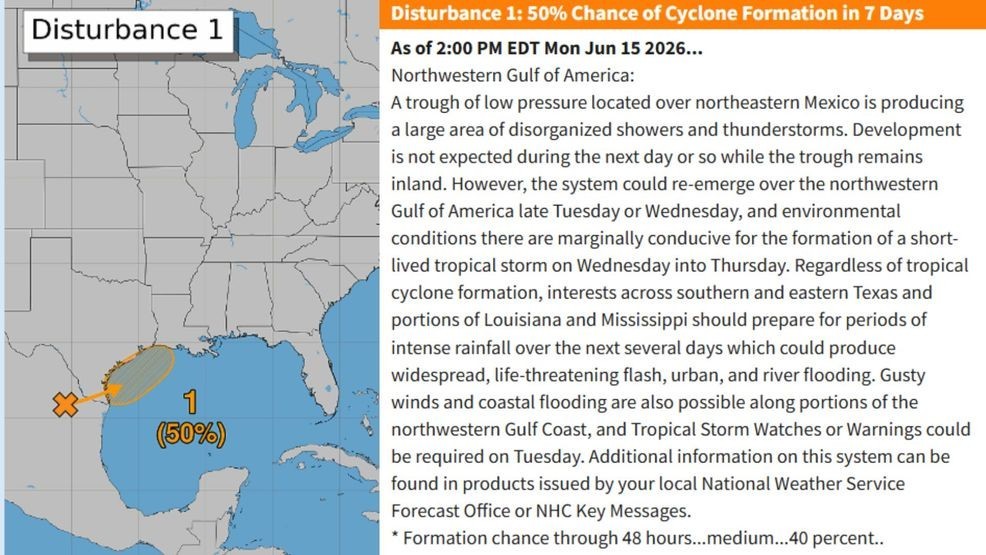
Identified by the NHC as “Disturbance 1,” it currently carries a 40% chance of formation within the next 48 hours and a 50% chance within the next seven days. While the system is not expected to organize in the immediate term, conditions could become more favorable as it tracks toward the northwestern Gulf later this week. (NHC)
If development occurs, it is expected to be brief, with the NHC noting the potential for a short-lived tropical storm forming sometime between Wednesday and Thursday. Regardless of whether the disturbance formally organizes into a tropical cyclone, the primary concern will be heavy rainfall and flooding across portions of the Gulf Coast.
Meteorologists warn that southern and eastern Texas, along with parts of Louisiana and Mississippi, could see several days of intense rainfall. This raises the risk for widespread and potentially life-threatening impacts, including flash flooding in urban areas, river flooding, and rapidly changing conditions on roadways. Residents in flood-prone areas are urged to stay alert and monitor forecasts closely.
In addition to heavy rain, gusty winds and localized coastal flooding are also possible along the northwestern Gulf Coast. Officials note that Tropical Storm Watches or Warnings could be required as early as Tuesday if the system shows signs of further organization.
See also: Sargassum seaweed blankets some Palm Beach County beaches; cleanup planned
Emergency managers and local National Weather Service offices are emphasizing preparedness, particularly as heavy rainfall events can quickly overwhelm drainage systems and waterways. Even in the absence of a named storm, slow-moving or disorganized systems can produce significant flooding hazards.
For Florida, however, the outlook remains unchanged. The CBS12 News StormTrac Weather Team confirms there is currently no threat to the state, and the system is expected to remain confined to the western Gulf region.
The NHC continues to monitor the disturbance closely, with additional updates expected in the coming days. Residents along the Gulf Coast are encouraged to stay informed through official forecasts and be ready to act should conditions deteriorate.