
The Certified Most Accurate Gulf Coast Hurricane Tracking team is monitoring a cluster of disorganized thunderstorms over northern Mexico and southern Texas for the potential of tropical development in the coming days. On Monday afternoon, the National Hurricane Center dubbed the feature Invest 90L. That’s a classification of an unnamed and disorganized tropical feature that is worth investigating for the potential of tropical development in the future. As of 8 p.m. Monday, the formation odds of the area being watched becoming at least a tropical depression over the next 48 hours have increased to 50%. The 7-day development odds remain unchanged at 50%. Regardless of formation, the disturbance will help to spark areas of heavy rain along the western Gulf Coast, but not in our part of Florida. Tropical Impacts The most impactful weather from this disturbance is expected to be from heavy rain in areas of Texas, Louisiana and Mississippi. Some communities could see 5-10″ of rain, heightening the risk of flooding toward the end of the workweek.If this disturbance strengthens into a tropical storm, the first name of the season is Arthur. What is an Invest?”Invest” is a shorthanded way of saying “area of investigation”. The term is used by the National Hurricane Center when forecasters want to take a closer look at it for the possibility of future development. When a system is named an invest, extra information becomes available, such as spaghetti plots. However you watch or scroll, we’re committed to delivering your Gulf Coast Weather Most Accurate Forecast, one you can rely on every day, wherever you are.Live Interactive Radar: Track conditions in real time with the Gulf Coast Live Radar.Watch Gulf Coast Weather: Find the latest weather forecast videos, streaming live or on demand, on TV and online.Stream on the Go: Download the free Gulf Coast News app to watch on your phone or tablet.Your Gulf Coast Weather TeamChief Meteorologist Allyson RaeMeteorologist Caroline CastoraMeteorologist Jim DickeyMeteorologist Lauren HopeMeteorologist Raphael TavernierMeteorologist Rob DunsMeteorologist Sara BlueFollow on Social: Follow, like and subscribe to Gulf Coast News on social media to share your tips and be part of the conversation with Southwest Florida’s most experienced, trusted weather team: Facebook | Instagram | YouTube | TikTok | Threads | Bluesky | Nextdoor | XDOWNLOAD the free Gulf Coast News app for your latest breaking news and weather alerts. And check out the Very Local Gulf Coast app to stream news, entertainment and original programming on your TV.
FORT MYERS, Fla. —
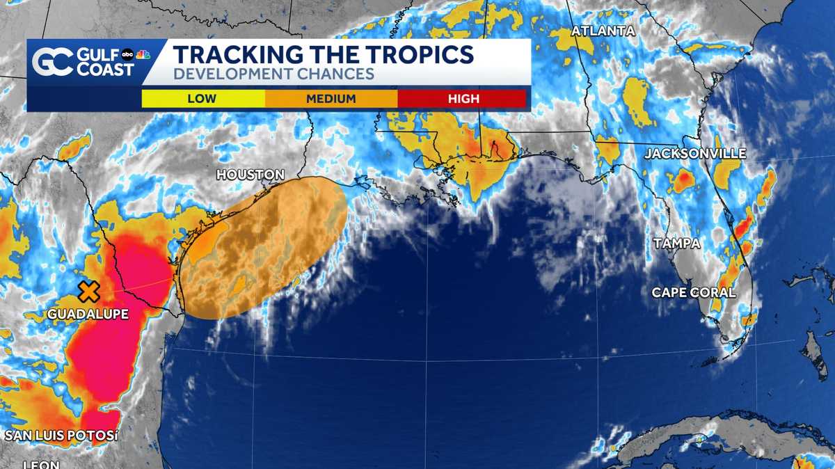
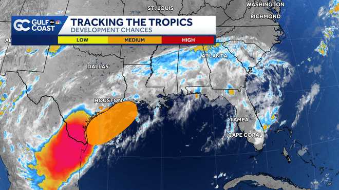
The Certified Most Accurate Gulf Coast Hurricane Tracking team is monitoring a cluster of disorganized thunderstorms over northern Mexico and southern Texas for the potential of tropical development in the coming days.
On Monday afternoon, the National Hurricane Center dubbed the feature Invest 90L. That’s a classification of an unnamed and disorganized tropical feature that is worth investigating for the potential of tropical development in the future.
As of 8 p.m. Monday, the formation odds of the area being watched becoming at least a tropical depression over the next 48 hours have increased to 50%. The 7-day development odds remain unchanged at 50%.
Regardless of formation, the disturbance will help to spark areas of heavy rain along the western Gulf Coast, but not in our part of Florida.
Tropical Impacts
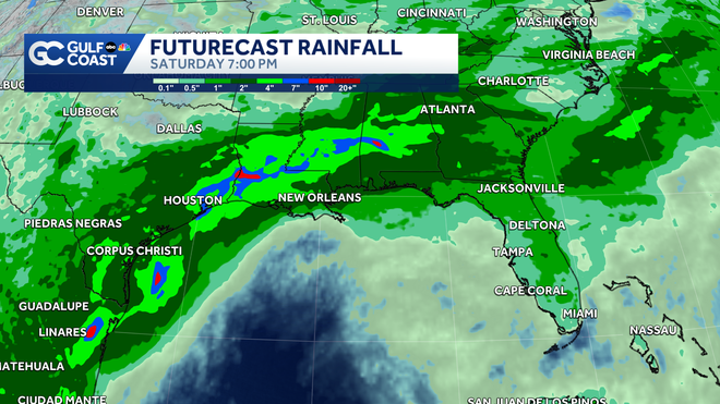
The most impactful weather from this disturbance is expected to be from heavy rain in areas of Texas, Louisiana and Mississippi. Some communities could see 5-10″ of rain, heightening the risk of flooding toward the end of the workweek.
Gulf Coast News
Futurecast Rainfall
If this disturbance strengthens into a tropical storm, the first name of the season is Arthur.
What is an Invest?
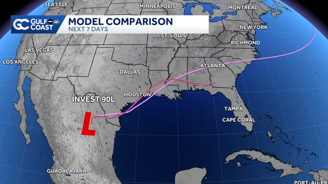
“Invest” is a shorthanded way of saying “area of investigation”. The term is used by the National Hurricane Center when forecasters want to take a closer look at it for the possibility of future development. When a system is named an invest, extra information becomes available, such as spaghetti plots.
However you watch or scroll, we’re committed to delivering your Gulf Coast Weather Most Accurate Forecast, one you can rely on every day, wherever you are.
Live Interactive Radar: Track conditions in real time with the Gulf Coast Live Radar.
Watch Gulf Coast Weather: Find the latest weather forecast videos, streaming live or on demand, on TV and online.
Stream on the Go: Download the free Gulf Coast News app to watch on your phone or tablet.
Your Gulf Coast Weather Team
Follow on Social: Follow, like and subscribe to Gulf Coast News on social media to share your tips and be part of the conversation with Southwest Florida’s most experienced, trusted weather team: Facebook | Instagram | YouTube | TikTok | Threads | Bluesky | Nextdoor | X
DOWNLOAD the free Gulf Coast News app for your latest breaking news and weather alerts. And check out the Very Local Gulf Coast app to stream news, entertainment and original programming on your TV.